Auburn Township, Fayette County, Iowa
Auburn Township is one of twenty townships in Fayette County, Iowa, USA. As of the 2010 census, its population was 527.[1]
Auburn Township | |
|---|---|
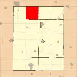 Location in Fayette County | |
| Coordinates: 43°02′34″N 91°53′46″W | |
| Country | |
| State | |
| County | Fayette |
| Area | |
| • Total | 36.73 sq mi (95.12 km2) |
| • Land | 36.73 sq mi (95.12 km2) |
| • Water | 0 sq mi (0 km2) 0% |
| Elevation | 1,152 ft (351 m) |
| Population (2010) | |
| • Total | 527 |
| • Density | 14/sq mi (5.5/km2) |
| Time zone | UTC-6 (CST) |
| • Summer (DST) | UTC-5 (CDT) |
| ZIP codes | 52144, 52147, 52166, 52171, 52175 |
| GNIS feature ID | 0467402 |
Geography
According to the United States Census Bureau, Auburn Township covers an area of 36.7 square miles (95.1 km2), all of it land.
Communities
Cities
Unincorporated communities
- Auburn
- Douglass at 43.008311°N 91.871275°W
- Massillon
- West Auburn
Adjacent townships
- Washington Township, Winneshiek County (north)
- Dover Township (east)
- Union Township (southeast)
- Windsor Township (south)
- Bethel Township (southwest)
- Eden Township (west)
- Jackson Township, Winneshiek County (northwest)
Cemeteries
The township contains these three cemeteries: Eden, Oak Ridge and Saint Lukes Catholic.
Major highways
School districts
- North Fayette Valley Community School District
- Turkey Valley Community School District
Political districts
- Iowa's 1st congressional district
- State House District 18
- State Senate District 9
References
External links
- US-Counties.com
- City-Data.com comprehensive statistical data
Municipalities and communities of Fayette County, Iowa, United States | ||
|---|---|---|
| Cities | Map of Iowa highlighting Fayette County | |
| Townships | ||
| Unincorporated communities | ||
| Footnotes | ‡This populated place also has portions in an adjacent county or counties | |
This article is issued from Wikipedia. The text is licensed under Creative Commons - Attribution - Sharealike. Additional terms may apply for the media files.