Atocha (Madrid)
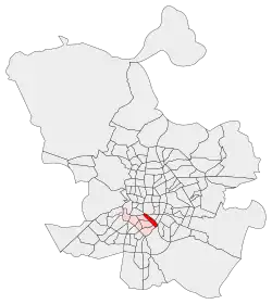
Atocha [aˈtotʃa] is an administrative neighborhood (barrio) of Madrid belonging to the district of Arganzuela.
Atocha | |
|---|---|
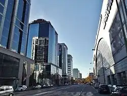
 Calle Retama | |
 | |
| Country | Spain |
| Aut. community | Community of Madrid |
| Municipality | Madrid |
| District | Arganzuela |
Etymology
The Atocha meadow appears as Prato de Thoia and prado de Toia in the 13th-century Madrid town charter.[1] It has been linked to atochar ("esparto field"), the hermitage of Our Lady of Atocha (derived from Theotoca ("Mother of God") or Antiochia) or atochada[2] (an earthwork with grasses to contain water, here applied to a local brook).[3]
Geography
Located in the middle of Madrid, the ward is formed by a strip between the avenue Calle de Méndez Álvaro (south-west), and the north-eastern area of Madrid Atocha railway station, that occupies great part of its territory. The northern border is at the square Plaza del Emperador Carlos V and the southern one in the avenue Calle de Pedro Bosch.
Atocha borders the districts of Centro (north), Retiro (north-east), Puente de Vallecas (south) and with the Arganzuelan wards of Palos de Moguer, Las Delicias and Legazpi.[4]
Transport
Home of Madrid Atocha, the main railway station of the city, the ward is also served by the Metro lines 1 (at Estación del Arte and Atocha stations), 6 (at Méndez Álvaro station) and by several lines of a commuter rail network named Cercanías Madrid.[5]
References
- Alvarado Planas, Javier; Oliva Manso, Gonzalo (2019). "Transcripción del original del Fuero de Madrid". El fuero de Madrid (PDF) (in Spanish). Madrid: Agencia Estatal Boletín Oficial del Estado. p. 207. ISBN 978-84-340-2542-4. Retrieved 4 March 2022.
- "atochada". atochada | Diccionario de la lengua española (in Spanish) (23.5 ed.). RAE-ASALE. 2021. Retrieved 4 March 2022.
Lomo hecho de atocha, romero o broza y tierra, para contener el agua en los bancales.
- Cruz, Luis de la (3 March 2022). "De hierbas, agua y leyendas: ¿cuál es el origen del topónimo Atocha?". Somos Madrid - ElDiario.es (in European Spanish). Retrieved 4 March 2022.
- Arganzuela district map
- Serving Madrid Atocha and Madrid Méndez Álvaro stations: see map
External links
![]() Media related to Atocha neighborhood, Madrid at Wikimedia Commons
Media related to Atocha neighborhood, Madrid at Wikimedia Commons