Arch of Triumph (Pyongyang)
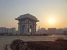
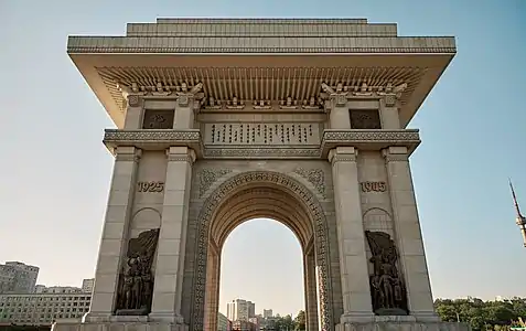
The Arch of Triumph (Korean: 개선문; MR: Kaesŏnmun) is a triumphal arch in Pyongyang, North Korea. It was built to commemorate the Korean resistance to Japan from 1925 to 1945. It is the second tallest triumphal arch in the world, after Monumento a la Revolución in Mexico, standing 60 m (197 ft) high and 50 m (164 ft) wide.[1]
 Arch of Triumph seen from the north-east | |
| Location | Pyongyang, North Korea |
|---|---|
| Material | White granite |
| Width | 50 metres (160 ft) |
| Height | 60 metres (200 ft) |
| Opening date | April 15, 1982 |
| Dedicated to | Kim Il-sung's resistance to Japan |
| Arch of Triumph | |
| Chosŏn'gŭl | 개선문 |
|---|---|
| Hancha | |
| Revised Romanization | Gaeseonmun |
| McCune–Reischauer | Kaesŏnmun |
Built in 1982 on the Triumph Return Square at the foot of Moran Hill (모란봉) in the North Korean capital city of Pyongyang, the monument was built to honour Kim Il-sung's role in the military resistance for Korean independence. Inaugurated on the occasion of his 70th birthday, each of its 25,500 blocks of finely-dressed white granite represents a day of his life up to that point.[2]
Design
The structure is modeled after the Arc de Triomphe in Paris, but is 10 metres (33 ft) taller. The arch has dozens of rooms, balustrades, observation platforms and elevators. It also has four vaulted gateways, each 27 m (89 ft) high, decorated with azalea carved in their girth. Inscribed in the arch is the revolutionary hymn "Song of General Kim Il-sung", and the year 1925, when North Korean history states that Kim set out on the journey for national liberation of the country from Japanese rule.[3] Also depicted on the arch is the year 1945, when Korea was liberated.
The arch is illuminated at night and has its own single cylinder diesel generator in case of main power failure.
See also
Notes
- "Guide to Pyongyang". The People's Korea. Archived from the original on 2008-09-27. Retrieved 2009-01-25.
- McCormack, Gavan, Target North Korea: Pushing North Korea to the Brink of Nuclear Catastrophe, p. 59. Nation Books, 2004, ISBN 1-56025-557-9.
- Justin Corfield (July 2013). Historical Dictionary of Pyongyang. Anthem Press. pp. 9–. ISBN 978-0-85728-234-7.
References
- Korean Central News Agency of DPRK. link – last accessed on January 19, 2006.
.jpg.webp)
_06.JPG.webp)
_03.JPG.webp)
