April 2009 Afghanistan earthquake
The 2009 Afghanistan earthquake was a dip-slip doublet earthquake occurred in eastern Afghanistan, with an initial shock of magnitude of 5.2 Mw at 01:57:51 April 17 local time, with a second shock of 5.1 Mw occurring several hours later. The maximum Mercalli intensity was VI (Strong).
 | |
| UTC time | Doublet earthquake: |
|---|---|
| 2009-04-16 21:27:51 | |
| 2009-04-16 23:42:51 | |
| ISC event | n/a |
| USGS-ANSS | |
| ComCat | |
| ComCat | |
| Local date | April 17 |
| Local time | |
| 01:57 | |
| 04:22 | |
| Magnitude | |
| 5.2 Mwc[1] | |
| 5.1 Mwb[2] | |
| Depth | 5.9 km (3.7 mi)[3] 4.0 km (2.5 mi)[4] |
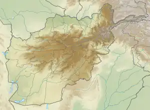
| Epicenter | 34.19°N 70.08°E[5] |
| Type | Reverse |
| Areas affected | Afghanistan Pakistan |
| Max. intensity | VI (Strong) [6] |
| Casualties | 19 dead [7] 51 injured [8] |
Damage
The quakes struck a remote area about 50 miles (90 km) east of Kabul near the Pakistan border. A government representative told AP News that the quakes destroyed 200 mud homes in four villages that had damage that was described as serious.[9]
Notes
Sources
- ANSS. "Afghanistan 2009a". Comprehensive Catalog. U.S. Geological Survey. Retrieved April 15, 2018.
- ANSS. "Afghanistan 2009b". Comprehensive Catalog. U.S. Geological Survey. Retrieved April 15, 2018.
- BBC (April 17, 2009). "Deadly quakes strike Afghanistan". BBC. Archived from the original on April 20, 2009.
- National Geophysical Data Center / World Data Service (NGDC/WDS) (1972), Significant Earthquake Database (Data Set), National Geophysical Data Center, NOAA, doi:10.7289/V5TD9V7K.
This article is issued from Wikipedia. The text is licensed under Creative Commons - Attribution - Sharealike. Additional terms may apply for the media files.