Andelu
Andelu (French pronunciation: [ɑ̃dly]) is a commune in the Yvelines department in north-central France.
Andelu | |
|---|---|
 Town hall | |
.svg.png.webp) Coat of arms | |
Location of Andelu | |
 Andelu  Andelu | |
| Coordinates: 48°52′52″N 1°49′30″E | |
| Country | France |
| Region | Île-de-France |
| Department | Yvelines |
| Arrondissement | Saint-Germain-en-Laye |
| Canton | Aubergenville |
| Intercommunality | Gally Mauldre |
| Government | |
| • Mayor (2020–2026) | Olivier Ravenel[1] |
| Area 1 | 3.96 km2 (1.53 sq mi) |
| Population | 482 |
| • Density | 120/km2 (320/sq mi) |
| Time zone | UTC+01:00 (CET) |
| • Summer (DST) | UTC+02:00 (CEST) |
| INSEE/Postal code | 78013 /78770 |
| Elevation | 111–133 m (364–436 ft) (avg. 119 m or 390 ft) |
| 1 French Land Register data, which excludes lakes, ponds, glaciers > 1 km2 (0.386 sq mi or 247 acres) and river estuaries. | |
Population
|
|
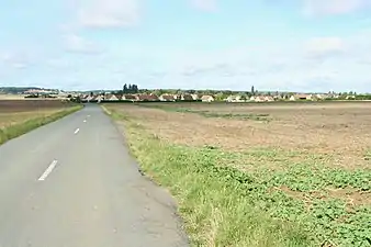 Approach
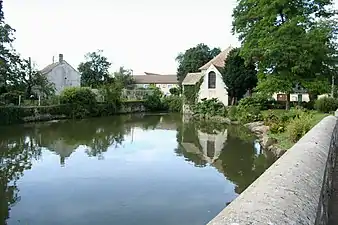 Pond and chapel
See also
References
- "Répertoire national des élus: les maires" (in French). data.gouv.fr, Plateforme ouverte des données publiques françaises. 4 May 2022.
- "Populations légales 2020". The National Institute of Statistics and Economic Studies. 29 December 2022.
Wikimedia Commons has media related to Andelu.
This article is issued from Wikipedia. The text is licensed under Creative Commons - Attribution - Sharealike. Additional terms may apply for the media files.