Altoona, Alabama
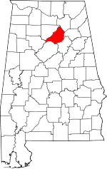
Altoona is a town in Etowah County (and a small portion of Blount County) in the U.S. state of Alabama. It is part of the Gadsden Metropolitan Statistical Area. At the 2020 census, the population was 948.
Altoona | |
|---|---|
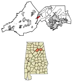
 Location of Altoona in Blount County and Etowah County, Alabama. | |
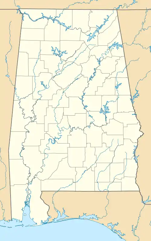
 Altoona  Altoona  Altoona | |
| Coordinates: 34°1′51″N 86°19′5″W | |
| Country | United States |
| State | Alabama |
| Counties | Etowah, Blount |
| Area | |
| • Total | 4.49 sq mi (11.63 km2) |
| • Land | 4.48 sq mi (11.60 km2) |
| • Water | 0.01 sq mi (0.03 km2) |
| Elevation | 942 ft (287 m) |
| Population (2020) | |
| • Total | 948 |
| • Density | 211.61/sq mi (81.70/km2) |
| Time zone | UTC-6 (CST) |
| • Summer (DST) | UTC-5 (CDT) |
| ZIP code | 35952 |
| Area codes | 205, 659 |
| FIPS code | 01-01660 |
| GNIS feature ID | 2405146[2] |
History
Altoona had its start in the year 1900 as a mining town, and was named for another coal town, Altoona, Pennsylvania.[3] A post office has been in operation at Altoona since 1900.[4] It incorporated in 1908.[5]
Geography
Altoona is located in western Etowah County at 34°1′45″N 86°19′14″W (34.029259, -86.320687).[6] The town extends west into Blount County. It is located in the Murphree Valley at the base of Altoona Mountain. Straight Mountain is a small, narrow ridge which runs nearly through the center of the town. Alabama State Route 132 (Main Street) leads southwest 10 miles (16 km) to Oneonta, the Blount County seat, and northeast towards Gadsden via U.S. Route 278.
According to the U.S. Census Bureau, the town has a total area of 4.3 square miles (11.2 km2), of which 0.012 square miles (0.03 km2), or 0.23%, is water.[7]
Demographics
| Census | Pop. | Note | %± |
|---|---|---|---|
| 1910 | 1,071 | — | |
| 1920 | 1,078 | 0.7% | |
| 1930 | 1,098 | 1.9% | |
| 1940 | 995 | −9.4% | |
| 1950 | 860 | −13.6% | |
| 1960 | 744 | −13.5% | |
| 1970 | 781 | 5.0% | |
| 1980 | 928 | 18.8% | |
| 1990 | 960 | 3.4% | |
| 2000 | 984 | 2.5% | |
| 2010 | 933 | −5.2% | |
| 2020 | 948 | 1.6% | |
| U.S. Decennial Census[8] | |||
Altoona first appeared on the 1910 U.S. Census as an incorporated town.[9] See also Altoona precinct/division below.
2000 Census data
As of the census[10] of 2000, there were 984 people, 397 households, and 271 families residing in the town. The population density was 258.7 inhabitants per square mile (99.9/km2). There were 437 housing units at an average density of 114.9 per square mile (44.4/km2). The racial makeup of the town was 95.43% White, 2.54% Black or African American, 0.10% Native American, 0.91% from other races, and 1.02% from two or more races. 2.54% of the population were Hispanic or Latino of any race.
There were 397 households, out of which 33.8% had children under the age of 18 living with them, 47.9% were married couples living together, 15.6% had a female householder with no husband present, and 31.5% were non-families. 29.2% of all households were made up of individuals, and 13.1% had someone living alone who was 65 years of age or older. The average household size was 2.36 and the average family size was 2.89.
In the town, the population was spread out, with 25.5% under the age of 18, 8.2% from 18 to 24, 26.3% from 25 to 44, 22.6% from 45 to 64, and 17.4% who were 65 years of age or older. The median age was 38 years. For every 100 females, there were 78.6 males. For every 100 females age 18 and over, there were 79.2 males.
The median income for a household in the town was $20,469, and the median income for a family was $28,750. Males had a median income of $30,250 versus $22,344 for females. The per capita income for the town was $11,168. About 21.8% of families and 27.2% of the population were below the poverty line, including 39.3% of those under age 18 and 16.3% of those age 65 or over.
Altoona Precinct/Division (1910-)
| Census | Pop. | Note | %± |
|---|---|---|---|
| 1910 | 1,158 | — | |
| 1920 | 1,202 | 3.8% | |
| 1930 | 1,316 | 9.5% | |
| 1940 | 1,187 | −9.8% | |
| 1950 | 1,014 | −14.6% | |
| 1960 | 3,661 | 261.0% | |
| 1970 | 3,401 | −7.1% | |
| 1980 | 3,976 | 16.9% | |
| 1990 | 4,390 | 10.4% | |
| 2000 | 5,127 | 16.8% | |
| 2010 | 5,302 | 3.4% | |
| U.S. Decennial Census[8] | |||
Altoona Precinct (Etowah County 32nd Precinct) first appeared on the 1910 U.S. Census. In 1960, it was changed to the Altoona Census Division as part of a general reorganization of counties.[11] The census division only includes the Etowah County portion of the town of Altoona. The Blount County portion is in the Clarence Census Division.[12]
References
- "2020 U.S. Gazetteer Files". United States Census Bureau. Retrieved October 29, 2021.
- U.S. Geological Survey Geographic Names Information System: Altoona, Alabama
- Howard, Steven (October 8, 1983). "Altoona once a trade center for all of Sand Mountain". Gadsden Times. pp. A7. Retrieved May 28, 2015.
- "Etowah County". Jim Forte Postal History. Retrieved May 2, 2015.
- "Altoona".
- "US Gazetteer files: 2010, 2000, and 1990". United States Census Bureau. February 12, 2011. Retrieved April 23, 2011.
- "Geographic Identifiers: 2010 Demographic Profile Data (G001): Altoona town, Alabama". U.S. Census Bureau, American Factfinder. Archived from the original on February 12, 2020. Retrieved September 17, 2013.
- "U.S. Decennial Census". Census.gov. Retrieved June 6, 2013.
- "Supplement for Alabama - Population, Agriculture, Manufactures, Mines and Quarries" (PDF). United States Census Bureau. 1910.
- "U.S. Census website". United States Census Bureau. Retrieved January 31, 2008.
- "Number of Inhabitants - Alabama" (PDF). United States Census Bureau. 1960.
- U.S. Census Bureau (December 2012). "Alabama: 2010 Census of Population and Housing - Summary Population and Housing Characteristics" (PDF). U.S. Government Printing Office. Archived from the original (PDF) on November 2, 2019.

