Altforst
Altforst is a village in the Dutch province of Gelderland. It is a part of the municipality of West Maas en Waal, and lies about 10 km north of Oss.
Altforst | |
|---|---|
Village | |
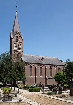 Church: the Sint-Donatuskerk | |
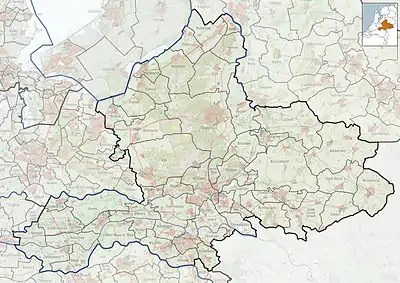 Altforst Location in the Netherlands  Altforst Altforst (Netherlands) | |
| Coordinates: 51°51′N 5°34′E | |
| Country | Netherlands |
| Province | Gelderland |
| Municipality | West Maas en Waal |
| Area | |
| • Total | 7.41 km2 (2.86 sq mi) |
| Elevation | 6 m (20 ft) |
| Population (2021)[1] | |
| • Total | 580 |
| • Density | 78/km2 (200/sq mi) |
| Time zone | UTC+1 (CET) |
| • Summer (DST) | UTC+2 (CEST) |
| Postal code | 6628[1] |
| Dialing code | 0487 |
It was first mentioned in 1134 as Altfurse, and means "old settlement near furze (ulex europaeus)".[3] The village started as a deforestation settlement. It was a low-lying area, and therefore, three artificial mounds have been erected in the village. The Dutch Reformed Church dates from 1824 and was decommissioned in 1970.[4] In 1840, it was home to 281 people. The Roman Catholic Church dates from 1891 and is the replacement of a barn church.[5]
Gallery
 Discotheque in Altforst
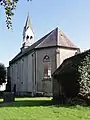 Dutch Reformed Church
References
- "Kerncijfers wijken en buurten 2021". Central Bureau of Statistics. Retrieved 25 March 2022.
- "Postcodetool for 6628AA". Actueel Hoogtebestand Nederland (in Dutch). Het Waterschapshuis. Retrieved 25 March 2022.
- "Altforst - (geografische naam)". Etymologiebank (in Dutch). Retrieved 25 March 2022.
- A.G. Schulte (1986). Het Land van Maas en Waal (in Dutch). The Hague: Staatsuitgeverij. p. 300. ISBN 90 12 05040 5. Retrieved 25 March 2022.
- "Alforst". Plaatsengids (in Dutch). Retrieved 25 March 2022.
This article is issued from Wikipedia. The text is licensed under Creative Commons - Attribution - Sharealike. Additional terms may apply for the media files.