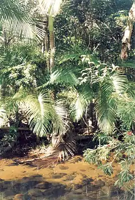
Alligator Creek, Queensland (Townsville)
Alligator Creek is a rural locality in the City of Townsville, Queensland, Australia.[2]
| Alligator Creek Queensland | |||||||||||||||
|---|---|---|---|---|---|---|---|---|---|---|---|---|---|---|---|
 Alligator Creek | |||||||||||||||
 Alligator Creek | |||||||||||||||
| Coordinates | 19.4241°S 146.9458°E | ||||||||||||||
| Population | 1,353 (2016 census)[1] | ||||||||||||||
| • Density | 27.39/km2 (70.94/sq mi) | ||||||||||||||
| Established | Subdivision started 1972 and completed 1985 | ||||||||||||||
| Postcode(s) | 4816 | ||||||||||||||
| Area | 49.4 km2 (19.1 sq mi) | ||||||||||||||
| Time zone | AEST (UTC+10:00) | ||||||||||||||
| LGA(s) | City of Townsville | ||||||||||||||
| State electorate(s) | Burdekin | ||||||||||||||
| Federal division(s) | |||||||||||||||
| |||||||||||||||
Geography
Alligator Creek is approximately 30 kilometres (19 mi) south-east of Townsville.
The locality is bounded on the north by the Bruce Highway. The North Coast railway line is aligned with part of the northern boundary, though mostly runs just north of the boundary in Nome.[3]
As the name suggests, Alligator Creek flows through the area from the south-east through to the north. It eventually enters Cleveland Bay within the locality of Cape Cleveland.[3]
Killymoon is a neighbourhood in the north-east of the locality (19.4°S 146.9833°E),[4] with Killymoon Creek running almost parallel to Alligator Creek, though it drains into the adjacent Crocodile Creek system.[3]
The Bowling Green Bay National Park encompasses much of the surrounding mountains, with the most prominent being Mount Elliot, distinguished by the statuesque Cockatoo Rock jutting from the foothills. Mount Elliot's tallest peaks are Mount Elliot proper at 1,221 metres (4,006 ft) and Sharp Elliot at 1,185 metres (3,888 ft). The popular bushwalking track to the Alligator Creek Falls follows the creek upstream and along the north-eastern aspect of the mountain.
Mount Storth (19.412748°S 147.011346°E) and Saddle Mountain (19.445986°S 147.015408°E) border the east, whilst The Sisters Mountains borders the west of the locality. Middle Sister (19.4161°S 146.9058°E) rises to 429 metres (1,407 ft).[5][6][3]
History
The region's traditional landowners are the Bindal people, with archaeological sites near Townsville dating back to over 10,000 years ago. The Bindal people call their country Thul Garrie Waja.[7]
Prior to the European settlers, shipwreck survivor James Morrill lived with the Bindal people in the Mount Elliot region from 1846 until 1863, also spending some of that time with the Juru to the south.[8]
The region has been inhabited by European settlers since before the creation of the Kennedy District in 1861, catering to the emerging pastoral industry, and the establishment of Townsville in 1864. Traces of the old coach road still remain, including its crossing of Alligator Creek about 1.7km upstream from the current Bruce Highway bridge. This road remained in regular use until the mid-1970s, although only the western section exists today as Allendale Drive.
In the 2016 census, Alligator Creek had a population of 1,353 people,[1] increasing to 1,550 in the 2021 census.[9]
Most properties in the area were delivered Townsville town water in 2006.
Amenities
The Townsville City Council operate a mobile library service which visits Parkland Road at Alligator Creek every second Wednesday morning.[10]
The Gator Girls branch of the Queensland Country Women's Association meets at the Alligator Creek Community & Sports Club at 10 Parklane Road.[11]
The Alligator Creek Pony Club has a long history in the area, and enjoyed by many of the locals.
Education
There are no schools in Alligator Creek. The nearest primary school is Wulguru State School in Wulguru to the north-west. The nearest secondary school is William Ross State High School in Annandale to the north-west.[3]
References
- Australian Bureau of Statistics (27 June 2017). "Alligator Creek (SSC)". 2016 Census QuickStats. Retrieved 20 October 2018.
- "Alligator Creek – locality in City of Townsville (entry 44564)". Queensland Place Names. Queensland Government. Retrieved 19 September 2020.
- "Queensland Globe". State of Queensland. Retrieved 17 October 2020.
- "Killymoon – locality unbounded in City of Townsville (entry 18135)". Queensland Place Names. Queensland Government. Retrieved 19 September 2020.
- "The Sisters Mountains – range in City of Townsville (entry 34122)". Queensland Place Names. Queensland Government. Retrieved 19 September 2020.
- "Middle Sister – mountain in City of Townsville (entry 21993)". Queensland Place Names. Queensland Government. Retrieved 19 September 2020.
- "About - Townsville NAIDOC". www.townsvillenaidoc.com.au. Retrieved 23 June 2023.
- Morrill, James (1863). Sketch of a Residence Among the Aboriginals of Northern Queensland for Seventeen Years: being a narrative of my life, shipwreck, landing, on the coast, residence among the Aboriginals, with an account of their manners and customs, and more of living; together with notices of many of the natural productions, and of the nature of the country. James Morrill. [Brisbane], QLD, Australia: Printed at the Courier General Printing Office.
- "2021 Alligator Creek (Townsville - Qld), Census All persons QuickStats | Australian Bureau of Statistics". www.abs.gov.au. Retrieved 23 June 2023.
- "Mobile Library Service" (PDF). Townsville City Council. Archived from the original (PDF) on 29 January 2018. Retrieved 29 January 2018.
- "Branch Locations". Queensland Country Women's Association. Archived from the original on 26 December 2018. Retrieved 26 December 2018.
External links
- "Alligator Creek (near Townsville)". Queensland Places. Centre for the Government of Queensland, University of Queensland.