Aktay
The Aktay (Russian: Актай) or Aqtay (Tatar: Актай, romanized: Aqtay) is a river in Tatarstan, Russian Federation, a left-bank tributary of the Volga, falling into the Kuybyshev Reservoir near Izmeri. It is 89 kilometres (55 mi) long, and its drainage basin covers 1,016 square kilometres (392 sq mi).
| Aqtay, Aktay | |
|---|---|
 Location of mouth | |
| Location | |
| Countries | Tatarstan, Russia |
| Physical characteristics | |
| Source | |
| • location | Verkhnie Mataki, Alkeyevsky District |
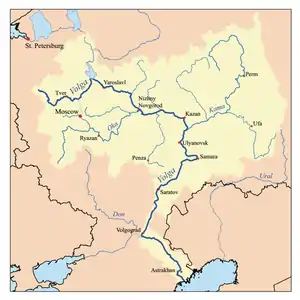
| Mouth | Volga |
• location | Izmeri, Spassky District |
• coordinates | 55.1209°N 49.5509°E |
• elevation | 53 m (174 ft) |
| Length | 89 km (55 mi) |
| Basin size | 1,016 km2 (392 sq mi) |
| Discharge | |
| • average | 422 m3/s (14,900 cu ft/s) |
| Basin features | |
| Progression | Volga→ Caspian Sea |
The major tributaries are Chelninka, Salmanka, and Romodanka. The maximal mineralization is 500 to 700 mg/L. The average sediment deposition at the river mouth each year is 71 millimetres (2.8 in). Drainage is regulated. In the upper stream use to dry.[1] Bazarnye Mataki is along the river.
References
- "Актай". Tatar Encyclopaedia (in Tatar). Kazan: The Republic of Tatarstan Academy of Sciences. Institution of the Tatar Encyclopaedia. 2002.
| Tributaries |
|  |
|---|---|---|
| Reservoirs | ||
| Hydroelectric stations | ||
| Canals | ||
| Cities | ||
This article is issued from Wikipedia. The text is licensed under Creative Commons - Attribution - Sharealike. Additional terms may apply for the media files.