Akkihebbal
Akkihebbalu is a Hobli in the southern state of Karnataka, India.[2][3] It is located in the Krishnarajpet taluk of Mandya district in Karnataka.
Akkihebbalu | |
|---|---|
Hobli | |
| Coordinates: 12.62197°N 76.39423°E / 12.62197; 76.39423 | |
| Country | |
| State | Karnataka |
| District | Mandya |
| Taluk | K R Pete |
| Government | |
| • Body | Village Panchayat |
| Area | |
| • Total | 5.33 km2 (2.06 sq mi) |
| Elevation | 804 m (2,638 ft) |
| Population (2011) | |
| • Total | 3,946 [1] |
| Languages | |
| • Official | Kannada |
| Time zone | UTC+5:30 (IST) |
| Vehicle registration | KA-54, KA-11 |
| Nearest city | Mandya |
.jpg.webp)
It has an 800 year old Lakshmi Narasimha Swamy temple constructed by Goutama Maharshi. Rathotsava is celebrated every year in the month of February. Near to that a very old Eeshwara temple (Konkaneshwara) is located.
Akkihebbalu is connected by bus(B) and train(T) to Mysuru(B&T), Hassana(B&T), Mandya(B) and Bengaluru(B). It is located 55 km from Mandya, 64 km from Mysuru, 61 km from Hassan and 176 km from Bangalore.
The railway station of Akkihebbalu (station code: AKK) falls under the jurisdiction of Mysuru division of South-western Railway and is the closest (16 km) railway station to Krishnarajapete.
Image gallery
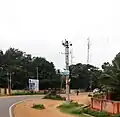
 Main Road
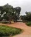
 Railway Station
References
- "Census Data Handbook 2011" (PDF). Retrieved 3 August 2023.
- "Census of India : List of Villages Alphabetical Order > Karnataka". Registrar General & Census Commissioner, India. Retrieved 18 December 2008., Census Village code= 2312000
- "Yahoo! maps India :". Archived from the original on 18 December 2008. Retrieved 17 April 2009. Akkihebbalu, Mandya, Karnataka
External links
District HQ: Mandya | |
|