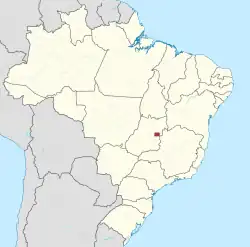
Administrative regions of the Federal District (Brazil)
The administrative regions of the Federal District (Portuguese: regiões administrativas do Distrito Federal) are administrative divisions of the Federal District, Brazil.[1][2]
_(2).png.webp)
History
The Federal District was first divided into administrative regions by a 1964 federal law.[3] Before this, the regions were not officially defined, but the seven oldest seats of government (Gama, Taguatinga, Brazlândia, Sobradinho, Planaltina, Paranoá, and Núcleo Bandeirante) already existed and were often called satellite cities (Portuguese: cidades satélites) to the capital Brasília,[4] which was included in the Plano Piloto administrative region.
The 1988 Constitution of Brazil divides the country into federated states and these into municipalities with a degree of autonomy, headed by an elected mayor, but explicitly forbids the Federal District to divide into municipalities.[5]
It is instead divided into decentralized administrative regions headed by a regional administrator appointed by the Governor of the Federal District ,[6][7] as opposed to the elected mayors of municipalities.
The regional administrations are tasked with representing the government of the Federal District and coordinating local public services, and carry out most tasks reserved for municipalities, except for matters exclusive to states, which are handled by the governor themself. [5]
List of administrative regions
| Number | Administrative region |
|---|---|
| I | Plano Piloto |
| II | |
| III | |
| IV | |
| V | |
| VI | |
| VII | |
| VIII | |
| IX | |
| X | |
| XI | |
| XII | |
| XIII | |
| XIV | |
| XV | Recanto das Emas |
| XVI | Lago Sul |
| XVII | |
| XVIII | Lago Norte |
| XIX | |
| XX | Águas Claras |
| XXI | Riacho Fundo II |
| XXII | Sudoeste/Octogonal |
| XXIII | Varjão |
| XXIV | |
| XXV | SCIA |
| XXVI | |
| XXVII | |
| XXVIII | |
| XXIX | |
| XXX | |
| XXXI | |
| XXXII | Sol Nascente/Pôr do Sol[8] |
| XXXIII | |
| XXXIV | Arapoanga[10] |
| XXXIV | Agua Quente[10] |
References
- "Lei Orgânica do Distrito Federal" (PDF) (in Portuguese). Portal CLDF. Archived from the original (PDF) on 2011-07-06. Retrieved 2012-08-24.
- "Estrutura do Distrito Federal" (in Portuguese). Portal GDF. Archived from the original on 2007-06-23. Retrieved 2012-08-24.
- Federal Law no. 4545. Archived from the original on 12 July 2023. Retrieved 29 September 2023.
- "Plano piloto e regiões administrativas" (in Brazilian Portuguese). Secretaria de Educação do Paraná. Archived from the original on 27 March 2023. Retrieved 29 September 2023.
- Laubé, Vitor Rolf (January 1990). "Distrito Federal : organização e natureza jurídica decorrentes da constituição de 1988". Revista de informação legislativa (in Brazilian Portuguese). 27 (105): 47–64. Archived from the original on 2021-06-19. Retrieved 2023-09-30.
- "Lei Orgânica do Distrito Federal" (PDF) (in Portuguese). Portal CLDF. Archived from the original (PDF) on 2011-07-06. Retrieved 2012-08-24.
- "Estrutura do Distrito Federal" (in Portuguese). Portal GDF. Archived from the original on 2007-06-23. Retrieved 2012-08-24.
- "Pôr do Sol/Sol Nascente se torna a 32ª região administrativa do DF". G1 (in Brazilian Portuguese). Archived from the original on 2022-08-18. Retrieved 2022-04-28.
- "CLDF aprova criação da Região Administrativa de Arniqueira". Agência Brasília (in Brazilian Portuguese). 2019-08-28. Archived from the original on 2021-08-05. Retrieved 2022-04-28.
- "DF terá mais duas regiões administrativas: Água Quente e Arapoanga". Câmara Legislativa do Distrito Federal (in Brazilian Portuguese). Archived from the original on 30 September 2023. Retrieved 29 September 2023.
