A4 motorway (Luxembourg)
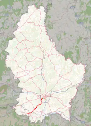
The Autoroute 4, abbreviated to A4 or otherwise known as the Esch-sur-Alzette motorway (French: Autoroute de Esch-sur-Alzette, Luxembourgish: Escher Autobunn, German: Escher Autobahn), is a motorway in southern Luxembourg. It is 16.302 kilometres (10.130 mi) long and connects Luxembourg City to Esch-sur-Alzette.
.JPG.webp)
 | |
|---|---|
| Autobunn 4 | |
| Autoroute d'Esch-sur-Alzette | |
 | |
| Route information | |
| Length | 16.302 km (10.130 mi) |
| Existed | 1969–present |
| History | Completed in 1992 |
| Major junctions | |
| North end | Luxembourg City |
| Croix de Cessange Leudelange Pontpierre | |
| South end | Esch-sur-Alzette |
| Location | |
| Country | Luxembourg |
| Highway system | |
Overview
The A4 was opened in six separate sections:
- 1969: Pontpierre – Lallange
- 1972: Leudelange-Nord – Leudelange-Sud
- 1974: Merl – Leudelange-Nord
- 1976: Leudelange-Sud – Pontpierre
- 1988: Lallange – Lankelz
- 1992: Lankelz – Raemerech[1]
Route
| Junctions and structures | ||
| Luxembourg City | ||
| Croix de Cessange | ||
| Leudelange (North) | ||
| Leudelange (South) | ||
| Pontpierre | ||
| Pontpierre services | ||
| Foetz | ||
| Esch Junction | ||
| Lallange | ||
| Lankelz Junction | ||
| Esch-sur-Alzette, Audun-Le-Tiche | ||
References
- "Evolution du réseau autoroutier" (in French). Administration des Ponts et Chaussées. 24 January 2008. Archived from the original on 3 March 2009. Retrieved 29 December 2008.
External links
![]() Media related to A4 (Luxembourg) at Wikimedia Commons
Media related to A4 (Luxembourg) at Wikimedia Commons
- (in French) Administration des Ponts et Chaussées
This article is issued from Wikipedia. The text is licensed under Creative Commons - Attribution - Sharealike. Additional terms may apply for the media files.