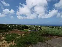
Tokunoshima (Japanese: 徳之島, Tokunoshima: トゥクヌシマ, Tukunushima) is one of the Amami Islands. Together with Amami Oshima, Iriomote and the northern part of the Okinawa Island it was listed as a natural world heritage site by UNESCO in 2021.
Understand
Much of the island is included within Amami Guntō National Park, established in 2017.
Tokunoshima has a culture that reflects a mix of Japanese and Ryukyuan influences, with much influence from the neighboring Amami islands and from Okinawa to the south. A popular musical instrument on the island is the sanshin, an Okinawan relative of the Japanese shamisen, and the Okinawan folk dance eisa is practiced.
The indigenous language of the island, the Ryukyuan language called Tokunoshima, is known on the island as sïmagucï or, in Japanese, shimaguchi ("island language"). However, the language has now largely been supplanted by standard Japanese. The Tokunoshima words for "thank you," oboradaren (Tokunoshima and Amagi towns) and oboradanii (Isen town) are widely known even among Japanese speakers.
Get in
The port of Kametoku, next to Kametsu in the administrative town of Tokunoshima, has regular ferry service to the towns of Naze on Amami and Wadomari on Okinoerabu. From Amami, the ferry continues to Kagoshima. From Okinoerabu, the ferry continues to Yoron and Okinawa. There are ferries to Kobe as well. The smaller port of Hetono, in the town of Amagi, has ferries to Kagoshima and to Setouchi on Amami. When waves are too strong on the Pacific side of the island, where Kametoku is located, the Kametoku ferries will instead land at Hetono port. Small ports primarily used by fishing or sightseeing boats exist elsewhere along the shoreline.
Tokunoshima Airport, in Amagi, is connected to Kagoshima, Amami, and Okinoerabu (with the flight continuing to Okinawa) by Japan Airlines and Japan Air Commuter.
Get around
The main highway on the island is Kagoshima Prefecture Highway 80, which traverses the island from Tokunoshima Airport and Amagi to Kametsu and then follows the southeastern coast of the island to Isen.
From Isen, Highway 83 crosses the southeast area of the island to Amagi.
Highway 629 follows the northern coast of the island from Tokunoshima Airport to the village of Kedoku.
Highway 617 is an inland route between Kametsu and the village of Itokina, while Highway 618 connects Kedoku to the village of Matsubara through the village of Todoroki.
See
Tokunoshima is a popular tourist destination. On the island's north coast, Mushiroze, a striking area of chiseled stone slabs set against the ocean, is a rare example of granite rock on a predominantly volcanic and coral island. The area is named for the way the flat stone slabs resemble mushiro, a Japanese term for woven straw mats.
Cape Inutabu, the westernmost point of the island, features a stunning ocean view and a memorial, built in April 1968, to the Japanese battleship Yamato and her escorts, which were sunk near Tokunoshima during the final stages of World War II.
Another notable seaside attraction is Innojofuta, an area of jagged, eroded coral rock with dramatic ocean vistas. At Innojofuta, a distinctive pair of eroded windows in the rock known as Megane-Iwa (Spectacles Rock) overlooks the ocean.
Do
Hiking is discouraged because of the habu snake, but the mountain trails are exotic and beautiful. The beaches are also quite stunning, and the island's coastline includes several notable natural landmarks.
Tokunoshima is known for tōgyū, a Japanese style of bullfighting in which human coaches encourage bulls with locked horns to push each other out of a ring. Tōgyū is a major event on the island and much of the island's culture revolves around the bullfights. Because of the importance of tōgyū, Tokunoshima's mascot and main icon is a tōgyū bull.
Buy
Eat
The local cuisine of the island combines standard Japanese fare with Okinawan dishes such as goya chanpurū.