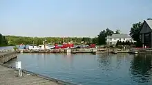
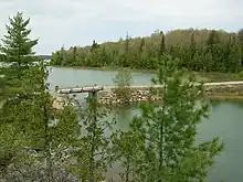
St. Joseph Island is home to about 2,300 residents (2021) in Algoma District in the Lake Superior North Shore region of Northern Ontario. It's the second largest island on Lake Huron (after Manitoulin). Locals claim that maple syrup produced on the island is Canada's best — as Ontario's largest maple syrup producing area, there are plenty of opportunities to taste for yourself.
Understand

St. Joseph Island has two towns: 🌍 Richard's Landing and 🌍 Hilton Beach. Its principal industries are maple syrup production, tourism and small-scale agriculture.
It is popular as camp and cottage country for Sault Ste. Marie and Mid-western American families.
Many small family farms or hobby farms operate on the island producing corn and other vegetables, beef, lamb, poultry and eggs.
History
Little evidence has been found of human activity on St. Joseph Island before the 17th century. By the time the first Europeans arrived in the 1630s, the north channel of Lake Huron was shared by the Ojibwe, Odawa and Potawatomi peoples whose Algonkian ancestors had come from the east around 1200. St. Joseph Island became a strategic mid-way point for French explorers, missionaries and fur traders on the long voyage between Quebec and Lake Superior. St. Joseph Island first appeared on European maps in the 1670s.
Any French claim to St. Joseph Island ended with the conclusion of the Seven Years' War in 1763. France relinquished virtually all of its interests in North America to the British. By 1783 the Treaty of Paris effectively ended the American Revolution. The border it created between the United States and British North America ran through the middle of Lake Huron. While the treaty very clearly placed Mackinac Island on the American side, it was unclear how St. Joseph and its neighbouring islands that fell in the middle of the St. Marys River were to be apportioned. In 1798, the Ojibwe agreed to sell the island to the British for £1,200 Quebec currency of trade goods, an annual gift exchange and the right to continue to harvest the island and bury their dead there.
In time, Fort St. Joseph became an important point for trade and commerce in the region. Settlers, many of whom had lived near the fort at Mackinac, and merchants of the Northwest Company followed the garrison to establish the first permanent European settlement on the island around Fort St. Joseph.
Within weeks of the commencement of the War of 1812, the British moved a force from Fort St. Joseph to reclaim their old fort at Mackinac. Abandoned, Fort St. Joseph was burned by a U.S. force in July 1814. The British did not rebuild the Fort St. Joseph following the war. In 1974, the ruins became a National Historic Site administered by Parks Canada. After the war, the border between British North America and the United States was drawn along the western shore of St. Joseph between it and St. Tammany (today Neebish) Island.
Major William Rains, a veteran of British wars in Europe, purchased over 2,200 hectares to start a colony on St. Joseph Island in 1834. Rains, his family and a company of investors established Milford Haven - named after Rains' hometown in Wales - with a store and sawmill in the southeast of the island. However, few settlers came to the island and by 1839 the community consisted of only eight houses.
The population of the island began to shift from the south and west to better agricultural land in the north. Government policies encouraged would-be farmers in the south of Ontario to relocate to tracts of land in Algoma by providing up to 200 acres of land per head of household. The greatest influx of settlers came between 1874 and 1882.
The completion of the Canadian Pacific Railway spur from Sudbury across the north channel to Sault Ste Marie in 1887 opened up the region to migration by farmers and settlers. A rough roadway followed so that by 1923, the communities along the channel were connected to Sault Ste Marie by road.
At the close of the 1800s and beginning of the 1900s, it became very fashionable among wealthy Americans and others to have summer residences along the Great Lakes and St. Lawrence River. Americans from the mid-west sought to establish resorts on islands accessible by steamboat on the Great Lakes. In 1900, Chicago merchant Edward H. Pitkin purchased Sapper Island to the west of Campement d’Ours Island and asked his neighbour Frank Lloyd Wright, then an apprentice architect, to design him a home. Completed in 1902, the Pitkin Cottage is one of only two buildings designed by the American architect in Canada, and the only one surviving.
Visitor Information
Get in
St. Joseph's Island is connected to the mainland via a free bridge. To access the island, turn south from Highway 17 onto Highway 548.
- 🌍 St. Joseph Island Airport. A private airstrip about half way between Richards Landing and Hilton Beach consisting of a 732 m (2,402 ft) turf runway.
Get around

The primary road system to and on the island is Highway 548, a 75-km (47-mi) secondary highway consisting of two separate segments: the north-south segment, that includes the St. Joseph Island Bernt Gilbertson Bridge, and a continuous loop route that circles the island.
The north-south segment connects with Highway 17/Trans Canada Highway in the north and terminates at a T-intersection with the loop segment at Kent's Corners, 5.4 km (3.4 mi) south of Highway 17.
The much longer 68-km (42-mi) continuous loop segment circles the island. To assist in navigation and street addressing, segments of the loop have been given suffix letters which generally correspond to the local road name. For example, the portion of Highway 548 which is signed along D Line is named 548D, along Huron Line it is named 548H, etc.
The primary road system on the island has crossroads every 1.25 miles (2 km). Many of these are still gravel roads, however, the local municipalities have been paving many of the more frequently used routes.
See
- Fall colours (September-October)
- 🌍 Adcock's Woodland Gardens.*
- Over the Rainbow Doll Museum, @ Rainbow Ridge Farm (2.5km west of Richards Landing), ☏ +1 705 246-2683. May-Oct, call for times. 1000-piece collection, antique to modern. Large groups welcome. $2, children free.
- 🌍 St. Joseph Island Museum, RR#2, Richards Landing (after crossing the bridge and reaching the first stop sign, proceed straight onto 20th side road to I Line), ☏ +1 705-246-2672, info@stjoemuseum.com. Open mid-June until early Sep: W-M 9:30AM-4:30PM. Founded in 1963 by the Historical Society, the St. Joseph Island Museum has over 6000 artifacts in six historic buildings, covering over 200 years of island history. The progression of the island is represented in four time periods: native encampments to Fort St. Joseph (1798-1814); pioneer settlements (1835-1890); to a period of almost complete private ownership by 1890; and the depression and war years (1900-1945).
Do
- 🌍 Fort St. Joseph National Historic Site of Canada, ☏ +1 705-246-2664. Jun–Sep: W-Su 10AM-5PM. Hike the trails, see the ruins,or watch brief historic film vignettes related to the site. The site is maintained by Parks Canada site. Its theme is the Fur Trade, the War of 1812 and the British military, and the Aboriginal people in the area with whom the British formed alliances. Wildlife viewing: deer, fox, bald eagle, racoon, bear, etc. Adults $4.25, seniors $3.75, under 18 free.
- Fort St. Joseph Ghost Walk, Fort St. Joseph National Historic Site. Third Saturday in August. A walk through the candlelit ruins of the old fort. Costumed spirit guides tell you tales of former Fort St. Joseph inhabitants with background music of bagpipes and traditional Indigenous drumming. $10.
- Country Road Open House, Various hosts (Map available), ☏ +1 705-246-2683. Self-driving tour to celebrate the harvest, weekend before the Canadian Thanksgiving weekend. Various farms and rural entrpreneurs open their doors for two days. Activities could include, hay rides, quilting or sheep shearing demo. Farm produce available and seasonal menus at local establishments.
Buy
- Richards Landing (pop. 1200, permanent population approx. 400) is the commercial centre of St. Joseph Island with services including a bank, pharmacy, grocer, liquor store, artisan shops and galleries, fuel station, post office, hospital and medical centre. There is a marina, sportsplex and community centre, as well as a historic town hall, restaurants and accommodation, public parks, beaches and a tennis court.
- 🌍 Kentvale Home Hardware, 712 K Line Rd, ☏ +1 705-246-2002. Although it is the island's primary hardware store, it's more of a country general store to anyone not buying tools or lumber, selling everything from groceries and clothing to souvenirs and maple candy.
Eat and drink
- Maple syrup season breakfast (Spring)
- Mostly fresh fish
- 🌍 St. Jo's Diner, 1581 Bridge Rd (Richards Landing), ☏ +1 705-246-3703. Daily 7AM-8PM.
- 🌍 Island Springs Golf Course Restaurant, 2674 10th Side Rd (Richards Landing), ☏ +1 705-246-1400. W-Su 9AM-7PM.
- The Dry Dock, Hwy 548, Hilton Beach.
Sleep
- Clansmen Motel, 1430 Richards St, Richards Landing, ☏ +1 705-246-2581, clansmen@stjosephisland.net. High speed wireless internet, cable TV, four-piece bath, housekeeping facilities that include a stove top, fridge, microwave oven, coffee maker with complimentary coffee, toaster and all necessary utensils. Single from $75, double from $80, triple from $90, quad from $95 plus taxes.
- Hilton Beach Inn and Island Bar and Grill, 3117 Mark St, Hilton Beach, ☏ +1 705-246-0063, info@hiltonbeachinn.ca. Amazing view overlooking the north channel in Hilton Beach. Great food and clean affordable rooms.
- 🌍 Sunnyside Bed & Breakfast, 1328 Sailors Encampment Dr (Richards Landing, on the North Shore shipping channel), ☏ +1 705-246-1555. In-room air conditioning, country quilts & down duvets, Wi-Fi. From $98.
- 🌍 Whiskey Bay Resort, 1187 Adcock Dr, ☏ +1 705-246-2463, hello@whiskeybayresort.ca. Cabins and RV camping next to Whiskey Bay, with a small beach and marina facilities.
Stay safe
There is an abundance of wildlife, especially deer which tend to pop out of the fields and woods at any given moment, so heads up!
Bicycling: The highway 548 which completely circles St.Joseph Island is hard surfaced as are most of the side roads. These are very scenic routes and well suited for bicycling during the good weather. St.Joseph Island is home to many, many permanent residents that go about their daily business year-round. In the summer months the population swells with summer residents and guests. Many are not familiar or expecting bicycle or pedestrians on rural roads.
Driving: Watch for wildlife, especially deer which can be found anytime of day year-round, in any area of St. Joseph Island
Respect
Private property: There is very little Crown (i.e., public) land on St. Joseph Island. Therefore, you should ask permission before hiking or hunting while visiting St Joseph Island.
Connect
- 🌍 St. Joseph Township Public Library, 1240 Richards St, ☏ +1 705-246-2353. M 5-8PM, W 10AM-3PM, Th 3-8PM, Sa 10AM-3PM. Provides computer and Wi-Fi access.
Go next
- Sault Ste Marie — about 50 km (31 mi) northwest from the bridge, the next city on the Trans-Canada Highway heading west. Across St. Mary's River from Sault Sainte Marie.
- Blind River — 95 km (59 mi) from the bridge, the next town to the east, serving as a rest stop on the Trans-Canada.
| Routes through St. Joseph Island |
| Ends at W |
N |
→ END |