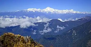
The Old Silk Route or simply the Silk Route is a high-altitude road trip in the East Sikkim district of Sikkim. The 2-day- and 1-night-long road trip follows the ancient trade routes and offers spectacular views of the snow-covered Kanchenjunga, the third-highest peak in the world. The route passes several beautiful high-altitude glacial lakes, high passes opening into Tibet, China and a couple of temples dedicated to a fallen Indian soldier.
| Note: Foreigners are not allowed on this route. | |
| (Information last updated 20 Aug 2020) |
Understand
History
- See also: Silk road
The tour covers part of an ancient trade route passing through the high passes of Nathula and Jelep La on the India Tibet (China) border. The route connected Eastern India with the famous Silk Route of Central Asia. The route also had strategic importance. In 1888 the rugged mountain served as a battleground between the Tibetans and the British. A small graveyard with a war memorial stands in the village of Gnathang (Nathanag) in memory of the fallen British soldiers. In 1903–04, this route was used by Francis Younghusband to invade Tibet and move onwards to Lhasa.
This was the route that George Mallory and his fellow mountaineers took during the Mount Everest expeditions of 1921, 1922 and 1924. Sir Francis Younghusband writes, in his book The Epic of Mount Everest, "But from Rongli they climbed steeply out of the tropical forest into the zone of flowering rhododendrons.... To flower lovers, like Howard Bury, Mallory and Wollaston, these were perpetual delight. They were all the more appreciated because they would be almost the last sign of luxuriance and grace they would behold before they to face the austerities and stern realities of rock and ice and snow, and the frosts of Mount Everest." The Silk Route also has stories from the recent past. The route has two temples dedicated to an Indian soldier who died from drowning in one of the fast-flowing streams of the region.
When to go
- Mid-September to mid-December: Is the best time with clear skies and great mountain views. Lush green meadows covered with colourful flowers.
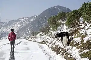
- Mid-December to April: It is a fairly good time with heavy snowfall. Upper portions of the route can become inaccessible. Vehicles can get stuck.
- May to mid-June: This is better than mid December - April with occasional snowfall or rains. Partially clouded sky with occasional views of snow-capped mountains.
- Mid-June to mid-September: Not a good time. Heavy rainfall. No views, frequent landslides.
Prepare
Fees and permits
Indians need a Protected Area Permit to travel in the Silk Route. The permits can be arranged by the travel agents and hotels. The permits are issued from the Sikkim Tourism Office at Gangtok or from the SDPO Office in Rongli. The office remains open till 14:00 on weekdays, 11:00 on Saturdays, and closed on Sunday). The permit issued from Rongli doesn't cover Nathula while the one issued from Gangtok permits visits to Nathula. The tourist need to carry the following documents. 4 passport size photographs, photo ID card (passport, adhar card, voter card, driving licence), both original and photocopies. The permit takes less than half an hour but in tourist season there can be long quques. Foreigners are not allowed in this route.
Get in
Since 🌍 Rongli is the place where the permits are issued for the Silk Route tour, it saves a lot of time. But since Rongli is not very scenic the tour can also be started from 🌍 Aritar 🌍 Icche Gaon and 🌍 Sillery Gaon and a few other destinations in Sikkim or North Bengal. For tourist starting the tour from other destination needs to travel to Rongli for the permit and proceed along the Silk Route. The route can also be done in the reverse direction starting from Gangtok. however it is not a preferred choice. The road trip involves high altitude so necessary precaution for Altitude sickness needs to be taken.
Route

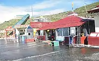
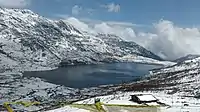
.jpg.webp)


- 🌍 Lingtam (9 km from Rongli) — a small village with a couple of hotels and a monastery. It has a check post where permits of Silk Route are checked.
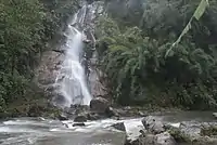
- 🌍 Que khola falls —A small waterfall between Lingtam and Padamchen
- 🌍 Phadamchen (12 km from Lingtam) — Scenic Himalayan village with a small monastery and a handful of hotels and homestays. Permits of the Silk Route are checked here for the second time.
- 🌍 Zuluk (2865 m) (9 km from Padamchen) — Zaluk (or Dzuluk) marks the beginning of the high altitude. It is a fairly large village with many hotels and homestays. A good night's destination.
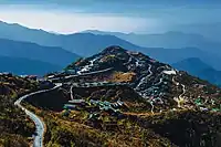
- 🌍 Zigzag Road — From Zuluk to Thambi View Point the road gains an altitude of 600+m in just 13 km. The road is an engineering marvel consisting of a series of numerous hairpin bends. The combination of the hairpin bends creates an amazing geometry of zig zag patterns best viewed from the Thambi View Point.
- 🌍 Thambi View Point (3415 mt) (13 km from Zuluk) — According to local sources, Thambi View Point is named after the civil engineer, who constructed the road, offers an extraordinary view of the Kanchenjunga and its sister peaks. But the view of Zuluk along with the meandering zig - zag road is definitely no less an attraction.
- 🌍 Lungthung View Point (3963 m) 4 km from Thambi View Point — The zig - zag road continues a little beyond the Thambi View point and after which it head almost straight to Lungthung View Point Lungthung View Point. This view point located closer and higher than the Thambi View Point offers a better and closer view of the Kanchenjunga and its adjoining peaks. A huge army barrack is located next to the view point. Being a border area the entire route has a heavy military presence.
- 🌍 Laxman Chowk — Just before the Gnathang valley the road bifurcates into two parts. The place is known as Laxman Chowk, and a memorial stands in memory of Lt. Col. Laxman Singh (Commanding Officer, 5 Mahar Borders) under whose command the unit pre-emptively secured the water shed opposite Chinese in General Area Dokala in 1965. The left road is the lower road and leads to the Gnathang valley and village. The upper road is on the right and leads to the Old Baba Mandir. Both the roads rejoin again just before the Kupup Lake.
- 🌍 Gnathang (4116 m) (6 km from Lungthung View Point) — Gnathang (also called Nathang) Valley consists of the Gnathang (Nathang) village. The village houses several basic hotel and homestays. Both sides of the road are lined up with small eateries selling hot soups, momos and thupkas. The village has a heavy military presence.
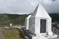
- 🌍 British War Memorial, Gnathang — According to historical records the Nathang area was captured by the Tibetans in 1886 and it was recaptured back by the British in 1888 and a memorial, along with a few graves, stands in the memory of the soldiers killed during the recapture. The memorial lies on the left hand side of the road for travellers travelling from the south. The complex consists of two memorials with shinning new granite plaques and fifteen graves. The epitaphs of the graves have long vanished. Sadly the original marble plaques have been replaced by granite plaques. An original marble plaque from one of the memorials can still be seen.
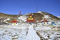
- 🌍 Old Baba Mandir — Being a border area, the entire Silk Route has a heavy army presence. Working in these harsh conditions is never easy and no wonder they have their share of legends. Harbhajan Sing is the legend of the Silk Route with two temples dedicated to his name. According to army records On Oct 4, 1968, Harbhajan Sing, while escorting a mule caravan in the silk route region, fell into a stream and was swept away. On the fifth day one of his fellow soldier had a dream, where Harbhajan Singh informed him about his tragic death and also about the location of his body. Incidentally a rescue operation recovered his body from the very position that was mentioned in the dream. Later a samadhi was built, in his honor, at the bunker, where Harbhajan Singh had his last posting. Today the samadhi is reached by a flight of stairs and small shrine (old Baba Mandir) with the photo of Hrbhajan Singh stands at its base. Even today the legend of Harbhajan Singh lives on, there are stories of soldiers being slapped when they fall asleep during his duties. Harbhajan Singh is also said to inform his colleagues of bad weather and other calamities. Even his Chinese counterpart is aware and afraid of his presence. The Old Baba Temple lies on the high (right) road from Laxman Chowk just before meeting point of the high and low road.
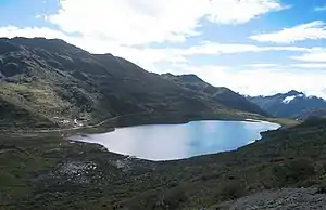
- 🌍 Kupup Lake (Elephant Lake) (4000 m) (6.4 km from Nathang) —The lake is located near the Kupup village and is locally known as Bitan Cho. It is shaped like an elephant, complete with a tail and trunk. Hence it is also popularly known as the Elephant Lake. It is one of the most sacred lakes of Sikkim and stunningly beautiful. The nearby Kupup village contains a golf course, which is said to be the highest in the world.
- 🌍 New Baba Temple (5.6 km from Kupup Lake)—This temple is also dedicated to Baba Harbhajan Singh and came up in 1982 and is popularly known a New Baba Temple. The central room of the three-room shrine contains a large portrait of Harbhajan Singh along with photos of Sikh Gurus and Hindu Gods and Goddesses.
- 🌍 Menmecho Lake —This lake is not on the main road and one has to trek for 4 km to reach it. The trail starts just beyond the New Baba Mandir and is on the left hand side of the road. The beautiful lake is surrounded by pine forest and the water changes colour several times a day. The lake is used by the Sikkim Fisheries Department for trout cultivation.
- 🌍 Hangu Lake (not to be confused with Changu Lake) (3938 m) (2 km from New Baba Temple) — This glacial lake lies on the left hand side of the road. It has paddle boating facilities. There is an Indian Army memorial for forgotten soldiers atop a hill next to the lake.
- 🌍 Ganju Lama War Museum (2 km from Hangu Lake) — Ganju Lama was a soldier from Sikkim who fought for the British Indian army during the Second World War. He was a recipient of Victoria Cross. The museum stands at the junction where the road to Nathula bifurcates from the Gangtok - Nathang road. At the entrance is marked with a statue of Ganju Lama. The museum runs a documentary throughout the day. There are other photos on display.
- 🌍 Nathula (4310 m) (4.4 km from Ganju Lama War Museum) —Tourists coming from Zuluk side are not permitted to visit Nathula but those coming from Gangtok can visit Nathula. It is a pass on the India China (Tibet) border. The pass is part of an ancient trade route. The pass is marked by entrance gates of both countries and military bunkers on both sides of the gates. This is the only open border crossing between China and India, though it is only open for cross-border trade, and tourists may not cross the border here.
- 🌍 Tsongmo (Changu Lake) (3753 m) (12.5 km from Ganju Lama War Museum) — One of the most spectacular lakes of Sikkim. The glacial lake changes colour with passing of the day. There are several eateries on the lakeside selling hot momos, thupkas and noodles. Snow boots can be hired and tourists can take a walk along the snowy ridge next to the lake. Yak rides are also available.
- 🌍 Gangtok (1650 m) (36 km from Tsongmo) —The round Silk Route ends at Gangtok, the capital of Sikkim
Itineraries
There are several itineraries for the Silk Route:
One-day tour
A very hectic tour. Permits need to be arranged the previous day.
Day 1: Start from Lingtem, Rongli, Aritar, etc. Closer the place better it is. Breakfast at the hotel and start early. Drive past Zuluk and zig-zag road halt at Thambi and Lungthung viewpoint. Take right road from Laxman Chowk, Visit Old Baba Mandir, tea break. Visit Kupup Lake. Turn back and head to Nathang, lunch break. Back to the hotel by late afternoon.
Two day Tour
A good option with lot of free time.
Day 1:Start from Lingtem, Rongli, Aritar, etc. Breakfast at hotel, collect permit and reach Zuluk. Lunch, dinner and night stay at Zuluk.
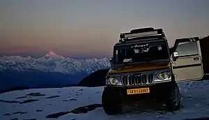
Day 2: Start very early. Reach Thambi view point before sunrise. Sunrise from Thambi view point. Great view of Kanchenjunga and zig-zag route. Move to Lungthung View Point and then on to Laxman Chowk. Take the high road on right and head to Old Baba Temple. Breakfast at Old Baba Temple. Continue to Kupup Lake. Turn around and take the lower road for the return journey. Visit Nathang on the return journey and follow the route back to Zuluk for lunch. After lunch continue to your hotel in Lingtem, Rongli, Aritar, etc., and reach by late afternoon.
Two-day round tour
This route has no backtracking. The second day is hectic.
Day 1: Same as two day tour.
Day 2: Same till Lakshman Chowk, after Lakshman Chowk take the lower route on the left. Breakfast at Nathang. Make a detour to Old Baba Mandir and get back to the road and head for Kupup Lake. The road continues to New Baba Mandir, Hangu Lake, Gunja Lama War Museum (visit to Nathula is not permitted), Tsongmo (Changu Lake) and finally to Gangtok.
Two-day round tour from Gangtok
Same as the two day round tour, but in the opposite direction. Nathula can be visited as the permit is obtained from Gangtok. Nightstay at Nathang, with sunrise views from Lungthung View Point.
Stay safe
- The route involves high altitude of above (4000+ m) and there are chances of Altitude sickness, so proper acclimatization is required. Moving slow and drinking plenty of fluids helps. Avoid spending a night at Gnathang, unless you are well acclimatized.
- The route is subject to regular landslides, especially during the monsoon months (June - August) In winter (December - April) the area receives heavy snowfall. Both landslides and snowfall can cut short the journey. The condition of the road is bad and the journey time can overshoot the scheduled time.