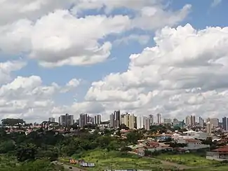
São Carlos is a city of 255,000 people (2020) in the Central region of the state of São Paulo in Brazil, named after Saint Charles Borromeo. It is about 231 km from the city of São Paulo and is known as the Capital of Technology.
São Carlos municipality is formed by São Carlos city and two districts: Água Vermelha and Santa Eudóxia. It is the 32nd most populated city in the state of São Paulo.
Get in
By car
- From São Paulo or Campinas, take Rodovia Anhanguera (SP-330) or Rodovia dos Bandeirantes (SP-348) until Limeira. From there, Rodovia Washington Luís (SP-310), heading to Araraquara and São José do Rio Preto;
- From Araraquara (33 km) or São José do Rio Preto (226 km), take the Rodovia Washington Luís (SP-310) heading to Limeira.
- Rodovia Eng° Thales de Lorena Peixoto Júnior (SP-318) connects São Carlos to the northern districts of Água Vermelha (12 km) and Santa Eudóxia (32 km), to the São Carlos Airport (14 km), to the Asas de um Sonho museum (16 km), and to Ribeirão Preto (97 km);
- Rodovia Luís Augusto de Oliveira (SP-215) connects São Carlos to the west, for cities like Ribeirão Bonito and Dourado;
- SP-255 connects São Carlos to the west, for cities like Jaú (83 km) and Bauru (153 km);
- Rodovia Dr. Paulo Lauro (SP-215) connects São Carlos to the east, for cities like Descalvado (35 km) and Porto Ferreira (48 km).
By bus
São Carlos is well served by intermunicipal bus lines, travelling up to 153 destinies, like Araraquara, Rio Claro, Ribeirão Preto, Campinas, Piracicaba, São Paulo, among other important cities within the state and across the country.
In Socicam website, it is possible to obtain informations regarding Terminal Rodoviário Paulo Egídio Martins, São Carlos bus station, as well as the list of the companies which offer passenger transport services.
By plane
Guarulhos International Airport (GRU IATA), in São Paulo (231 km (144 mi)), and Viracopos International (VCP IATA) in Campinas (150 km (93 mi)) are the main international airports around São Carlos, operating regular flights to several destinies, including major cities in North America, Europa, Africa and Asia.
Other nearby airports are:
- Ribeirão Preto (RAO IATA) (100 km), connecting São Carlos to a number of regional cities in São Paulo, Rio de Janeiro, Goiás, Mato Grosso, Minas Gerais, Tocantins, and Bahia;
- Araraquara (AQA IATA) (33 km), with 9 weekly flights to Campinas, operated by Azul.
Inside São Carlos city, there is the Mário Pereira Lopes airport, which operates only charter flights.
Get around
By taxi
By car
There are several car rental companies in São Carlos.
By bus
There are dozens of urban bus lines (managed by SiTrans), running through the city, and its two connecting terminals (North and South).
See
Museums
- Cerqueira César Historical and Pedagogical Museum (Museu Histórico e Pedagógico Cerqueira César). M-F 08:00-12:00 and 14:00-18:00, Sa 08:00-12:00. Historical museum, exhibiting colonial and imperial era items, including a D.Pedro II carriage and objects that belonged to local family farmers. Free.
- 🌍 Computing Museum (Museu de Computação), Avenida Trabalhador São-carlense, 400 - Centro (in USP-São Carlos Campus I, block 4 of the Science, Mathematics, and Computing Institute - ICMC), ☏ +55 16 3373 9700, fax: +55 16 3371 2238. M-F 08:00-18:00, Sa 09:00-12:00. Free.
- Museum of Energy (Museu de Energia), Fazenda Cascatinha, km 7.0 - (at SP-310 km 228) (inside Monjolinho power station).
- Wings of a Dream Museum (Museu Asas de um Sonho), Rodovia SP 318, km 249.5 – Água Vermelha, ☏ +55 16 3306 2020. W-Su 10:00-16:00. TAM Airline museum, an aviation museum, 15 km from São Carlos, exhibiting 35 aircraft in a historical building measuring 450 meters long by 130 meters wide and 11 meters high. Free on W, R$ 25 (general public), R$ 12.50 (students and half-price beneficiaries).
Churches and temples
- São Carlos Cathedral (Catedral de São Carlos Borromeu), Praça D. José Marcondes Homem de Mello, no number - Centro (Avenida São Carlos), ☏ +55 16 3371 2277, catedral-saocarlos@hotmail.com.
- Our Lady of Fátima Church (Igreja Nossa Senhora de Fátima), Rua: Dona Maria Jacinta, 39, ☏ +55 16 3371 5390.
- Presbyterian Church (Igreja Presbiteriana), Rua Dona Alexandrina, 1468 - São Carlos/SP CEP: 13560-290, ☏ +55 16 3371 8217. Th 19:30-20:30, Su 09:00-11:00 19:00-20:30.
- Saint Antônio of Pádua Church.
- Saint Benedito Church.
- Saint Sebastião Church.
- Our Lady Aparecida of Babylon Sanctuary.
Theaters
- Municipal Theater (Teatro Municipal), Rua Sete de Setembro, 1735, ☏ +55 16 3371 4339, procedimentotmsc@gmail.com. Tu-F 11:00-20:00, Sa Su 14:00-20:00.
- Theatre of the Social Service of Commerce.
- Theatre of Sāo Carlos Federal University.
Parks and forests
- Public Garden (Opposite to the Cathedral).
- Square of the XV.
- Colonel Salles Square.
- Kart Circuit Park.
- Line Park of the Wide Street.
- Line Park of the Towers.
- Line Park of the Chimney.