The Langtang Valley Trek is in Langtang National Park, Nepal.
For information on preparing for this trek, including when to go, what to bring, what permits are required, and safety precautions including altitude sickness, and water contamination, see Trekking in Nepal.
Understand
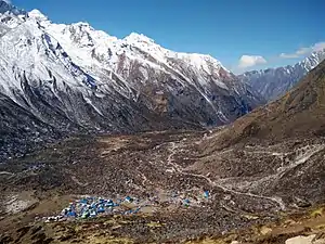
The Langtang Valley Trek is characterised by steep, jungle covered valleys at lower elevations, and wide, barren alpine valleys once the trail climbs to Langtang Village.
It is best to visit the park in October and November, after the monsoons have ended and before winter sets in. The sky is clear and the leaves are colourful, providing a photogenic background. March to May is also a good time to visit as the wildflowers and rhododendrons are blooming.
Langtang Valley was severely impacted by the 2015 Nepal earthquake. The village of Langtang was completely destroyed by an avalanche in which several hundred residents and foreigners perished. Though most of the trail has been repaired, the scars are still visible in the form of damaged bridges, abandoned villages and crumbling structures.
Prepare
Guides/Porters
This trek is relatively short and easy, and there are many teahouses along the way to eat and sleep. The path is also well indicated, and you will need a map in any case to be sure. So if you are fit, neither a guide nor a porter is necessary.
Fees/Permits
TIMS Card
You first need to purchase your TIMS card for the trek. Go to the Tourism Board's Tourist Service Centre in Kathmandu. As of 2018, the cost is:
- Independent trekkers, green card, Rs. 2,000
- Trekkers who are part of a group with a guide, blue card, Rs. 1,000
Park Entrance Fee
The entrance fee to the Langtang National Park is Rs. 3,000 (2021). You can purchase it at the Tourism Board's Tourist Service Centre (ask for the Langtang National Park office) when you get your TIMS card. Another option is to purchase it when the bus stops at the entrance of the park, just outside Dhunche.
Get in
The trek starts at Shyaphru Besi (also spelled Syabru Besi), approximately 120 km (75 mi) north of Kathmandu by road. Depending on the route, the road conditions range from okay to horrible. If you suffer from motion sickness, consider taking along medication.
By bus
Buses from Kathmandu leave from Macha Pokhari bus stand (Ring Road, north of Thamel). A taxi from Thamel to Macha Pokhari should cost Rs. 200-300.
The bus ride takes 8-11 hours, longer if it rains or if Kathmandu traffic is bad. Be prepared for a bumpy/scary/spectacular ride, beautiful scenery as the road turns and crosses the countryside. If possible, try sitting as much in front as possible to have a smoother trip. As of 2023, a regular bus ticket is Rs. 700, a bus ticket with air conditioning is Rs. 1000.
By car
A (much) more expensive option is to take a car/jeep. Jeeps are easy to arrange from any tour agency and will pick you up just outside of Thamel. The driver may take a different route than the bus to avoid the worst of the traffic but will rejoin the bus route at Bidur. Jeeps seat up to 7 passengers and most have racks to tie luggage on the roof. Consider not filling every seat to make the ride more comfortable and to keep gear inside away from the dust. The drive takes 7-8 hours and the driver will expect a tip. Expect to pay around USD150 (for an entire jeep) one way.
By foot
It is possible to trek to Shyaphru Besi from Dhunche, or even from Kathmandu (via Helambu & Gosainkunda Lake Trek).
Walk
The times listed below are estimates. The lower bound is for someone in good physical condition, that has a good walking pace but nevertheless allows himself a break once in a while. The higher bound is an estimate of someone (or a group) who would be hiking more slowly
- 🌍 Shyaphru Besi (Syabru Besi). (1460m) A small town with a dozen of guest houses on the main road, some shops, and a river flowing below. The main road continues north to the Chinese border (15 km). The start of your trek.
If you took the bus, it will drop you off in the center of Shyaphru Besi, sometime in the afternoon. If you have booked a guest house, it shouldn't be very far away. If you haven't, you have the choice to get some rest (in one of the many guest houses along the main road) and start hiking the next morning, or head directly to the trail ! The first teahouses are only 1-2 hours away, so it's a great warming up. A bit higher on the main road there should be a police checkpoint, ask them if it is reasonable for you to reach Domen, Hot Spring, or even Bamboo before it gets too dark.
Shyaphru Besi (1460m) to Rimche (2450m)
There are two trails to go up to Rimche:
- the high trail that passes through Wangal, Khanjim and Sherpagaon. It is longer and steeper.
- the low trail that passes through Domen and Bamboo. This is the most common trail, and goes up gently through the valley.
You could choose for example to go up via the first trail and go down via the other.
High trail (via Sherpagaon)
- Shyaphru Besi to Khanjim (via Wangal (1633m)): 3h (steep)
- Khanjim (2235m)
- Khanjim to Sherpagaon: 3h
- Sherpagaon (2563m)
- Sherpagaon to Rimche: 1h
Low trail (Via Bamboo)
- Shyaphru Besi to Domen: 1h-1h30
- 🌍 Domen. (1670m) A bridge, two or three houses, a garden, and a teahouse. A river coming from the south (right hand side if going up) flows down along the village. You can hear the river at night but it won't bother you to sleep.
- Domen to Hot Spring: 30-50mn
- Hot Spring (Pairo). (1772m) 2 teahouses overlooking the river below (it forms a small reservoir, worth considering a stop for a quick swim if you're not afraid of cold water).
- Hot Spring to Bamboo: 1h-1h30
- 🌍 Bamboo. (1970m, 8km from Shyaphru Besi) The largest village so far, with half a dozen teahouses all close to each other, in between the river and the steep surrounding mountains (there is a rock landslide just above the village)
- Bamboo to Rimche: 1-2h
- 🌍 Rimche (Rimchie). (2450m) 2 or 3 teahouses ideally situated just after a steep passage.
Rimche (2450m) to Kyanjin Gompa (3870m)
- Rimche to Lama Hotel: 20mn
- 🌍 Lama Hotel. (2470m) A village of about 20 houses with many teahouses to eat, drink and sleep.
- Lama Hotel to River Side: 1h-1h30
- 🌍 River Side (Gumnachowk ?). (2769m) A few houses along the path and next to the river.
- River Side to Ghoda Tabela: 1h15-2h. About 20mn after River Side you will pass Woodlands teahouse. Then there will be the DAV Bridge (2854m), where the path separates into two. Crossing the bridge follows the main path, but it probably ends up to the same if you continue straight without crossing the bridge. After a steep climb the valley starts to widen and give way to meadows. Cross the river again just before Ghoda Tabela. The river should now be to your right (when going up).
- 🌍 Ghoda Tabela. (3008m) A farm and a teahouse.
- Ghoda Tabela to Thangshyap: 30-50mn
- 🌍 Thangshyap. (3205m) A few houses and teahouses scattered around.
- Thangshyap to Gompa: 40mn-1h

- 🌍 Gompa. (3400m, 15.5km from Bamboo) A small village with a couple of teahouses.
- Gompa to New Langtang: 1-1h30 (3km). You'll cross the huge landslide that wiped Langtang village during the 2015 earthquake.
- 🌍 New Langtang (Langtang). (3430m) The main village of the trek. Suffered the most from the 2015 earthquake, there are still ongoing reconstruction works. There is a memorial at the entrance of the village. Take the time to make a break (even short) to share the local's hospitality and warmth.
- New Langtang to Mundu: 30mn
- 🌍 Mundu. (3550m) A village with a few teahouses just outside of New Langtang.
- Mundu to Singdum: 15mn
- 🌍 Singdum. (3555m) A farm and a teahouse a bit further up the valley.
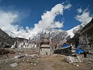
- Singdum to Kyanjin Gompa: 1h15-2h. You'll pass a couple of farms along the way, cross the path of yaks, and start to catch a glimpse of high snowy peaks. You will also see some stupas before you arrive in Kyanjin Gompa.

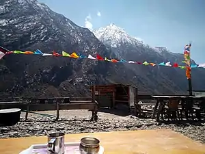
- 🌍 Kyanjin Gompa (Kyanjin Gumpa). (3830m, 2-3h / 6.5km from New Langtang) A dense village with many teahouses, a couple of bakeries, and a monastery at the top. If you have the time, a good place to stay for a couple of days to enjoy the vibe and explore the surroundings with day trips.
Hikes around Kyanjin Gompa
Kyanjin Gompa is a good base to stay a few days and explore the surrounding mountains. Depending on the season and the weather, there can be large quantities of snow around and above Kyanjin Gompa. If there is snow, some of the hikes below will be more difficult, and might necessitate a guide.
Kyanjin Ri (4300m) and Menchhyamsa Ri (4650m)
The easiest and most common hike from Kyanjin Gompa. The path forms a loop, so you can start by hiking up to Kyanjin Ri (the path laces up the hill above the village), make a break and take some nice pictures of Kyanjin Gompa below. Then head along the ridge up to the main peak to get a much nicer view of the surroundings (including Langtang Lirung (7227m) and Yubra (6264m)). The path continues a bit along the ridge, then makes a turn to the right and follows the hollow down back to Kyanjin Gompa.
- 🌍 Kyanjin Ri (Kyanjin Ri Lower Peak). (4300m)
- 🌍 Menchhyamsa Ri (Kyanjin Peak). (4650m)
Tserko Ri (4984m)
- 🌍 Tserko Ri (Tsergo Ri). (4984m)
Yala Peak (5500m)
Usually done as a 2-day trip from Kyanjin Gompa (doable in 1 day if the conditions are good and the person is very fit).
- 🌍 Yala Peak. (5500m)
Going down from Kyanjin Gompa
The hike back down from Kyanjin Gompa to Shyaphru Besi is usually done in 2 days, staying in or near Lama Hotel in the middle. If you are in a hurry to catch the bus, or feel enough energy when going down, you can push it to Bamboo or even Domen on the first day down (6-8h, 28km), stay the night at a teahouse, and wake up early enough to catch the morning bus back to Kathmandu (there is usually a bus at 8am and another around 10am). Better, a teahouse owner in Kyanjin Gompa said he regularly goes down to Shyaphru Besi in a single day.
Stay safe
Go next
- Tamang Heritage Trail
- Gosainkunda Lake Trek