On a geological timescale, Earth's climate has gone through considerable changes. Colder periods, during which glaciers covered more land and sea than today, are called ice ages. The last glacial period, commonly referred to as the Ice Age, began 115,000 years before present, and ended around 9,700 BC; that is 11,700 years ago.
In particular North America, Europe and Asia have traces of glaciation. Some glaciated regions are now covered with Boreal forest.
Understand
| “ | From Ymir's flesh the earth was formed, and from his bones the hills, the heaven from the skull of that ice-cold giant, and from his blood the sea. |
” |
—The Elder Edda | ||
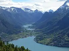
The Nordic countries were covered by ice during the last Ice Age, until 10,000 BC. The ice has set its mark on the scenery. The ice has set other traces in the scenery, such as enormous rocks in otherwise flat terrain (glacial erratics), large potholes drilled in the bedrock by eddies in glacial rivers (giants kettles), and a hundred metre high sandy terraces at valley mouths. Fjords, such as the fjords of Norway, were also created by glacial erosion, though at a longer time scale. The rising land has lifted parts of some fjords above the sea level and in this way created picturesque lakes. Traces of the Nordic Ice Age can be found even in Germany and Poland, which have glacial erratics transported there from the former Nordic bedrock; glacial erratics are common in southern Finland.
Post-glacial rebound
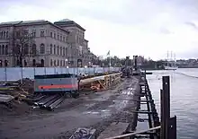
The ice pushed down Earth's crust, and it is still rising in modern times, up to one centimetre each year in the area around Kvarken between Sweden and Finland. The post-glacial rebound constantly moves the coastline; most modern settlements and farmlands in Sweden and Finland were navigable sea a few thousand years, or even less than one thousand years ago. The movement is enough for old people to remember a different shoreline from their youth.
In Norse mythology, the gods Thor and Loki visited the giant Skrymir (also referred to as Utgarda-Loki), who gave them many challenges. Skrymir wagered that Thor, famous for his strength and thirst for beer, could not empty Skrymir's enormous drinking horn in three sips. While Thor took great effort, he failed. Skrymir revealed that he had put the spike of the horn into the sea, to prevent Thor from emptying the horn. However, the sea level had dropped since before he drank.
Destinations
Nordic countries
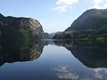
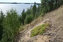
- 🌍 Eidfjord terraces. Eidfjord high terrace (Hæreid) was originally a river delta. The top of Hæreid terrace is almost perfectly horizontal. During the rebound the land at Eidfjord emerged 120 metres above sea level and the river from Eidfjord lake dug through the sandy terrace creating a small gorge. The road between Eidfjord village and Vøringsfossen runs through the gorge. The high terrace is called Hæreid which means high isthmus. Hæreid farm was presumably the home of powerful chiefs during the Viking age and earlier, possibly like a capital in Hardanger. There are several hundred burial mounds at Hæreid. Free.
- Glacial potholes: A giant's kettle, also known as either a giant's cauldron (Norwegian: jettegryte), moulin pothole, or glacial pothole, is a typically large and cylindrical pothole drilled in solid rock underlying a glacier. These are common in the Nordic countries.
- 🌍 Rullestadjuvet jettegryter (E134 between Odda and Fjæra). The numerous potholes in Rullestad gorge are among the largest (several metres across) in Northern Europe and were created during the Ice Age. Relatively easy hike (elevation gain about 250 m) but cliffs are steep and hikes should be done in dry conditions and with good hiking shoes/boots. Free.
- 🌍 Mågålaupet (several linked potholes), Drivdalen (E6 south of Oppdal village). Several linked potholes forms a narrow gorge in Driva river. Driva river flows from Dovre plateau north to Oppdal. Free.
- 🌍 Helvete (several potholes), Gausdal (Oppland district) (Road 255 north of Lillehammer to Espedalsvatnet lake). Several large potholes, up to 20 metres wide and 50 metres deep. The name Helvete simply means Hell because these potholes were difficult to pass. Presumably the greatest pothole area. Free.
- 🌍 Haukalivatnet. Haukalivatnet is a fjord-lake at 50 metres above sea level in Rogaland near mouth of Lysefjorden. Jens Esmark in 1823 realized similarities to moraines near existing glaciers at Jostedalsbreen. Esmark concluded that glaciers had covered large parts of the land. Esmark's discovery were later attributed to or appropriated by Theodor Kjerulf and Louis Agassiz. Geoscientist Jens Esmark in 1824 published an article stating that there was indisputable evidence that Norway and other parts of Europe had previously been covered by enormous glaciers carving out valleys and fjords, in a cold climate caused by changes in the eccentricity of Earth's orbit. Esmark and his travel companion Otto Tank arrived at this insight by analogous reasoning: enigmatic landscape features they observed close to sea level along the Norwegian coast strongly resembled features they observed in the front of a retreating glacier during a mountain traverse in the summer of 1823. Free.
- 🌍 High Coast and Kvarken Archipelago (Höga kusten och Kvarkens skärgård) (Västernorrland County, Sweden, and Ostrbothnia, Finland). A region where post-glacial rebound reaches nearly 1 centimetre a year, a
 UNESCO World Heritage Site.
 - 🌍 Punkaharju (Punkaharju, Finland). A ridge and national landscape.
- 🌍 Salpausselkä (Stängselåsarna). Three terminal moraines in Finland, stretching through southern Finland and the Finnish Lakeland. They were created when the withdrawal of the glacier temporarily stopped during three periods in 10,250–9,300 BCE. In Scandinavia, the Ra (described separately) was created during the same times. The moraines are mostly 20–30 m high, but rise to 70–80 m above Lohjanjärvi in Lohja, Hiidenvesi in Vihti and Vesijärvi in Lahti. One more terminal moraine runs south-west to north-east through Jyväskylä.
- Salpausselkä I (Stora Stängselåsen). The first and greatest of the Salpausselkä moraines was created in 10,250–10,050 BCE. It starts at the Hanko Peninsula (Hanko), continues as Lojoåsen through Raseborg and Lohja to Hyvinkää and Kärkölä, after which it is no more unbroken, but continues through Hollola, Lahti, Kouvola, Lappeenranta and Joensuu.
- Salpausselkä II (Lilla Stängselåsen). The second of the Salpausselkä moraines ("small Salpausselkä") was created 9,790–9,590 BCE. It can be seen as sandy areas in Örö and Hitis of Kimitoön, emerges from the sea in Bromarv of Raseborg, continues to Sammatti of Lohja, from where it becomes broken up but forms parallel moraines and continues through Karkkila, Loppi and Janakkala to Lammi of Hämeenlinna. From Asikkala it is again continuous through Vääksy, Jaala of Kouvola, Savitaipale and Kesälahti of Kitee to Joensuu.
- Salpausselkä III. The third of the Salpausselkä moraines, not always counted, was created 9,400–9,300. It appears first as Jurmo, can be seen as some other islands and reefs, on land in Kimitoön and again here and there to Hämeenlinna.
- 🌍 Simo Upthrust Park (Simon Maankohoumapuisto) (Simo, Finland). During the last ice age the kilometres-thick ice sheet caused the basement rock to depress. The Bothnian Bay area is the best place on Earth to see how it slowly rises up, nearly one centimetre a year. Eventually this phenomenon known as post-glacial rebound will slowly turn the whole Bothnian Bay into a lake. The Upthrust Park is a collection of sites where one may get some feeling on this fancy phenomenon. Info plates.
- The South Scandinavian Ra: The Ra is the largest terminal moraine in Southern Scandinavia and Finland. The Ra was created at one of the last glacial advances around 11,000 years B.C. The Ra crosses the Scandinavian peninsula roughly between Oslo and Stockholm, then runs around Norway's south coast. Ra is an old Norse word for a ridge of gravel. Terminal moraines are typically mixed material of boulders, pebbles, sand and clay. On the surface, finer particles have been washed off and left course particles like boulders and pebbles. In Norway, the Ra is clearly visible and well-known particularly in Østfold and Vestfold areas around the Oslofjord. Some of Norway's best agricultural land is along the slopes of the Ra. In Vestfold the main road has since prehistory followed the Ra because the highest point of the Ra is naturally dry and stable. In Østfold road E6 runs along the Ra between Halden and Moss (about 60 km).
- 🌍 Raet National Park. Raet National Park (Norwegian: Raet nasjonalpark) is a national park in Arendal, Tvedestrand and Grimstad in Agder, southeastern Norway. It is partly on short and partly under water, and includes some islands and coastal areas.
- 🌍 Jomfruland (island). Jomfruland is a elongated island located off the coast at Kragerø in Telemark, Norway. The island is largely made of pebbles and is part of the Ra, the great terminal moraine. Jomfruland shelters the archipelago within. The island and surround sea is protected as a national park.
 Glacial potholes near Trolltunga.
- 🌍 Svelvikryggen (Svelvik ridge) (Svelvik near Drammen). The Svelvik ridge cuts the Drammensfjord almost in two. The ridge is some 50–70 metres high and contains glacial sand and gravel (fluvioglacial gravel from the last Holocene deglaciation). Water has dug a natural strait or canal between the inner and outer Drammensfjord. The great supply of freshwater to the inner Drammensfjord makes the water in deep inner fjord brackish and almost like a lake (a common situation in glacial fjords with shallow thresholds). Surplus water and tide sets up one of Norway's strongest tidal currents in the Svelvik canal. The Svelvik canal is crossed by Norway's shortest ferry trip. The canal is the access to Drammen port, one of Norway's most important. Free.
- 🌍 Vandresteinen i Stavanger (Travelling boulder in Stavanger). Glacial erratic (or travelling boulder) resting in Rogalandsgaten, Stavanger. Protected by law since 1959 as natural heritage. Glacial erratics are common in the Nordic countries. Free.
Rest of Europe
- Snowdonia in Wales
North America
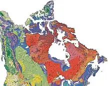
- Canadian Shield (Laurentian Plateau). This is a large region of mostly igneous rock formed in the Precambrian period, more than 540 million years ago. During the ice ages it was heavily glaciated, and it is now a region of mostly flat land with thin soil and many rock outcrops.
Canada has more lakes than any other country by quite a wide margin; most of them are in this region and were gouged out by glaciers. If you fly London-LA (Arlo Guthrie's "Coming in from London from over the pole") or various other routes that pass over northern Quebec, then you get a view of a huge region (larger than France or Texas) that is mostly boreal forest and is all dotted with dozens of lakes.
Much of the tourism in the region is fishermen or hunters who come in by float planes that land on the lakes. - 🌍 Ice Age trail (Ice Age National Scientific Reserve) (Wisconsin, United States). A walking trail with a showcase of geological features.
- 🌍 Finger Lakes (New York, United States). Eleven north-south lakes.
Beringia
During the last ice age, what is now the Bering Sea was land and people migrated across this Bering Land Bridge from Asia into the Americas. There are a few archaeological sites from the period; see Indigenous cultures of North America.
There are parks on both sides of the straits:
- 🌍 Bering Land Bridge National Preserve (Arctic Alaska, USA).
- 🌍 Beringia National Park (Chukotka in the Russian Far East). Russia's largest national park. Any visit to Chukotka requires a permit.
Both are difficult to visit, quite remote with limited transport and a cold climate.
Flora and fauna
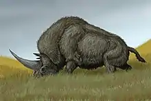
2 m (6.6 ft) at the shoulder
Many species of large animal, which biologists call megafauna, that were common during the ice ages became extinct around the end of those ages, about 10,000 BCE. These included the woolly mammoth, woolly rhinoceros, saber-tooth tiger, and several species of deer and cattle (aurochs) much larger than modern species.
One site is particularly famous for preserved examples of these beasts:
- 🌍 La Brea Tar Pits, 5801 Wilshire Blvd (Los Angeles, California). An area in the middle of L.A. with Ice Age beasts preserved in tar. It has a large museum.
See Paleontology for other sites and other museums.
Other species that were widespread then, such as reindeer in Europe and caribou in North America, survive to this day though their range has been reduced. Polar bears are another survivor, and a tourist attraction in Churchill, northern Canada.