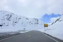
East Norway (Norwegian: Østlandet) is a region in south-eastern Norway, which contains the capital Oslo, as well as half of the country's 5 million inhabitants. From the central lowlands around Oslo, Oslofjord and lake Mjøsa long valleys cut into the uplands and high mountains until the watershed with Trøndelag and West Norway. East Norway is home to Norway's biggest lakes and rivers, widest forests and highest mountains. The pleasant climate and gentle coastline of Oslofjord is a fascinating contrast to the high mountains.
Most foreign visitors to Norway arrive in East Norway.
Understand
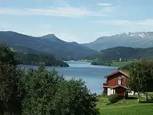
This region has about half of Norway's population including the larger Oslo metropolitan area. Locally known as Østlandet (or Austlandet), literally "the east country", it is defined by the border with Sweden and mountain ranges creating watersheds with Trøndelag and Western Norway. East Norway includes the densely populated lowlands around Oslofjord (and lake Mjøsa) and the more sparsely populated valleys, forests and highlands in the hinterland. The most populated lowlands/flatlands are greater Oslo, around Oslofjord and around lake Mjøsa, informally referred to as Central East Norway - this area is home to well over ⅓ of the people of Norway.
Landscape
A number of long valleys (notably Gudbrandsdalen, Valdres, Østerdal and Hallingdal) and rivers converge in the lowlands around Oslo. Oslo itself is separated from these rivers and valleys by forests and hills known as Oslomarka (the Oslo woodlands). Areas around Oslofjord and lake Mjøsa are mostly lowlands or flatlands, while upstream along the big valleys and rivers the gently rolling landscape gradually gives way to steep hills, barren highlands (such as Hardangervidda) and alpine summits such as Jotunheimen. These valleys also host transport corridors (rail and road) to West Norway and Trøndelag. Western parts of Telemark, Buskerud and Oppland are part of the central mountains/highlands, while northern parts of Oppland and Hedemark includes wide mountain areas such as Reinheimen, Dovrefjell and Rondane. These mountain areas separate East Norway from West Norway and Trøndelag, and is a major transport barrier particularly in winter. These mountains create Norway's main watershed as well as a crucial weather divide. Climate differs notably and there can be great differs in weather between valleys on either side of the watershed within few kilometers, particularly in winter.
East Norway is home to a large number of lakes, including several of Norway's largest, and Norway's biggest rivers. The shores of southern Oslofjord with myriads of polished islands and bays are popular summer resorts for city residents. Topographically large parts of East Norway is more connected to Sweden than to the rest of Norway: There are no high mountains or similar great barriers along the border.
Climate
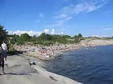
The interior of Eastern Norway generally enjoys relatively dry almost continental climate (warm summers and cold winters). Winters can be bitterly cold in the interior with January average around minus 10° C in the inner valleys and temperatures can occasionally drop below minus 30° C in the coldest areas. Closer to Oslofjord the winters are milder, although temperatures below minus 10° C are common in Oslo, and summers are slightly warmer in sheltered valleys. Large parts of East Norway enjoys the rain shadow created by the central mountains, and some of East Norway gets less than 300 mm precipitation annually - which is less than Madrid and in fact some of the places with least in Europe. Thanks to modest temperatures and big rivers flowing from glaciers these inner valleys stay green. On warm summer days there can be afternoon showers and in the interior valleys summer months (June to August) are the rainiest, although summers are slightly drier than in Oslo. Around Oslofjord spring and early summer is the driest season, and most rain falls September-November. The eastern interior has the consistently warmest summers in Norway, notably lower valleys of Buskerud and Telemark. Vestfold and Østfold (the areas around outer Oslofjord) has the most sunshine. Weather forecasting Norway is generally very reliable 3 days in advance and quite reliable 7-10 days in advance. Forecasts in summer are generally less precise with regard to rain and clouds.
Regions
| Buskerud Buskerud county stretches from the urban and agricultural lowlands at Oslos western suburbs through great valleys to popular ski resorts and the barren Hardangervidda. |
| Hedmark The landlocked county in East Norway's deep interior, great valleys, rivers and forests |
| Oppland From lakes and lowlands to uplands and the highest mountains in Scandinavia. |
| Oslo region Norway's capital and the surrounding region, with about ¼ of Norway's population. |
| Østfold Lowlands east of Oslofjord |
| Telemark From urban lowlands through green valleys to rugged highlands - a mini-Norway. |
| Vestfold Lowlands west of Oslofjord |
Cities
Towns

Other destinations
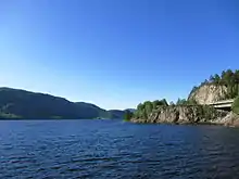
- 🌍 Trysil – Norway's largest ski resort
- 🌍 Gudbrandsdalen - the great central valley from lowlands at Lillehammer to the highest mountains
- 🌍 Hallingdal - a major valley from fertile lowlands at Drammen into Hardangervidda
- 🌍 Jotunheimen - Scandinavia's highest mountains
- 🌍 Rondane - Mountain range and Norway's first national park
- 🌍 Dovrefjell - Mountain range and high plateau
- 🌍 Valdres - picturesque highlands, lakes and valleys beneath Jotunheimen
- 🌍 Hardangervidda – Europe's largest highland plateau
- 🌍 Gardermoen - Oslo International Airport, main entry point for overseas visitors and hub for domestic flights
Talk
Most people will respond in English to any question you may have. Some Norwegians also speak some German, due to the proximity of the language, and that they study it in school. Migrant workers from Sweden, Poland, and elsewhere may not even speak Norwegian.
Norwegian
Those interested in dialects can observe the diversity of Norwegian dialects spoken in Eastern Norway, especially the differences between urban areas and peripheries. The differences can be observed even if you do not understand Norwegian. There are differences in the tone of language and words used. Even within the capital, Oslo, there are dialect differences between the east end and west end.
In some inland municipalities, a writing form of Norwegian usually associated with West Norway known as Nynorsk is the official form.
Get in
In Norway, transport is a key part of the trip and best way to do sightseeing. Visitors should consider scenic routes and not merely the merely the fastest and most convenient transport.
By boat
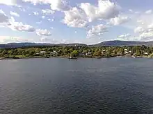
Norway is separated from Denmark by the Skagerrak waters that merges with Oslofjord between Strömstad and Telemark.
- Oslo is connected to Kiel and Copenhagen by ferries. The ferry from Kiel (kielferga) in particular is an effective way of skipping the less interesting transport leg through Sweden and is overnight with a fine arrival along Oslofjord in the morning. The ferry from Copenhagen is known as danskebåten (Danish boat) among Norwegians and has a long tradition. The Copenhagen ferry is often used by Norwegians on a weekend trip to Copenhagen, while the Kiel ferry is often used by truck drivers.
- Larvik is connected to northern Denmark by ferry, whereas Sandefjord is connected to Strömstad (Sweden) by ferry.
By plane
East Norway has two international airports:
- Oslo Airport, Gardermoen is Norways largest airport and well connected
- Sandefjord airport at Torp
By train
By car
- Road 3 (Østerdalen road) is the alternative road from Trondheim and runs through all of Hedmark nort-south.
- The E6 is Norway's main road and a key reference for road trips in Norway.
- The E6 is the main access from Sweden, at Svinesund border point near Halden.
- The E6 is the main access from Trøndelag and Northern Norway.
- E136 from Ålesund and Åndalsnes connects to E6 at Dombås
- Road 15 is the east-west main road from Stryn with connections from Geiranger.
- Road 55 from Sognefjord through Sognefjellet mt pass to Lom is one of the great mountain roads.
- Road E16 is the east-west european route Bergen-Valdres-Hønefoss-(branch to Oslo/Sandvika)-Oslo Airport, Gardermoen-Kongsvinger-(border with Sweden)-Gävle.
- Road 7 through Hardangervidda is the main alternative to E16 from Bergen
- Road E134 from Haugesund and Hardanger through Haukeli pass to Telemark, Kongsberg and Drammen.
- Road E18
- From the west: the main access from Stavanger and Kristiansand, but generally considered the less scenic option.
- From the Sweden: the main access from Stockholm and Karlstad to Oslo area.
Get around
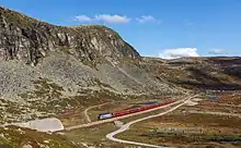

Oslo totally dominates this region. Oslo and its airport at Gardermoen is the transport hub for East Norway. Roads and railway lines have Oslo as their focal points. All railway lines, including the airport express train, terminate at Oslo Central Station ("Oslo S"). Main roads E6, E18, E16 and Road 4 meet at or near Oslo S. Regional and long distance buses depart from the bus station next door to Oslo S. Oslo Subway (T-banen) has a main station underground next to the train station.
Air transport is in general not an option within East Norway. The main axis to/from Oslo are covered by railway lines and motorways. Overland transport is however restricted by natural barrierers. The Oslofjord cuts deep into the land and transport between east and west of the fjord are through the subsea Oslofjord tunnel, by car ferry Horten-Moss or through Oslo. Mjøsa and other big lakes also limit transport perpendicular to the main watercourses. The car ferry across Randsfjorden lake is the only car ferry on a lake. Mountains and uplands are also barriers to overland transport and roads and rails largely runs along the big valleys and rivers. Transport between big inner valleys is more cumbersome and often runs through a few passes or elevated plateaus with steep roads to/from valleys.
By plane
- Fagernes Airport (Leirin - operated by DOT) (10 minutes from Fagernes). The local airport with daily connections to Oslo (30 minutes)
- Oslo Gardermoen Airport (Gardermoen) (25 minutes with the Airport Express Train from Oslo). Norway's main airport with domestic and international flights.
- Sandefjord Torp Airport (Torp) (1 hour 50 minutes with the Torpekspressen coach from Oslo). Rygge mainly caters to travelers to/from Oslo, Akershus and Østfold. Most flights are with Ryanair.
- Skien Geiteryggen Airport. serviced by flights to Bergen, Stavanger and Molde (daily), as well as three times per week to Stockholm, Sweden
By bus
- Nor-Way Bussekspress (express buses). Most express buses running through the region are operated by this company. Connections to Oslo, Lillehammer, Valdres, Jotunheimen and Hallingdal.
- Valdresekspressen (express coach), ☏ +47 61 36 59 00, fax: +47 61 36 16 00, post@valdresekspressen.no. Route (Up to six daily departures): Oslo-Hønefoss-Valdres-Sogn and Oslo-Hønefoss-Valdres-Jotunheimen.
- Lavprisekspressen (express coach), ☏ +47 67 98 04 80. Routes: (One departue per day):Trondheim-Dovrefjell-Lillehammer-Hamar-Gardermoen-Oslo and (Two departues per day):Stavanger-Kristiansand-Larvik-Sandefjord-Oslo low cost internet booking.
- Øst-Vest Xpressen (express coach), ☏ +47 61 36 59 00, fax: +47 61 36 16 00, jvb@jvb.no. Route (One departue per day): Bergen-Voss-Lærdal-Valdres-Land-Lillehammer.
- JVB (local buses), ☏ +47 61 36 59 00, fax: +47 61 36 16 00, jvb@jvb.no. 08-16. Connections to Gjøvik, Gol, Lærdal and Gjende.
- TIMEkspressen (express coach). Connections to Skien, Notodden and Kongsberg.
By train
- NSB (Noregs Statsbaner (National Rail)), ☏ +47 23 62 00 00 (abroad). Oslo Central Station (Oslo S) is the main train station in Eastern Norway, where all train routes connect. Connections to Stavanger, Gjøvik, Lillehammer, Bergen, Trondheim, Skien, Fredrikstad and Kristiansand, plus a large number of local trains. Also, trains to Sweden and the rest of Europe depart from here. Call 815 00 888 for domestic..
By car
For more details see: Driving in Norway
Most of Norway's motorways are around Oslo. There is one car ferry across Oslofjord at Moss-Horten and one across Randsfjorden lake.
See
|
Lake Mjøsa - East Norway's small inland ocean 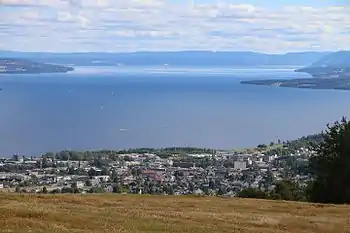 |
Do
- All kinds of winter sports, even some at summertime. In the interior and in the uplands skiing season is usually long.
- Alpine ski resorts often operate until late April or early May
- The ski resort at Galdhøpiggen is open in summer only
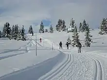
- Cross-country skiing is possible all over East Norway, usually from late November in the high areas. There are countless groomed trails and many loops are floodlit for the dark mid winter evenings.
- Back country skiing is possible virtually anywhere. In the uplands and high mountains such as Jotunheimen and Hardangervidda back country skiing usually continues until mid May, some years well into June.
- Sailing
- Fishing in salt water and fresh water (rivers & lakes). Fishing in fresh water requires a permit from the landlord.
- Canoeing or kayaking on the long lakes in Telemark, Hedmark and Østfold. In Østfold (Halden canal) and in Telemark (Telemark canal) several lakes are connected by locks. Some lakes and rivers are shared with Sweden and are connected to the large Swedish lakes.
- Climb or hike mountains
East Norway includes gentle sloping highlands such as Hardangervidda as well as alpine peaks such as Jotunheimen.
- The Gausta summit (1883 meters) near Rjukan in Telemark gives the best outlook, on a clear day on can see one sixth of Norway (or an area twice that of Belgium). Easy hike 2-3 hours, possible for children aged 10+. Very popular.
Eat
The Norwegian cuisine is known for eclectic food with a good supply of many local ingredients. Try Norwegian seafood!
Drink
Local Norwegian beer, aquavit and cider. Or simply clean and fresh water.
Stay safe
Eastern Norway is experienced as generally very safe, with few exceptions in parts of Oslo and the larger cities. Just take normal precautions.
