Cachuma Lake Recreation Area is in Santa Barbara County, California.

Understand
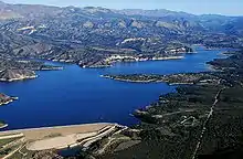
Cachuma Lake Recreation Area, run by the Santa Barbara County Community Services Department - Parks Division, is a beautiful rural park in the hills above the city of Santa Barbara. Cachuma Lake is actually a reservoir that is the main source of drinking water for the city of Santa Barbara. The recreation area consists of 9,000 acres of wilderness and lake, with the Santa Ynez and San Rafael Mountains looming above the park.
History
Landscape
The centerpiece of this park is Cachuma Lake, a medium-sized lake. Due to the state-wide drought, the lake is drastically reduced in size from the way it looks in the map you can obtain for free at the boat rental office uphill from the Marina on the lake, but it is still a challenge for a person of ordinary fitness to kayak from one end of the lake to the other.
The lake is surrounded by slopes and tall hills, with the mountains clearly visible in the background.
Flora and fauna

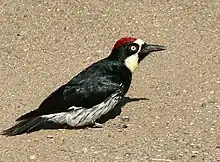
There is a lot of bird life in the park. Many grebes and some ducks live in the lake, and a large number of hawks soar above the lake and hills, swooping down to catch fish in the lake and rabbits and rodents on land. There are also many crows and deer in the park.
Climate
Despite being higher up than Santa Barbara, you should not expect it to be cooler in the summertime, although you may find it windier. Make sure you guard against sunburn by applying a good sunscreen, and if you plan on boating on the lake, expect to expose your lower legs because they will inevitably get wet, and apply sunscreen there, as well.
Get in
Take California Route 154 North from Santa Barbara approximately 18 miles and look for the sign for the park on your right. Or if you come from points north, take Route 154 South and look for the sign on your left.
Fees and permits
Vehicle entry: $10; entry per hiker, cyclist, or biker: $5.
Get around
Once you have parked your vehicle, you will get around by walking or cycling.
See
The things to see in the park are the lovely views, the wildlife, the trees and the other visitors. And even if you aren't boating, make sure to walk down the hill to the lake and look at the view across to the other side and the mountains beyond.
Do
Boat around the lake. Single or double kayaks cost a maximum of $38 for a single day and are both a strenuous and very pleasant way to spend an afternoon. More information about boat rentals and fees here.
There are also hiking paths. For more information about hiking in the park, read here.
Buy, eat, drink
There is a small general store that can supply your immediate needs. (The building that includes the general store is also where you would rent a boat.) There is also a gas station in the park, and hot showers are available, too.
Sleep
Lodging
Cabins rent for $100-140/night. More about cabins here.
Camping
Basic camping costs $30/night from April 1 through September 30: and $25/night from October 1 through March 31; hookups are also available for an additional charge. More information about camping here.
Backcountry
Stay safe
Route 154 is an old highway, built to old standards that have been vastly superseded by freeways like the 101. It is mostly a single lane each way, though there are some short stretches with a passing lane. Local drivers can be aggressive and impatient, but if you do not know the road, you must be careful, as it winds up into the hills and has some sharp curves. If you are driving cautiously, make sure to take the right lane when passing lanes open up, so that locals who know the road well can easily pass you.
The road is also mostly unlit at night, so night driving is particularly challenging.
Go next
South

- Santa Barbara is an obvious place to go next.
- Another thing you might want to do is visit a viewpoint that you will see a sign for (left turn) on your way to Santa Barbara on the 154. You can see a great panorama from there, including the lake.
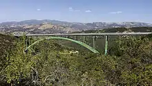
- Also along Route 154, there is a turnoff on your left for Paradise Road. Take that, and when you get to Stagecoach Road, turn right. This old road, which was indeed the stagecoach road in the pre-automobile days, will lead you under the Cold Spring Canyon Arch Bridge, a beautiful structure and marvel of engineering which carries Route 154 hundreds of feet over the valley.
- About a quarter of a mile past the bridge underpass, you will come to Cold Spring Tavern, a pretty and historic relic of stagecoach days which includes a wooden bar/restaurant with very good somewhat upscale American food and drink and several other buildings.
North
If you turn right when you reach California 154, you can visit Santa Ynez and Los Olivos in the Santa Barbara Wine Country.