Zeeland Bridge
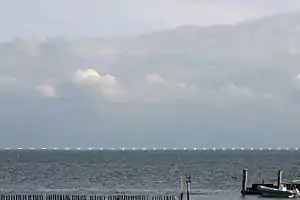
The Zeeland Bridge (Dutch: Zeelandbrug) is the longest bridge in the Netherlands. The bridge spans the Eastern Scheldt estuary. It connects the islands of Schouwen-Duiveland and Noord-Beveland in the province of Zeeland.
Zeeland Bridge Zeelandbrug | |
|---|---|
 The Zeeland Bridge in May 2014 | |
| Coordinates | 51°36′40″N 3°53′23″E |
| Crosses | Eastern Scheldt estuary |
| Locale | Schouwen-Duiveland and Noord-Beveland |
| Heritage status | Rijksmonument [1] |
| Characteristics | |
| Material | Concrete |
| Total length | 5,022 metres (16,476 ft) |
| Longest span | 95 metres (312 ft) |
| No. of spans | 51 |
| Piers in water | 54 |
| Load limit | 50 tonnes (49 long tons; 55 short tons) |
| No. of lanes | 2 |
| History | |
| Constructed by | Van Hattum en Blankevoort NV and NV Amsterdamsche Ballast Maatschappij[2] |
| Construction start | 1963 |
| Construction end | 1965 |
| Inaugurated | 15 December 1965 |
| Statistics | |
| Toll | no |
| Location | |
The Zeeland Bridge was built between 1963 and 1965. It was inaugurated on 15 December 1965 by Queen Juliana of the Netherlands, and was originally called Eastern Scheldt Bridge (Dutch: Oosterscheldebrug) before being renamed the Zealand Bridge on 13 April 1967.[3] At the time of its completion, it was the longest bridge in Europe. It has a total length of 5,022 metres, and consists of 48 spans of 95 metres, 2 spans of 72.5 metres and a movable bridge with a width of 40 metres.
The province of Zeeland borrowed the money for the construction of the bridge. The loan was repaid by levying tolls for the first 24 years.[4]
 Side view |
 Zeeland Bridge (bascule bridge part) |
 Side view |
References
- National heritage
- Rijkswaterstaat Beeldarchief
- "The Zeeland Bridge". Zeeland. Retrieved 11 February 2021.
- "Zeelandbrug". Deltawerken Online (in Dutch). Archived from the original on 11 September 2014. Retrieved 30 June 2021.