Yakhtul
Yakhtul (Arabic: يختل) is a large coastal fishing village in the Taiz Governorate of southwestern Yemen. Yakhtul is located about "two German leagues (10 miles) north of the city of Mocha."[1][2] It contains a number of white houses, the Yakhtul Mosque and a school.
Yakhtul
يختل | |
|---|---|
Village | |
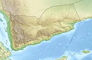
 Yakhtul Location in Yemen | |
| Coordinates: 13°26′53″N 43°16′12″E | |
| Country | |
| Governorate | Taiz Governorate |
| District | Al Mukha District |
| Time zone | UTC+6.30 (MST) |
History
During World War I, British patrol vessels shelled Dhubab fort in November 1914 and opened fire on Yakhtul on 8 December 1914, damaging 7 or 8 dhows moored there.[3]
Geography
Yakhtul lies on the coast of the Red Sea, at the head of a small shoal inlet, 10 miles (16 km) north of Mocha.[4][2] Jirdan lies farther to the north of Yakhtul, 'Abus to the southeast and Kudhaysah to the northeast.[5][6] The nine-mile (14 km) stretch between Yakhtul and Marsa Farjah has numerous sand and coral patches which give the sea a dark grey colour.[4] The stretch between Yakhtul and Al Zahari contains coastal palm groves.[7]
Economy
MEED describes Yakhtul as being tourist oriented.[8] Fishing is a major source of income for the locals.[9] As of 1996, despite many of the houses having their own wells, high water salinity meant that it could only be used for bathing and cleaning, and drinking water had to be imported.[10] However, the local diet is said to meet the World Health Organization minimum requirements, with a plentiful supply of nutrients from fresh fish and other local commodities.[2] A French medical team was reported to be operating in Yakhtul in the mid-1980s.[11]
Notable landmarks
Yakhtul is described as consisting of "a few white houses, some huts, and a mosque."[4] The town contains Yakhtul Mosque, which was said to have been "built at the expense of the good people of the area at a cost of one million riyals."[12] The same man who built the mosque also established Yakhtul preparatory school in the town, at a cost of 150,000 riyals.[12] The "first phases of construction work" were reported to have been completed in 1989.[8]
At the village is what is called "Dar al-milh" (the place of salt). The salt pans, called darah are said to be "cut out of the hard ground and the soil heaped up on the sides to form bunds (zabir al-darah).[13]
References
- Niebuhr, Carsten (1889). ... Description of Arabia made from personal observations and information collected on the spot by Carsten Niebuhr. p. 74. Retrieved 1 October 2011.
- Tighe, Joanne P. Nestor (1981). Maternal and infant nutrition reviews: a guide to the literature. International Nutrition Communication Service, Education Development Center, Inc. p. 25. Retrieved 1 October 2011.
- Serjeant, Robert Bertram; Bidwell, Robin Leonard (21 July 2005). Arabian Studies. Cambridge University Press. p. 29. ISBN 978-0-521-01729-9. Retrieved 1 October 2011.
- Griffes (1 January 2007). Prostar Sailing Directions 2007 Red Sea and the Persin Gulf Enroute. ProStar Publications. p. 128. ISBN 978-1-57785-755-6. Retrieved 1 October 2011.
- Maps (Map). Google Maps.
- Bing Maps (Map). Microsoft and Harris Corporation Earthstar Geographics LLC.
- Varisco, Daniel Martin; Ross, James Perran; Milroy, Anthony (1992). Biological diversity assessment of the Republic of Yemen. International Council for Bird Preservation. p. 14. Retrieved 1 October 2011.
- MEED. Economic East Economic Digest, ltd. 1989. p. 30. Retrieved 1 October 2011.
- Serjeant, Robert Bertram (1991). Customary and Shari'ah law in Arabian society. Variorum. p. 252. ISBN 978-0-86078-299-5. Retrieved 1 October 2011.
- Library Information and Research Service (1996). The Middle East: Abstracts and index. Library Information and Research Service. Retrieved 1 October 2011.
- Stone, Francine (1985). Studies on the Tihāmah: the report of the Tihāmah Expedition 1982 and related papers. Longman. p. 118. ISBN 978-0-582-78387-4. Retrieved 1 October 2011.
- United States. Foreign Broadcast Information Service; United States. Joint Publications Research Service. Near East/South Asia report. Foreign Broadcast Information Service. p. 103. Retrieved 1 October 2011.
- Serjeant, Robert Bertram; Smith, Gerald Rex (1996). Society and trade in South Arabia. Variorum. p. 308. ISBN 978-0-86078-603-0. Retrieved 1 October 2011.