Wolftail Mountain
Wolftail Mountain (8,176 feet (2,492 m)) is located in the Lewis Range, Glacier National Park in the U.S. state of Montana.[3]
| Wolftail Mountain | |
|---|---|
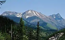 Wolftail Mountain centered, west aspect. (Peril Peak left, Mt. Doody right) | |
| Highest point | |
| Elevation | 8,192 ft (2,497 m)[1] |
| Prominence | 272 ft (83 m)[1] |
| Coordinates | 48°26′26″N 113°36′38″W[2] |
| Geography | |
 Wolftail Mountain Location in Montana  Wolftail Mountain Location in the United States | |
| Location | Flathead County, Montana, U.S. |
| Parent range | Lewis Range |
| Topo map | USGS Mount Saint Nicholas, MT |
| Climbing | |
| Easiest route | Scramble |
Climate
According to the Köppen climate classification system, Wolftail Mountain is located in an alpine subarctic climate zone with long, cold, snowy winters, and cool to warm summers.[4] Winter temperatures can drop below −10 °F with wind chill factors below −30 °F. Due to its altitude, it receives precipitation all year, as snow in winter, and as thunderstorms in summer.
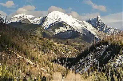
Wolftail Mountain centered
References
- "Wolftail Mountain, Montana". Peakbagger.com. Retrieved January 16, 2019.
- "Wolftail Mountain". Geographic Names Information System. United States Geological Survey, United States Department of the Interior. Retrieved January 16, 2019.
- Mount Saint Nicholas, MT (Map). TopoQwest (United States Geological Survey Maps). Retrieved January 16, 2019.
- Peel, M. C.; Finlayson, B. L.; McMahon, T. A. (2007). "Updated world map of the Köppen−Geiger climate classification". Hydrol. Earth Syst. Sci. 11. ISSN 1027-5606.
This article is issued from Wikipedia. The text is licensed under Creative Commons - Attribution - Sharealike. Additional terms may apply for the media files.