Wildenrath
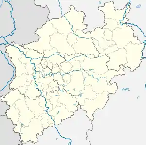
Wildenrath is a township within the municipality of Wegberg in North Rhine-Westphalia, Germany. The town is situated on the Bundesstraße 221 between Wassenberg and Arsbeck on the edge of Maas-Schwalm-Nette Nature Park and close to the border with the Netherlands.
Wildenrath | |
|---|---|
 The Siemens test centre at Wildenrath | |
 Coat of arms | |
Location of Wildenrath | |
 Wildenrath  Wildenrath | |
| Coordinates: 51°07′N 6°11′E | |
| Country | Germany |
| State | North Rhine-Westphalia |
| Admin. region | Köln |
| District | Heinsberg |
| Town | Wegberg |
| Population (2020)[1] | |
| • Total | 1,619 |
| Time zone | UTC+01:00 (CET) |
| • Summer (DST) | UTC+02:00 (CEST) |
| Postal codes | 41844 |
| Dialling codes | 02434 |
| Website | www.wegberg.de |
For 40 years, the town was the home of the British military airfield, RAF Wildenrath. After the airfield closed in 1992, it became the Test- and Validationcenter Wegberg-Wildenrath, a railway test centre operated by Siemens Mobility.[2]

The "Haus Wildenrath" heritage farm
Climate
Climate in this area has mild differences between highs and lows, and there is adequate rainfall year-round. The Köppen Climate Classification subtype for this climate is "Cfb" (Marine West Coast Climate/Oceanic climate).[3]
| Climate data for Wildenrath | |||||||||||||
|---|---|---|---|---|---|---|---|---|---|---|---|---|---|
| Month | Jan | Feb | Mar | Apr | May | Jun | Jul | Aug | Sep | Oct | Nov | Dec | Year |
| Average high °C (°F) | 4 (39) |
6 (42) |
10 (50) |
14 (58) |
19 (66) |
22 (71) |
23 (73) |
23 (74) |
19 (67) |
15 (59) |
9 (48) |
6 (42) |
14 (57) |
| Average low °C (°F) | 0 (32) |
1 (34) |
3 (37) |
5 (41) |
9 (48) |
12 (54) |
13 (56) |
14 (57) |
12 (53) |
8 (46) |
4 (40) |
2 (36) |
7 (45) |
| Average precipitation mm (inches) | 64 (2.5) |
56 (2.2) |
38 (1.5) |
46 (1.8) |
69 (2.7) |
69 (2.7) |
89 (3.5) |
86 (3.4) |
61 (2.4) |
46 (1.8) |
79 (3.1) |
66 (2.6) |
760 (30) |
| Source: Weatherbase [4] | |||||||||||||
References
- Bevölkerungsstatistik Stadt Wegberg 30.06.2020
- "Test- and Validationcenter Wegberg-Wildenrath". Siemens Mobility. Retrieved 5 March 2010.
- Climate Summary for Wildenrath
- "Weatherbase.com". Weatherbase. 2013. Retrieved on July 26, 2013.
This article is issued from Wikipedia. The text is licensed under Creative Commons - Attribution - Sharealike. Additional terms may apply for the media files.