West Wyalong
West Wyalong is the main town of the Bland Shire in the Riverina region of New South Wales, Australia.[2] Located 467 kilometres (290 mi) west of Sydney, 2km west of East Wyalong, 2km south of North Wyalong and 2km North of South Wyalong as well as being 262 m (860 ft) above sea level, it is situated on the crossroads of the Newell Highway between Melbourne and Brisbane, and the Mid-Western Highway between Sydney and Adelaide.[3]
| West Wyalong New South Wales | |||||||||
|---|---|---|---|---|---|---|---|---|---|
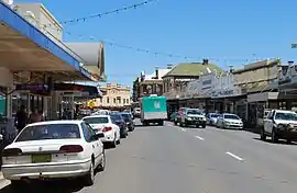 Main Street (Newell Highway) in West Wyalong | |||||||||
 West Wyalong | |||||||||
| Coordinates | 33°55′0″S 147°13′0″E | ||||||||
| Population | 2,698 (UCL 2021)[1] | ||||||||
| Postcode(s) | 2671 | ||||||||
| Elevation | 262 m (860 ft) | ||||||||
| Location |
| ||||||||
| LGA(s) | Bland Shire | ||||||||
| Region | Riverina (New South Wales) | ||||||||
| State electorate(s) | Cootamundra | ||||||||
| Federal division(s) | Riverina | ||||||||
| |||||||||
The West Wyalong district is the largest cereal-growing centre in NSW. Eucalyptus oil production started in 1907 and the West Wyalong area became one of the major world exporters of the product.
History
The Wiradjuri people were the first to inhabit this region. (Wiradjuri northern dialect pronunciation [wiraːjd̪uːraj]) or Wirraayjuurray people (Wiradjuri southern dialect pronunciation [wiraːjɟuːraj]) are a group of indigenous Australian Aboriginal people that were united by a common language, strong ties of kinship and survived as skilled hunter–fisher–gatherers in family groups or clans scattered throughout central New South Wales.
In the 21st century, major Wiradjuri groups live in Condobolin, Peak Hill, Narrandera and Griffith. There are significant populations at Wagga Wagga and Leeton and smaller groups at West Wyalong, Parkes, Dubbo, Forbes, Cootamundra, Cowra and Young.
Gold was discovered at Wyalong in September 1893 by Joseph Neeld. In 1895 West Wyalong was developed 5 kilometres (3 mi) from Wyalong around the bullock track, without the benefit of town planning, resulting in curious kinks in the road where it avoided trees. As well as the mines, the White Tank water supply was located here. This is now the location of McCann Park.[3] The goldfield was declared the most productive in the colony in 1899.[3]
As mining declined West Wyalong became the main service centre for agriculture in the surrounding district, although for many years there was rivalry between the towns. Both towns wanted the Temora railway line, but settled on a compromise of a station midway between the two towns, called Wyalong Central.
Development since the 1970s has expanded Wyalong in the direction of West Wyalong with several motels built at Central Wyalong. A shared bicycle and pedestrian track was constructed in 1994 to link Wyalong with West Wyalong.
The population has stabilised recently. This is due, in part, to the Cowal Gold Mine adjacent to Lake Cowal, 45 km northeast and Pace Farm's egg production facility.
Climate
West Wyalong has long, hot and very dry summers; and contrastingly cool winters with extended overcast periods not uncommon, with an increased susceptibility to cold fronts due to its far western location. Mean maximum temperatures range substantially between the seasons. There is a stark difference in sky conditions between high summer and mid winter, especially for this northern latitude; in March there are 13.9 clear days and 6.0 cloudy days; whereas in July there are only 7.4 clear days but 12.5 cloudy days. This too is evident by the mean afternoon humidity readings.
| Climate data for Wyalong Post Office (1950–2015, rainfall 1895–2022); 245 m AMSL; 33.93° S, 147.24° E | |||||||||||||
|---|---|---|---|---|---|---|---|---|---|---|---|---|---|
| Month | Jan | Feb | Mar | Apr | May | Jun | Jul | Aug | Sep | Oct | Nov | Dec | Year |
| Record high °C (°F) | 45.3 (113.5) |
44.8 (112.6) |
40.6 (105.1) |
36.2 (97.2) |
28.3 (82.9) |
24.2 (75.6) |
25.5 (77.9) |
28.4 (83.1) |
34.4 (93.9) |
37.6 (99.7) |
42.2 (108.0) |
43.6 (110.5) |
45.3 (113.5) |
| Average high °C (°F) | 32.9 (91.2) |
31.9 (89.4) |
28.7 (83.7) |
23.7 (74.7) |
18.7 (65.7) |
14.9 (58.8) |
14.1 (57.4) |
16.0 (60.8) |
19.6 (67.3) |
23.5 (74.3) |
27.3 (81.1) |
30.7 (87.3) |
23.5 (74.3) |
| Average low °C (°F) | 17.6 (63.7) |
17.5 (63.5) |
14.5 (58.1) |
10.0 (50.0) |
6.8 (44.2) |
4.2 (39.6) |
3.0 (37.4) |
3.9 (39.0) |
6.2 (43.2) |
9.4 (48.9) |
12.6 (54.7) |
15.4 (59.7) |
10.1 (50.2) |
| Record low °C (°F) | 6.7 (44.1) |
8.2 (46.8) |
5.0 (41.0) |
−1.1 (30.0) |
−3.0 (26.6) |
−4.5 (23.9) |
−5.0 (23.0) |
−4.5 (23.9) |
−3.0 (26.6) |
1.1 (34.0) |
2.5 (36.5) |
6.2 (43.2) |
−5.0 (23.0) |
| Average precipitation mm (inches) | 42.7 (1.68) |
38.6 (1.52) |
39.7 (1.56) |
34.9 (1.37) |
39.1 (1.54) |
43.1 (1.70) |
41.8 (1.65) |
39.1 (1.54) |
37.5 (1.48) |
45.4 (1.79) |
38.3 (1.51) |
43.7 (1.72) |
485.8 (19.13) |
| Average precipitation days (≥ 0.2 mm) | 5.0 | 4.5 | 4.8 | 4.7 | 6.6 | 8.6 | 9.8 | 9.0 | 7.3 | 6.9 | 5.7 | 5.4 | 78.3 |
| Average afternoon relative humidity (%) | 32 | 35 | 37 | 43 | 51 | 61 | 62 | 53 | 46 | 39 | 35 | 34 | 44 |
| Source: Australian Bureau of Meteorology; Wyalong Post Office | |||||||||||||
Places of interest
- The Poppet Head
- Lions Park Dakota DC3
- West Wyalong Museum
- The Sister Kissing Booth
- West Wyalong Airport
- Easel sculpture of West Wyalong (Drysdale)
- Wyalong Wetlands
- Tivoli Theatre
Schools
- St Mary's War Memorial Catholic School (K-6) - The original St. Mary's Church School was built in 1901 of corrugated iron and staffed by the Sisters of Mercy. By 1903 there were 167 students. The present St. Mary's School was built in 1961.
- West Wyalong Primary School (K-6)
- West Wyalong High School (7-12)
- Wyalong Public School (K-6)
Pubs and clubs in West Wyalong
- The Tattersalls Hotel
- The Metropolitan Hotel
- Royal Hotel
- The White Tank Hotel
- West Wyalong Services & Citizens Club
- West Wyalong Lawn Bowling Club
- West Wyalong Golf Club
- Toppy Pub (Wyalong)
Sport
The most popular sport in West Wyalong is rugby league. The Goldfields Rugby League was established in 1911, and, along with Tamworth and Wollongong, was one of the first leagues outside of Sydney and Newcastle.
The town hosts a number of different sports club, catering for both adults and junior players.
- West Wyalong Mallee Men - rugby league and competes in the Group 20 Rugby League competition.
- West Wyalong-Girral Bulldogs - Australian rules football & netball and competes in the Northern Riverina Football League
- West Wyalong Weevils - senior rugby union
- West Wyalong Pirates - junior rugby union
- West Wyalong Wildcats - (basketball)
- Alleena Cricket Club - cricket
- Tallimba Cricket Club - cricket
- White Tank Cricket Club - cricket
Annual Shows and Events
January
- Australia Day Breakfast and Awards (26th), West Wyalong[4]
- David Earl Memorial Cricket Match, West Wyalong[4]
February
April
May
July
- Catholic Debutante Ball, West Wyalong[4]
September
October
- Mirrool Silo Kick Challenge (2nd Sat.)[4]
- 'in the West' Festival www.inthewest.com.au[4]
November
- Early Markets (1st Sat.), Wyalong[4]
Notable people from the area
- Dymphna Cusack, author[3]
- Reginald Roy Rattey, Victoria Cross recipient
- Terry Gathercole, champion swimmer
- Mark O'Meley, rugby league footballer
- Anthony Gelling, rugby league footballer
- Ron "Dookie" Crowe, Australian representative rugby league footballer
- Col Ratcliff, rugby league footballer
- Liam Martin, rugby league footballer
- Scott Staniforth, rugby union footballer
- Mat McLachlan, author and historian
- Neale Daniher AM, former AFL footballer, former AFL coach and motor neurone disease campaigner
- Terry Daniher, former AFL footballer
- Anthony Daniher, former AFL footballer
- Chris Daniher, former AFL footballer
- Dal Stivens, author - grew up in the town
- Danny Meagher, Catholic bishop
Gallery
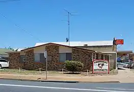 Aboriginal Artifacts Store
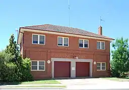 Ambulance Station
- West Wyalong Anglican Church
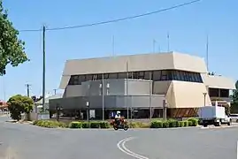 Bland Shire Council Offices
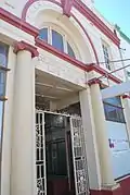 Colonial Mutual
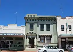 Commercial Bank of Australia
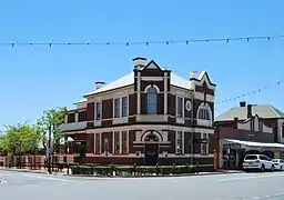 Commercial Bank of Australia
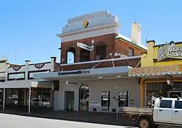
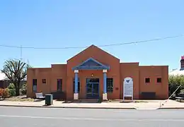 Court House
 CWA Hall
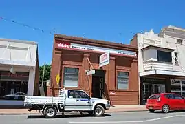 Elders Office
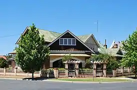 West Wyalong Federation House
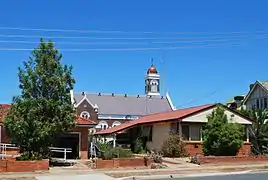 Houses & Church
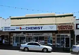 Leadbetter Motor Garage
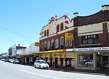
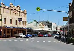 Main Street
 Medical Hall
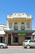 Mentor Chambers
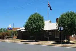 West Wyalong Police Station
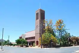
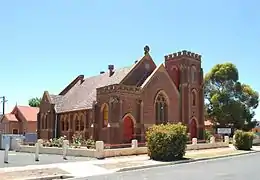 West Wyalong Presbyterian Church
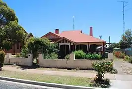 West Wyalong Presbyterian Manse
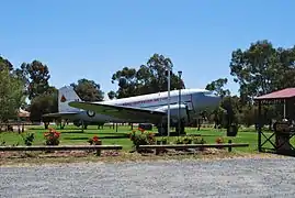 RAAF Plane
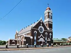 West Wyalong Roman Catholic Church
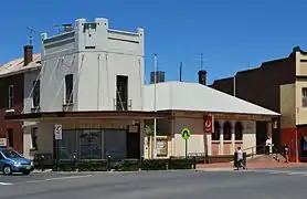 West Wyalong Post Office
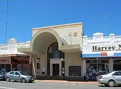 West Wyalong Rural Bank
 West Wyalong Rural Bank
 Main Street
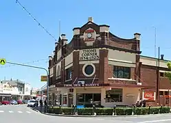 Thom's Corner
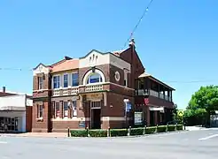
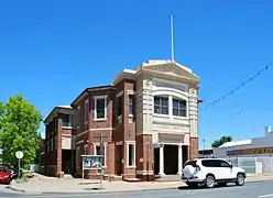 Memorial Literary Institute
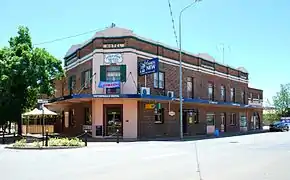 Tattersalls Hotel
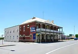 White Tank Hotel
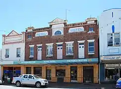 Royal Hotel
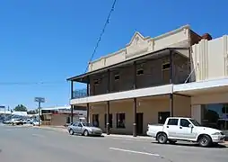 Post Office Hotel
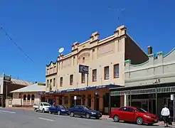 Metropolitan Hotel
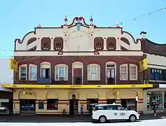 Globe Hotel
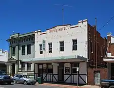 Empire Hotel
Media
The West Wyalong Advocate newspaper is an independent publication,[5] printed on Fridays. It also services nearby towns including Ungarie and Barmedman.
94.5 GOLD FM is West Wyalong's community radio station.[6] It is an independent not-for-profit community broadcaster founded in 2001.
West Wyalong Movies is a project by Ross Harmer aimed at documenting the history of West Wyalong and The Bland Shire.[7]
Surrounding towns
| • Barmedman | (32 km or 20 mi) |
| • Burcher | (52 km or 32 mi) |
| • Tallimba | (34 km or 21 mi) |
| • Ungarie | (42 km or 26 mi) |
| • Weethalle | (57 km or 35 mi) |
| • Wyalong | (3.5 km or 2.2 mi) |
References
- Australian Bureau of Statistics (28 June 2022). "West Wyalong (Urban Centre and Locality)". Australian Census 2021.
- "Archived copy". Archived from the original on 17 September 2006. Retrieved 16 January 2007.
{{cite web}}: CS1 maint: archived copy as title (link) - Dow L, Guyon D, Irving R, McPhee M, Matthews A, Prineas P, Rubinich T, Simpson J (1995). Reader's Digest Illustrated Guide to Australian Places. Surry Hills, NSW: Reader's Digest. p. 227. ISBN 0-86438-399-1.
- West Wyalong NSW find hearts of gold. West Wyalong: Bland Shire Council. 2012. p. 11.
- "Members | Country Press New South Wales Inc. | Australia's oldest newspaper industry association Founded 1900". www.cpnsw.org.au. Retrieved 1 August 2022.
- "94.5 GOLD FM website". Retrieved 1 August 2022.
- "West Wyalong Movies bringing local history to life". Retrieved 28 December 2016.