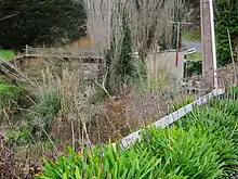
Waingaro River (Waikato)
The Waingaro River is a river of the Waikato region of New Zealand's North Island. It flows generally southwest from its origins near Glen Afton and Glen Massey, west of Ngāruawāhia, to reach a northern arm of Raglan Harbour (see 1:50,000 map). Its main tributary is Kahuhuru Stream, which Highway 22 follows for several kilometres. Tributaries total about 170 kilometres (110 mi).[1] At Waingaro it is fed by a hot spring.
| Waingaro River | |
|---|---|
 Waingaro Landing and mangroves at mouth of Waingaro River | |
| Location | |
| Country | New Zealand |
| Physical characteristics | |
| Source | |
| • elevation | 150 m (490 ft) |
| Mouth | |
• location | Raglan Harbour |
• elevation | 0 m (0 ft) |
| Length | 18 km (11 mi) |
| Basin size | 123 km2 (47 sq mi) |
Geology

The lower river flows over Puaroan age (about 150 million years ago), blue-grey Puti siltstone.[2]
Pollution
The Waingaro River is one of the largest sources of sediment in Whaingaroa Harbour, partly because it is 99 percent unfenced.[3]
Pollution has been worsening for phosphorus, though nitrogen has improved, as shown in this table of important (i.e. slope direction probability over 95% and RSKSE over ±1% pa) improvements, or deteriorations (-) in relative seasonal Kendall slope estimator (RSKSE) trends (monthly records are flow-adjusted using a Lowess curve fit with 30% span.) -[4] Turbidity is also poor.[5]
| % per year | Nitrate-N | Total phosphorus | Dissolved reactive P |
|---|---|---|---|
| 1993–2017 | 1.0 | -1.0 | -1.0 |
| 2008–2017 | -3.4 |
See also
References
- Land Air Water Aotearoa
- Geology of the Raglan-Kawhia Area: Institute of Geological & Nuclear Sciences (N.Z.), Barry Clayton Waterhouse, P. J. White 1994 ISBN 0-478-08837-X
- Regional Council report on Whaingaroa Harbour Care
- Vant, Bill. Waikato Regional Council Technical Report 2018/30 Trends in river water quality in the Waikato region, 1993-2017.
- "Waingaro River (Pukemiro) at Ruakiwi Rd Off SH22 River Quality". Land, Air, Water Aotearoa (LAWA). Retrieved 18 January 2019.
- "Place name detail: Waingaro River". New Zealand Gazetteer. New Zealand Geographic Board. Retrieved 12 July 2009.
- New Zealand 1:50000 Topographic Map Series sheet BD32 – Raglan
External links
- most of the river is close to Ohautira and Waingaro Roads, so many images are available in street scene on https://maps.google.com/
- water quality at Ruakiwi Rd LAWA WRC
- water level at Waingaro
- , , - National Library 1910 photos of Waingaro Landing, Waingaro Bay (note the 1900 road to the Landing on the hillside) and Waingaro Estuary.
- 1955 Waingaro Landing aerial photo - the foreground shows part of the Kerikeri River arm of the harbour, which is over 3 km long. The Waingaro River joins the estuary in the middle left of the photo.
- Photo of oil launch 'Nita'.
- 2012 Estuarine Vegetation Survey - page 15 describes the wildlife in the Waingaro and Kerikeri River arm of the harbour.