Twmpath Castle
Twmpath Castle,[4][2] also known as Twmpath Motte (Welsh: Caer Cynwrig),[1][2] is a medieval motte on the southern slope of Wenallt Hill near Rhiwbina in Cardiff, Wales, which is a scheduled monument.[5][3]
| Twmpath Castle Twmpath Motte | |
|---|---|
| Native name Welsh: Caer Cynwrig[1][2] | |
.jpg.webp) Twmpath Castle | |
| Type | Motte-and-bailey castle[1] |
| Location | Rhiwbina, Cardiff, Wales[1] |
| Coordinates | 51.532355°N 3.221363°W |
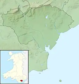
 Twmpath Castle Location in Cardiff | |
| Official name | Twmpath, Rhiwbina[3] |
| Designated | 23 July 1930[3] |
| Reference no. | GM017[3] |
Toponymy
Twmpath is a Welsh word literally meaning a hump.[6] Caer Cynwrig are both Welsh words. Caer (Old Welsh: cair or kair) is a placename element meaning a fortification, a camp, an inclosure, a wall or mound of defence,[7] while Cynwrig in Old Welsh means high hill.[2]
History
The motte-and-bailey castle dates back to the middle Ages from about 1066 to 1540.[3] Originally Twmpath Castle was a Welsh camp called Caer Cynwrig, which was captured and occupied by the Normans and became the third largest motte in the Lordship of Glamorgan.[8] Robert Fitzhamon founded Cardiff Castle and used the old Cardiff Roman Fort to construct it.[9] Cardiff Castle was the capital of the Lordship of Glamorgan and Twmpath Castle formed one of a string of fortifications used to defend the newly conquered town of Cardiff with a ring of eight smaller earth and timber castles, Caerau Hillfort, Morganstown Castle Mound, Castell Coch and Whitchurch (known as Treoda), Cae’r Castell, near St Mellons and Rumney Castle.[9]
Present day
Today the site is overgrown and stands approximately 25 ft (7.6 m) high and 130 ft (40 m) around.[8] The top is 16 m (52 ft) in diameter. The motte is surrounded by a ditch, which varies in depth between 1 m (3.3 ft) to 1.2 m (3.9 ft) and width between 4 m (13 ft) and 5 m (16 ft).[3]
Cadw has described the monument as being of "National importance for its potential to enhance our knowledge of medieval defensive practices.[3] The monument is well-preserved and an important relic of the medieval landscape.[3] It retains significant archaeological potential, with a strong probability of the presence of both structural evidence and intact associated deposits."[3] It was designated as a scheduled monument on 23 July 1930.[3]
Legends
Legend has it that it is a burial mound erected about 1089 for Iestyn ap Gwrgan, Lord of Glamorgan.[10] The other legend says that the Devil piled up some earth in the form of a mound.[10]
See also
References
- "Caer Cynwrig (307123)". Coflein. RCAHMW. Retrieved 30 May 2021.
- "Meaning of Cynwrig". TheNamesDictionary. Retrieved 31 May 2021.
- Cadw. "Twmpath, Rhiwbina (GM017)". National Historic Assets of Wales. Retrieved 30 May 2021.
- Terry Breverton (15 October 2010). Wales' 1000 Best Heritage Sites. Amberley Publishing Limited. p. 33. ISBN 978-1-4456-2013-8.
- "Twmpath, Rhiwbina". Ancient Monuments. Retrieved 12 May 2021.
- "Twmpath". FolkWales. Retrieved 31 May 2021.
- Nicholas Carlisle (1811). A Topographical Dictionary of the Dominion of Wales, Exhibiting the Names of the Several Cities, Towns, Parishes [etc] ...: Being a Continuation of The Topography of the United Kingdom of Great Britain and Ireland. Pr.for William Miller. p. xxx.
- "The castles of Cardiff-Caer Cynwrig". dicmortimer. Retrieved 31 May 2021.
- "Environmental Statement – Cultural Heritage and Archaeology (14.73)" (PDF). DPP Planning (Black Mountains Archaeology Ltd). Retrieved 31 May 2021.
- "Twmpath Castle". castlewales.com. Retrieved 31 May 2021.
Further reading
- Royal Commission on the Ancient and Historical Monuments of Wales (May 1991). An Inventory of the Ancient Monuments in Glamorgan: Volume III: Medieval secular monuments. The early castles - from the Norman Conquest to 1217: Volume III: Medieval secular monuments. Royal Commission on the Ancient and Historical Monuments of Wales. pp. 68–70. ISBN 978-0-11-300035-7.
External links
 Media related to Twmpath Castle at Wikimedia Commons