Transport in the United Arab Emirates
This article covers the various forms of transport in the United Arab Emirates (UAE), by road, rail, air, water, etc.
Roads
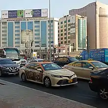
In the UAE, they drive on the right. In the old days, it was a British protectorate and they used to drive on the left, but later they swapped to the right.[1] The United Arab Emirates have an extensive and well-developed road network, principally in the northern coastal area where the main population centres are located. Many of these roads have been improved to become multi-lane dual-carriageway motorways, coping with the high demand for road transportation.
Speed limits are 160 km/h (100 mph) on freeways (some freeway network's like E22 were imposed with a lower speed limit by the Abu Dhabi Government [2]), 100 km/h (60 mph) on rural roads, and 60 or 80 km/h (35 or 50 mph) on urban dual-carriageways. Heavy trucks and buses are installed with speed limiters to prevent overspeeding.
In 2006 UAE have a score of 190 killed per million population in traffic collisions linked to high speeds and poor safety culture.[3]
In 2010, UAE have a score near of 100 killed per million population in traffic collisions.[4]
In 2013, UAE have a score near of 109 killed per million population in traffic collisions, as estimated by the WHO[5]
Between 2014 and 2018 peopled killed by traffic has drop by 34%.[6]
List of motorways
- E10 Abu Dhabi – Al Shahama. Length: 44 km (27 mi).
- E11 Al Silaa – Al Qir. Length: 583 km (362 mi). This is the most important motorway of the country, stretching from Saudi Arabia to Oman, connecting Abu Dhabi, Dubai, Sharjah, Umm al-Quwain, Ras al-Khaimah, and other important centres.
- E12 Abu Dhabi – Al Falah. Length: 34 km (21 mi).
- E14 Abu Dhabi - Al Faqaʻ Road (from E11 to E66). Length: 84 km.
- E15 Ruways – Wasit Oasis. Length: 145 km (90 mi).
- E16 Al Rahba – Al Saad. Length: 100 km (62 mi).
- E18 Ras Al Khaimah – Al Manama. Length: 61 km (38 mi).
- E20 Abu Dhabi – Al Hayer. Length: 144 km (89 mi).
- E22 Abu Dhabi – Al Ain. Length: 157 km (98 mi).
- E30 (Abu Dhabi - Al Ain Road; parallel to E 22 Road)
- E44 Dubai–Hatta. Length: 129 km (80 mi).
- E45 Tarif–Liwa. Length: 109 km (68 mi).
- E55 Umm al-Quwain – Al Shuwaib. Length: 131 km (81 mi).
- E66 Dubai – Al Ain. Length: 130 km (81 mi).
- E75 Saih Sheib – Al Fayah Truck Road
- E77 (Expo Road/Jabal Ali-Lahbab Road). Length: 54 km (33 mi).
- E84 Al Malaiha – Fujairah. Length: 43 km (27 mi).
- E88 Sharjah – Masafi. Length: 77 km (48 mi).
- E89 Diba al Fujairah – Fujairah. Length: 66 km (41 mi).
- E99 Diba al Fujairah – Kalba. Length: 82 km (51 mi).
- E102 Sharjah – Kalba. Length: 119 km (74 mi).
- E311 Abu Dhabi – Ras al Khaimah. Length: 139 km (86 mi).
- E611 Dubai – Umm al-Quwain. Also known as Emirates Road, formerly Dubai Bypass Road. Length: 110 km (68 mi).
Major accidents
Six people were killed, at least 40 were injured and dozens of vehicles burned March 11, 2008 when hundreds of cars collided on a fog-shrouded Abu Dhabi–Dubai highway.[7]
Buses

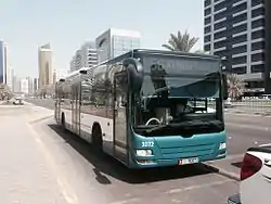
Bus services were introduced in Abu Dhabi by the Emirate in 2008 with four routes which were zero fare in their pilot year.[8] At the end of 2011, bus services in the Emirate of Abu Dhabi provided more than 95 service routes with 650 buses to transport 50 million passengers in the region. In the Bus Network Plan in 2013, 14 bus routes were operated in Abu Dhabi City.[9]
In Dubai, the Roads and Transport Authority (RTA) operates bus services under the name DubaiBus. Buses in Sharjah are operated by Mowasalat, and in Ajman by Ajman bus. There are also buses operating between the different Emirates due to the lack of rail connectivity, although this is planned to be rectified in the near future.[10][11]
Transport payment systems
Fares on Abu Dhabi buses are paid by the Hafilat Card since 2015, which is a contactless smart card to be flashed when entering and exiting the bus at mini-terminals inside of the bus.[12] It is currently only available for bus travellers but will gradually be expanded into the water transport systems and the planned Abu Dhabi Metro, Etihad Rail and the Abu Dhabi Tram System. The Ojra card is used by frequent travellers. The Nol card is a contactless smart card used for Public Transport in Dubai.[13] It is also used for payment on buses between Dubai and other cities.
Rail
Etihad Rail is a state-owned company, and is the national railway company. It was set up in 2009 to manage a national-level freight and passenger rail network within the country, and later to other nations of the Gulf Cooperation Council as part of Gulf Railway. The first phase of the system is complete and freight service has begun. The second phase will connect the railway to Mussafah, Khalifa and Jebel Ali ports in Dubai, and is planned to connect to the Saudi and Omani borders. In January 2016, construction of phase two was suspended for re-evaluation, while service on phase one continued. Costing approximately US$10 billion, the three-stage rail system is planned to have 1,200 km (750 mi) of railway connecting cities in UAE and linking to other Gulf countries. Abu Dhabi, Al Ain, Dubai, Sharjah, Fujairah, Ras Al Khaimah and Khor Fakkan will be linked by Etihad Rail when construction is completed.[14][15]
The Dubai Metro has operated since 2009, and the Abu Dhabi Metro is currently under construction.
The Dubai Tram was launched in November 2014, and operates mainly in the Dubai Marina with new stations being constructed.[16] Another tram system is being planned for Sharjah and Ajman.[17]
Air
The General Civil Aviation Authority (GCAA) started applying an advanced program in 2010 that allows the assessment of aircraft registered in foreign countries in order to ensure their safety and airworthiness.[18] In 2011, it banned all aircraft registered in Congo DR, Eswatini, Equatorial Guinea, Sierra Leone and São Tomé and Príncipe due to their poor safety standards.[19]
Airports
Dubai International Airport was the busiest airport in the world by international passenger traffic in 2014.[20] Abu Dhabi International Airport is the second-largest airport in the UAE.
There are 42 airports in the UAE as of 2013.[21]
| Runways | ||
|---|---|---|
| Length | Number of | |
| paved | unpaved | |
| over 3,000 m (10,000 ft) | 12 | 1 |
| 2,400–3,000 m (8,000–10,000 ft) | 3 | 1 |
| 1,500–2,400 m (5,000–8,000 ft) | 4 | 4 |
| 910–1,520 m (3,000–5,000 ft) | 4 | 6 |
| under 910 m (3,000 ft) | 2 | 5 |
| Total: | 25 | 17 |
Heliports: Five are known as of 2013.[21]
Airlines
Emirates is the biggest national airline of the UAE and is owned by Dubai.[22] Etihad Airways is the second-largest national airline and is owned by Abu Dhabi.[23] Other airlines are flyDubai, Air Arabia and Royal Jet.
Pipelines
- Crude oil, 830 kilometres (516 mi)
- Natural gas, including natural gas liquids, 870 kilometres (541 mi)
Ports and harbours
The major ports are Khalifa Port, Zayed Port, Port of Jebel Ali, Port Rashid, Port Khalid, Port Saeed, and Container Port Khor Fakkan. Other ports include Fujairah Port (a bunkering port), Das Island (tanker port).[24][25]
Merchant marine
The merchant marine consisted of 68 ships of 1,000 gross tonnage (GT) or over, totaling 1,107,442 GT or 1,795,235 tonnes deadweight (DWT) in the following types (1999 est.):
- bulk, 1
- cargo, 18
- chemical tanker, 3
- container, 8
- liquified gas, 1
- livestock carrier, 1
- passenger, 1
- petroleum tanker, 27
- roll-on/roll-off, 7
- specialized tanker, 1
See also
References
- "Remembering the day Dubai swapped left-hand driving for right". September 2021.
- "Abu Dhabi road restrictions: speed limit reduced on major road". Retrieved 2023-08-18.
- Barss, Peter; Mohamed El-Sadig, Yousef Al-Hosani (30 August 2021). "Road traffic injuries in the Middle East: A view from the United Arab Emirates".
- "UNITED ARAB EMIRATES" (PDF). Archived from the original (PDF) on 2018-04-19. Retrieved 2023-08-18.
- "UNITED ARAB EMIRATES" (PDF). Archived from the original (PDF) on 2016-07-20. Retrieved 2023-08-18.
- "Baisse remarquable du taux de mortalité routière aux Emirats arabes unis".
- "Dozens of vehicles burn in massive Emirates wreck - CNN.com". edition.cnn.com. Retrieved 4 June 2017.
- "All aboard for a free ride". The National. 30 June 2008. Archived from the original on 15 September 2008. Retrieved 2008-07-12.
- "Abu Dhabi Region Bus Services". dot.abudhabi.ae. Retrieved 2016-11-09.
- "Etihad Rail". Etihad Rail. Archived from the original on 29 April 2020. Retrieved 4 June 2017.
- Staff, ASC. "Etihad Rail set to award phase 2 of $11bn rail plan - ArabianSupplyChain.com". www.arabiansupplychain.com. Retrieved 4 June 2017.
- "Hafilat smart card". dot.abudhabi.ae. Archived from the original on 2018-06-11. Retrieved 2018-11-26.
- "Public transport in the UAE: a guide to getting around | Expatica". Expat Guide to United Arab Emirates | Expatica. Retrieved 2021-07-29.
- Wam. "2017: Abu Dhabi to Dubai by train". Emirates 24|7. Retrieved 2016-11-09.
- Haider, Haseeb. "UAE's Etihad Rail stage two tendering process suspended - Khaleej Times". www.khaleejtimes.com. Retrieved 2016-11-09.
- "Dubai Tram". www.alsufouhtram.com. Retrieved 2017-08-23.
- Deulgaonkar, Parag (3 September 2015). "Tram in Sharjah: Where is it being built... click to know". Retrieved 4 June 2017.
- Haq, Robeel. "Breaking News: UAE bans ANTONOV An-12 Aircraft - ArabianSupplyChain.com". www.arabiansupplychain.com. Retrieved 4 June 2017.
- "United Arab Emirates bans Congo registered aircraft". eTN. Archived from the original on 17 March 2012. Retrieved 22 March 2011.
- Anderson, Elizabeth (27 January 2015). "Dubai Overtakes Heathrow To Become World's Busiest". The Telegraph.
- "The World Factbook — Central Intelligence Agency". www.cia.gov. Retrieved 2018-01-24.
- "Emirates and Dnata now under ICD | GulfNews.com". archive.is. 2013-01-03. Archived from the original on 2013-01-03. Retrieved 2018-01-24.
- "Corporate profile - Etihad Airways". Etihad Global. Retrieved 2018-01-24.
- "WPS - Index of ports in United Arab Emirates". World Port Source. Retrieved 2022-04-29.
- "WPS - Map of ports in United Arab Emirates". World Port Source. Retrieved 2022-04-29.
