Transport in Slovakia
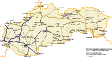
Transport in Slovakia is possible by rail, road, air, or rivers. Slovakia is a developed Central European country with a well-developed rail network (3,662 km) and a highway system (854 km). The main international airport is the M. R. Štefánik Airport in the capital, Bratislava. The most important waterway is the river Danube, which is used by passenger, cargo, and freight ships. The two most important harbours in Slovakia are Komarno harbour and Bratislava harbour.
Railways
- Total: 3,662 km (2008)
- Broad gauge: 99 km of 1,520 mm (4 ft 11+27⁄32 in) gauge - used for freight transport only, see Uzhhorod - Košice broad gauge track
- Standard gauge: 3,473 km of 1,435 mm (4 ft 8+1⁄2 in) gauge (1,588 km electrified; 1,011 km double track)
- Narrow gauge: 50 km (45 km of 1,000 mm (3 ft 3+3⁄8 in) gauge; 5 km of 760 mm (2 ft 5+15⁄16 in) gauge)
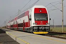
Slovakia has a range of railway connections that provide access to all of Slovakia in the country and from the rest of Europe. There are many railway operators that control railways across the country, with the main railway operator being ZSSK. The railway network is very dense in the western and eastern parts of Slovakia but is less accessible in central Slovakia. The singular high-speed rail line in Slovakia is the Rychlik between Bratislava and Kosice (Via Zillina). The top speed of the line is 200 km/h (120 mph). The Rychlik was established in 2002 after ZSSK took over ZSR. Most of the country's railways run on Tas REX (Regional Express)[1] [2] which operates at speeds between 140 and 160 km/h (87 and 99 mph).
Train operators
- Passenger
- ZSSK Rychlik - High-speed rail passenger trains
- ZSSK REX - Regional express trains
- Leo Express - Intercity railway
- Regio jet - Intercity trains
- Railjet - High-speed rail passenger trains operated by the OBB
- Cargo
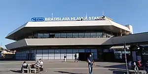
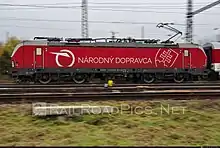
The main cargo train operator for the cargo freight rail in Slovakia is ZSSK cargo.
Rail links with adjacent countries
Roads
- Total: 43,761 km
- Paved: 38,085 km (including 384 km of express-ways)
- Unpaved: 5,676 km
(2018)
Slovakia has a total of 43,761 km of roads in the country with 3,336.6 km being main or national roads, 13,958.7 km being secondary and regional roads, and 861.2 km (535.1 mi) being highways, with the rest being other types of roads.[3]
Highways
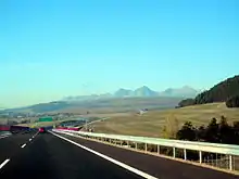
 Motorways in Slovakia 543 km (337 mi) (2022)
- D1: Bratislava - Trnava - Trenčín - Považská Bystrica - Žilina, Liptovský Mikuláš - Jánovce, Prešov - Košice - Záhor(SK/UA border)
- D2: Kúty (CZ/SK border) - Malacky - Bratislava - Jarovce (SK/H border)
- D3: Dolný Hričov - Žilina - Čadca - Skalité(SK/PL border)
- D4: Jarovce - (SK/A border)
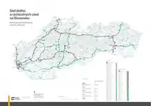 Highway network in Slovakia (2022)
 Expressways in Slovakia 311 km (193 mi)
- R1: Trnava - Nitra - Zvolen - Banská Bystrica
- R2: (SK/CZ border) - Trenčín - Prievidza - Zvolen - Rimavská Sobota - Košice
- R3: (SK/H border) - Zvolen - Martin - (SK/PL border)
- R4: (SK/H border) - Košice - Prešov - Svidník - (SK/PL border)
- R5: Svrčinovec - (SK/CZ border)R6: Beluša - Púchov - (SK/CZ border)
- R7: Bratislava - Nové Zámky - Krupina - Lučenec
Waterways
Pipelines
- Petroleum products 416 km; natural gas 6,769 km (2010)
- Gas pipelines 162 km Poland Slovakia interconnector
- Crude oil 19 km Druzhba pipeline
Ports and harbors
- Port of Bratislava
- Port of Komárno
Airports
See:List of airports in Slovakia
total: 37 (2012)
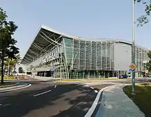
Commercial airports: Bratislava Airport, Košice International Airport, Poprad–Tatry Airport
Airports with paved runways
| Length | Amount |
|---|---|
| over 3,047 m | 2 |
| 2,438 to 3,047 m | 2 |
| 1,524 to 2,437 m | 3 |
| 914 to 1,523 m | 3 |
| under 914 m | 9 |
| Total | 19 |
(2012)
Airports with unpaved runways
total: 18
- 914 to 1,523 m: 10
- under 914 m: 8
(2002)
Heliports
total: 5 (2022)
Municipal transport
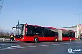
Buses and trolleybuses
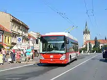
.svg.png.webp) Most towns and cities in Slovakia have well-developed bus networks. Most of the buses are operated by the city or town council but most regional buses are operated by private operators with the permission of local authorities and/or the county council. There is also a trolleybus system which only operates in large cities and is operated by the town council. They are more of an ecological system of transport than a standard bus.
Most towns and cities in Slovakia have well-developed bus networks. Most of the buses are operated by the city or town council but most regional buses are operated by private operators with the permission of local authorities and/or the county council. There is also a trolleybus system which only operates in large cities and is operated by the town council. They are more of an ecological system of transport than a standard bus.
Tram
.svg.png.webp)
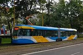
Trams are only found in Bratislava and Kosice. The first tram to arrive in Slovakia was in 1895 in Bratislava and then later on in 1913 trams arrived in Kosice. Today the tram network is expanding rapidly in both cities.
References
- "Regionálny expres (REX)". Rail.cc. Retrieved 18 September 2023.
- "Train Categories". ZSSK. Retrieved 18 September 2023.
- "ROAD NETWORK - SLOVAK REPUBLIC". cdb.sk. Slovenská správa ciest (Slovak Road Administration). Retrieved 18 September 2023.
- "SLOVAKIA". icpdr.org. Retrieved 18 September 2023.
- "Danube Facts and Figures" (PDF). icpdr.org. Retrieved 18 September 2023.
![]() This article incorporates public domain material from The World Factbook. CIA.
This article incorporates public domain material from The World Factbook. CIA.

_AN2006029.jpg.webp)
