Tongowoko County
Tongowoko County is one of the 141 Cadastral divisions of New South Wales. It is located in the remote north-west of the state, south of the Queensland border.
| Tongowoko New South Wales | |||||||||||||||
|---|---|---|---|---|---|---|---|---|---|---|---|---|---|---|---|
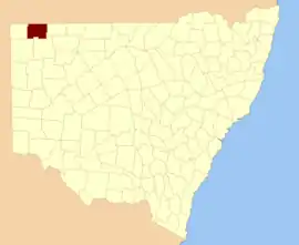 Location in New South Wales | |||||||||||||||
| |||||||||||||||
The name Tongowoko is believed to be derived from a local Aboriginal word.[1]
Parishes within this county
A full list of parishes found within this county; their current LGA and mapping coordinates to the approximate centre of each location is as follows:
| Parish | LGA | Coordinates |
|---|---|---|
| Binaroo | Unincorporated | 29°23′50″S 142°20′04″E |
| Bolwarry | Unincorporated | 29°26′39″S 142°30′25″E |
| Calathunda | Unincorporated | 29°17′01″S 142°37′25″E |
| Caryapundy | Unincorporated | 29°02′34″S 142°38′57″E |
| Churriga[2] | Unincorporated | |
| Connulpie | Unincorporated | |
| Hermitage | Unincorporated | 29°22′57″S 142°01′09″E |
| Koonyaboothie | Unincorporated | 29°36′59″S 142°23′17″E |
| Kurawillia | Unincorporated | 29°36′59″S 142°34′32″E |
| Mokely[3] | Unincorporated | |
| Mount Stuart | Unincorporated | 29°30′32″S 142°01′08″E |
| Mount Wood | Unincorporated | 29°16′58″S 142°17′37″E |
| Olive | Unincorporated | 29°02′40″S 141°52′14″E |
| Silva | Unincorporated | 29°07′49″S 142°21′47″E |
| Tooncurrie | Unincorporated | 29°31′44″S 142°13′52″E |
| Tongowoko | Unincorporated | |
| Torrens | Unincorporated | 29°14′00″S 142°09′27″E |
| Wanpah | Unincorporated | 29°07′48″S 142°10′52″E |
| Warratta | Unincorporated | 29°34′54″S 141°51′08″E |
| Warri | Unincorporated | 29°02′09″S 141°57′55″E |
| Whittabranah | Unincorporated | 29°12′31″S 142°01′10″E |
| Yalpunga | Unincorporated | 29°02′40″S 142°03′13″E |
| Yanderra | Unincorporated | 29°20′36″S 142°34′55″E |
From 2009, the parishes of Tongowoko lie within Division A of the Western Livestock Health and Pest District,[4] along with Evelyn, Farnell, Fitzgerald, Mootwingee, Poole, Tandora, Yantara, and Yungnulgra Counties; some parishes of Killara, Yancowinna, and Young; and with Connulpie and Omura Parishes of Delalah County.
References
- "Tongowoko". Geographical Names Register (GNR) of NSW. Geographical Names Board of New South Wales. Retrieved 4 August 2013.
- "NSW Place and Road Naming Proposals System".
- "NSW Place and Road Naming Proposals System".
- "Rural Lands Protection Act 1998, Order – Section 6, Divisions of Western Livestock Health and Pest District" (PDF). N.S.W. Government Gazette (29): 760–787. Retrieved 29 September 2022.
External links
This article is issued from Wikipedia. The text is licensed under Creative Commons - Attribution - Sharealike. Additional terms may apply for the media files.