Thomond Bridge
Thomond Bridge is the name of a former and current bridge over the river Shannon in Limerick city.

Thomond Bridge
Historic bridge
The earliest bridge, was built near a fording point.[1] It was the scene of a failed defence of the city during the Siege of Limerick. The old Thomond bridge was located at the same location as the current bridge,[2][3] near King John's Castle.[4] The Treaty Stone was placed near there.
Current bridge

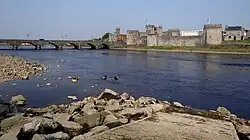
The current bridge over the River Shannon with King John's Castle in the background
The current bridge was built from 1836 to 1836,[5] replacing the earlier bridge.[6] The bridge now forms part of the R445 (formerly N7), carrying traffic on the Northern Relief Road.[7]

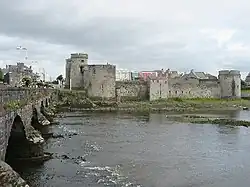
Thomond Bridge (on the left of this photograph), from the 19th century, stands on the site of the earlier bridge.
References
- "Thomond Bridge in Limerick, Ireland". GPSmyCity.
- Lewis 1837.
- "The District of Thomondgate" (PDF). Limerickcity.ie. Retrieved 25 November 2012.
- Slater, Sharon (18 April 2010). "Thomond Bridge - The Bridge of Many Arches • Limerick Places". LimericksLife.com.
- "Thomond Bridge, LIMERICK MUNICIPAL BOROUGH, Limerick, LIMERICK". Buildings of Ireland.
- "1836 – Thomond Bridge, Limerick | Archiseek - Irish Architecture". 2 May 2011.
- Raleigh, David (26 April 2023). "Limerick bridge tragedy inquest hears of valiant efforts to save stonemasons". Irish Mirror.
Sources
- Lewis, Samuel (1837). "Killely, or Killeely". County Clare: A History and Topography. Retrieved 4 April 2014.
This article is issued from Wikipedia. The text is licensed under Creative Commons - Attribution - Sharealike. Additional terms may apply for the media files.