Thọ Xuân district
Thọ Xuân is a district (huyện) of Thanh Hóa province in the North Central Coast region of Vietnam.
Thọ Xuân district
Huyện Thọ Xuân | |
|---|---|
%252C_Vietnam_National_Museum_of_Fine_Arts%252C_Hanoi%252C_Vietnam_-_20131030.JPG.webp) Statue of a tiger from the Lê Lợi mausoleum | |
| Country | |
| Region | North Central Coast |
| Province | Thanh Hóa |
| Area | |
| • Total | 233 sq mi (603 km2) |
| Population (2018) | |
| • Total | 233,752 |
| Time zone | UTC+7 (UTC + 7) |
As of 2003 the district had a population of 233,603.[1] The district covers an area of 603 km². The district capital lies at Lam Sơn.[1]
Climate
| Climate data for Bái Thượng, Thọ Xuân District | |||||||||||||
|---|---|---|---|---|---|---|---|---|---|---|---|---|---|
| Month | Jan | Feb | Mar | Apr | May | Jun | Jul | Aug | Sep | Oct | Nov | Dec | Year |
| Record high °C (°F) | 33.6 (92.5) |
36.2 (97.2) |
37.7 (99.9) |
40.5 (104.9) |
41.5 (106.7) |
41.5 (106.7) |
40.5 (104.9) |
39.0 (102.2) |
37.4 (99.3) |
35.4 (95.7) |
36.2 (97.2) |
34.3 (93.7) |
41.5 (106.7) |
| Average high °C (°F) | 20.7 (69.3) |
21.5 (70.7) |
24.0 (75.2) |
28.3 (82.9) |
32.1 (89.8) |
33.4 (92.1) |
33.5 (92.3) |
32.3 (90.1) |
31.1 (88.0) |
28.9 (84.0) |
26.1 (79.0) |
22.6 (72.7) |
27.9 (82.2) |
| Daily mean °C (°F) | 16.9 (62.4) |
18.0 (64.4) |
20.4 (68.7) |
24.1 (75.4) |
27.0 (80.6) |
28.5 (83.3) |
28.5 (83.3) |
27.8 (82.0) |
26.7 (80.1) |
24.6 (76.3) |
21.5 (70.7) |
18.2 (64.8) |
23.6 (74.5) |
| Average low °C (°F) | 14.3 (57.7) |
15.8 (60.4) |
18.2 (64.8) |
21.4 (70.5) |
23.8 (74.8) |
25.3 (77.5) |
25.3 (77.5) |
24.9 (76.8) |
23.9 (75.0) |
21.7 (71.1) |
18.4 (65.1) |
15.2 (59.4) |
20.7 (69.3) |
| Record low °C (°F) | 2.6 (36.7) |
5.7 (42.3) |
6.9 (44.4) |
12.3 (54.1) |
16.3 (61.3) |
19.9 (67.8) |
21.1 (70.0) |
21.5 (70.7) |
17.3 (63.1) |
13.5 (56.3) |
8.1 (46.6) |
1.0 (33.8) |
1.0 (33.8) |
| Average precipitation mm (inches) | 28.9 (1.14) |
27.2 (1.07) |
47.2 (1.86) |
87.6 (3.45) |
248.2 (9.77) |
249.0 (9.80) |
244.0 (9.61) |
338.7 (13.33) |
329.6 (12.98) |
219.0 (8.62) |
84.3 (3.32) |
24.7 (0.97) |
1,938.5 (76.32) |
| Average rainy days | 10.9 | 11.8 | 14.9 | 14.5 | 17.3 | 16.0 | 15.9 | 18.0 | 14.5 | 11.7 | 8.4 | 6.8 | 161.5 |
| Average relative humidity (%) | 86.6 | 87.6 | 88.9 | 88.4 | 85.2 | 83.7 | 83.7 | 86.5 | 86.0 | 84.8 | 83.1 | 83.5 | 85.7 |
| Mean monthly sunshine hours | 78.1 | 57.6 | 58.2 | 95.1 | 153.6 | 154.3 | 164.1 | 160.1 | 152.5 | 145.1 | 130.4 | 99.8 | 1,448.9 |
| Source: Vietnam Institute for Building Science and Technology[2] | |||||||||||||
References
- "Districts of Vietnam". Statoids. Retrieved March 19, 2009.
- "Vietnam Institute for Building Science and Technology" (PDF). Retrieved 16 August 2023.
| Thanh Hóa province | 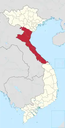 | |
|---|---|---|
| Nghệ An province | ||
| Hà Tĩnh province | ||
| Quảng Bình province |
| |
| Quảng Trị province | ||
| Thừa Thiên Huế province |
| |
※ denotes provincial seat. | ||
This article is issued from Wikipedia. The text is licensed under Creative Commons - Attribution - Sharealike. Additional terms may apply for the media files.