Telegraph Peak (California)
Telegraph Peak, is a peak of the San Gabriel Mountains, in the San Gabriel Mountains National Monument and San Bernardino County, California.
| Telegraph Peak | |
|---|---|
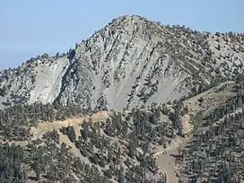 Telegraph Peak as seen from Devils Backbone ridge on Mount San Antonio. | |
| Highest point | |
| Elevation | 8,989 ft (2,740 m) NAVD 88[1] |
| Prominence | 1,183 ft (361 m)[1] |
| Parent peak | Mount San Antonio[2] |
| Listing | Hundred Peaks Section[3] |
| Coordinates | 34°15′41″N 117°35′53″W[4] |
| Geography | |
| Location | San Bernardino County, California, U.S. |
| Parent range | San Gabriel Mountains |
| Topo map | USGS Telegraph Peak |
| Climbing | |
| Easiest route | Hike, class 1[3] |
With an elevation of 8,989 feet (2,740 m), it is highest point in the Cucamonga Wilderness of the San Bernardino National Forest.[1]
See also
- San Gabriel Mountains National Monument−related topics
References
- "Telegraph Peak, California". Peakbagger.com. Retrieved 2012-04-01.
- "Telegraph Peak". ListsOfJohn.com. Retrieved 2012-04-01.
- "Telegraph Peak". Hundred Peaks Section List. Angeles Chapter, Sierra Club. Retrieved 2009-08-24.
- "Telegraph Peak". Geographic Names Information System. United States Geological Survey, United States Department of the Interior. Retrieved 2007-08-15.
This article is issued from Wikipedia. The text is licensed under Creative Commons - Attribution - Sharealike. Additional terms may apply for the media files.