Taz (river)
The Taz (Russian: Таз) is a river located in western Siberia, has a length of 1,401 kilometers (871 mi) and drains a basin estimated at 150,000 square kilometers (58,000 sq mi).[1] Its middle and lower course are located within Yamalo-Nenets Autonomous Okrug, while its upper course borders with Krasnoyarsk Krai.
| Taz Таз | |
|---|---|
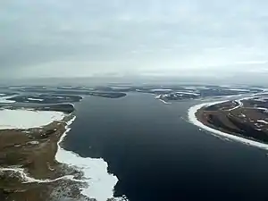 View of the river | |
 Mouth location in the Yamalo-Nenets Autonomous Okrug, Russia | |
| Location | |
| Country | Yamalo-Nenets Autonomous Okrug, Russia |
| Physical characteristics | |
| Source | |
| • location | Siberian Uvaly |
| • coordinates | 62°37′6″N 84°09′51″E |
| • elevation | 139 m (456 ft) |
| Mouth | |
• location | Taz Estuary |
• coordinates | 67.5794°N 78.1595°E |
• elevation | 0 m (0 ft) |
| Length | 1,401 km (871 mi) |
| Basin size | 150,000 km2 (58,000 sq mi) |
| Discharge | |
| • average | 1,450 m3/s (51,000 cu ft/s) |
The now ruined city of Mangazeya was located by the Taz.
Course
The Taz begins near Lake Dynda, Siberian Uvaly, a hilly area of the West Siberian Plain. It flows roughly northwestwards across largely uninhabited areas. Its mouth is in the Taz Estuary, a roughly 250-kilometer (160 mi) long estuary that begins in the area of the settlement of Tazovsky and ends in the Gulf of Ob. A portage connects the Taz with the Turukhan and the Yenisey. There are numerous lakes in its basin, such as the Chyortovo.[2]
Its major tributaries include the Bolshaya Shirta and Khudosey from the right and the Tolka and Chaselka from the left.[2]
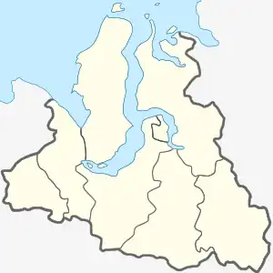
 Drainage basin of the Taz River. It flows into the Taz Estuary which is the large eastern arm of the Gulf of Ob. |
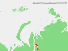 Location of the Taz estuary within Siberia. |
References
- Russian State Water Register - Taz River
- Таз // Great Soviet Encyclopedia, in 30 vols. / Ch. ed. A.M. Prokhorov. - 3rd ed. - M .: Soviet Encyclopedia, 1969