Tarcău Mountains
The Tarcău Mountains (Romanian: Munții Tarcău, Hungarian: Tarkő-hegység) are a mountain range, part of the Moldavian-Muntenian Carpathians of the Outer Eastern Carpathians.
| Tarcău Mountains | |
|---|---|
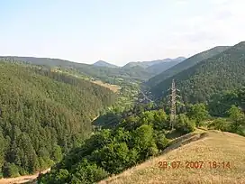 The Tarcău Mountains. View towards the Doamna River valley | |
| Highest point | |
| Peak | Grindușu Peak |
| Elevation | 1,664 m (5,459 ft) |
| Dimensions | |
| Length | 65 km (40 mi) |
| Width | 40 km (25 mi) |
| Area | 1,810 km2 (700 sq mi) |
| Geography | |
| Country | Romania |
| Region | Moldavia |
| Range coordinates | 46°46′N 26°16′E |
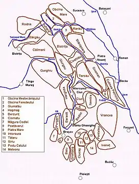
Map of the Eastern Carpathians, with the Tarcău Mountains in the center
The range is located between the latitudes 46°25′ and 46°57′ N and between the longitudes 25°52′ and 26°28′ E. The range is bordered by the following rivers:
- The Bicaz and the Bistrița to the north.
- The Dămuc and Valea Rece to the west.
- The Trotuș to the south.
To the east they are limited by the subcarpathian hills along a line running approximately from Piatra Neamț to Moinești. The highest point is Grindușu Peak at 1,664 metres (5,459 feet).
References
- "Munții Tarcău – Descriere". bocutz.iscaria.ro (in Romanian). Archived from the original on 2010-08-20.

The Tarcău Mountains, with the Bistrița River valley and the Bâtca Doamnei Lake
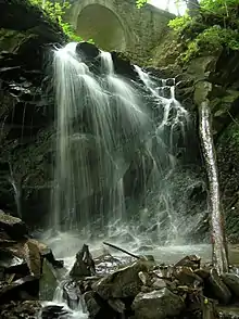
Cascade in Tarcău commune
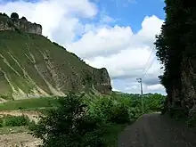
Falcon Stone (Piatra Șoimului) in Piatra Șoimului commune
This article is issued from Wikipedia. The text is licensed under Creative Commons - Attribution - Sharealike. Additional terms may apply for the media files.