St Magdalene's Hill
St Magdalene's Hill is a hill located 1.5 miles (2.4 km) south-southwest of Perth, Scotland, next to the M90 motorway. Its summit is at 131 metres (430 ft).[2][1]
| St Magdalene's Hill | |
|---|---|
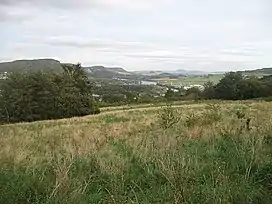 Looking east from St Magdalene's Hill to Friarton Bridge and Kinnoull Hill | |
| Highest point | |
| Elevation | 131 m (430 ft)[1] |
| Coordinates | 56°22′27″N 03°26′30″W |
| Geography | |
| Location | Perth, Perth and Kinross, Scotland |
The hill (and woodland, which is shown on a 1783 military survey map) takes its name from St Mary Magdalene's hospital for the poor, which was located near the site.[3]
References
This article is issued from Wikipedia. The text is licensed under Creative Commons - Attribution - Sharealike. Additional terms may apply for the media files.