St. Theodosius Nunatak
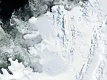
St. Theodosius Nunatak (Bulgarian: нунатак Св. Теодосий, ‘Nunatak Sv. Teodosiy’ \'nu-na-tak sve-'ti te-o-'do-siy\) is the mostly ice-free ridge extending 1.9 km in northeast-southwest direction and 1 km wide, rising to 430 m[1] on the west side of Havre Mountains in northern Alexander Island, Antarctica. It surmounts Lennon Glacier to the north and Pipkov Glacier to the south-southeast.

The feature is named after the Bulgarian cleric and hermit St. Theodosius of Tarnovo (1300-1363), in connection with the settlement of Teodosievo in Northern Bulgaria.
Location
St. Theodosius Nunatak is located at 69°13′13″S 72°04′36″W, which is 3.13 km east-northeast of Buneva Point, 8.86 km south-southwest of Saint George Peak, 5.6 km west of Kutev Peak and 8.4 km northwest of Simon Peak. British mapping in 1991.
Maps
- British Antarctic Territory. Scale 1:250000 topographic map. Sheet SR19-20/5. APC UK, 1991
- Antarctic Digital Database (ADD). Scale 1:250000 topographic map of Antarctica. Scientific Committee on Antarctic Research (SCAR). Since 1993, regularly upgraded and updated
Notes
- Reference Elevation Model of Antarctica. Polar Geospatial Center. University of Minnesota, 2019
References
- Bulgarian Antarctic Gazetteer. Antarctic Place-names Commission. (details in Bulgarian, basic data in English)
- St. Theodosius Nunatak. SCAR Composite Gazetteer of Antarctica
External links
- St. Theodosius Nunatak. Copernix satellite image
This article includes information from the Antarctic Place-names Commission of Bulgaria which is used with permission.