Sparnberg
Sparnberg is a village in Thuringia, Germany. It was an independent municipality until 1994, when it became a district of the town Hirschberg.[1] It is situated on the right bank of the river Saale, at 440 m above sea level. It has an area of about 333 hectares. Sparnberg counted about 160 residents in 2005.

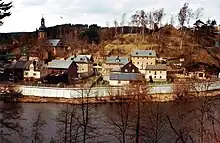
Sparnberg in the 1980s, surrounded by an East German border wall
Sparnberg | |
|---|---|
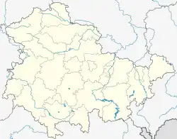
Location of Sparnberg | |
 Sparnberg  Sparnberg | |
| Coordinates: 50°24′46″N 11°46′16″E | |
| Country | Germany |
| State | Thuringia |
| District | Saale-Orla-Kreis |
| Town | Hirschberg |
| Area | |
| • Total | 3.3 km2 (1.3 sq mi) |
| Population (2005) | |
| • Total | 160 |
| • Density | 48/km2 (130/sq mi) |
| Time zone | UTC+01:00 (CET) |
| • Summer (DST) | UTC+02:00 (CEST) |
From 1949 to 1990 the Saale formed the border between East (GDR) and West Germany (FRG) here, with Sparnberg on the GDR side.
References
- Statistik Thüringen, Gebietsveränderungen: Sparnberg
This article is issued from Wikipedia. The text is licensed under Creative Commons - Attribution - Sharealike. Additional terms may apply for the media files.