Shale Butte Wilderness Study Area
The Shale Butte Wilderness Study Area is a Bureau of Land Management wilderness study area (WSA) in Lincoln County, Idaho. It covers 15,560 acres (6,300 ha). The WSA is located to the south of Craters of the Moon National Monument and Preserve.[1]
| Shale Butte Wilderness Study Area | |
|---|---|
 | |
| Location | Lincoln County, Idaho, United States |
| Nearest city | Minidoka, ID |
| Coordinates | 42.935°N 113.850°W |
| Area | 15,560 acres (6,300 ha) |
| Established | 1992 |
| Governing body | Bureau of Land Management |

Map of Shale Butte WSA. Image is 13 km across.
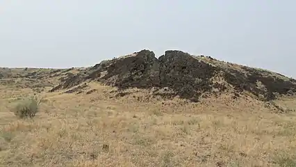
Shale Butte itself is located in the northeast corner of the WSA.[2] It is not composed of shale, but basalt lava of Pleistocene age.[3] The lava extends to the south from the butte to cover the eastern WSA.
The WSA is accessible only by unimproved roads and jeep trails, or by hiking.
To the north is Sand Butte Wilderness Study Area.
 Lava flow in southeastern Shale Butte WSA
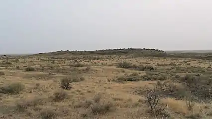 Terrain of northern Shale Butte WSA
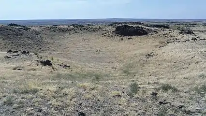 Caldera of Shale Butte
External links
- Volcanic landscape, top of plateau in southeastern Shale Butte Wilderness Area
References
- "Shale Butte Wilderness Study Area". Bureau of Land Management. Retrieved September 4, 2019.
- Shale Butte Quadrangle, Idaho-Lincoln Co., 7.5 Minute Series (Topographic), United States Geological Survey, 1976 edition.
- Kuntz, M.A., Champion, D.E., Lefebvre, R.H., and Covington, H.R. Geologic map of the Craters of the Moon, Kings Bowl, and Wapi lava fields, and the Great Rift volcanic rift zone, south-central Idaho. Miscellaneous Investigations Series Map I-1632. 1988. Map Scale: 1:100,000
This article is issued from Wikipedia. The text is licensed under Creative Commons - Attribution - Sharealike. Additional terms may apply for the media files.