Shah Hasan, Sindh
Shah Hasan, also spelled Shah Hassan, is a village and deh in Johi taluka of Dadu District, Sindh.[3] It is located at the western end of Lake Manchar, about 24 miles west of Sehwan.[4] As of 2017, Shah Hasan has a population of 2,597, in 481 households.[2] It is the seat of a tappedar circle, which also includes the villages of Berah, Dhabhari, Dhori Kunri, Khanwah, Lohri, and Makhan Belo.[2]
Shah Hasan
Shāh Hasan, Shah Hassan | |
|---|---|
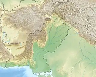
 Shah Hasan Location in Sindh  Shah Hasan Shah Hasan (Pakistan) | |
| Coordinates: 26.440417°N 67.566905°E[1] | |
| Country | Pakistan |
| Region | Sindh |
| District | Dadu |
| Taluka | Johi |
| Population (2017)[2] | |
| • Total | 2,597 |
| Time zone | UTC+5 (PST) |
| • Summer (DST) | UTC+6 (PDT) |
Shah Hasan hosts a fair on the 9th of Zilhuz in honour of Pir Gaji, a famous Sufi pir whose tomb is located on a hilly spur six miles west of the village.[4]
Around 1874, Shah Hasan had an estimated population of about 1,200, including about 880 Muslims (mostly Mohanas and Bughios) and about 320 Hindus (mostly Lohanos).[4] Its main manufactured products were ropes and mats made from the pfis, a type of dwarf palm.[4] There was a local trade in grain, fish, and mats, but no significant long-distance commerce.[4] Shah Hasan was then the seat of a tappedar and had a small police post, a dharamsala, and a cattle pound.[4] The Pir Gaji festival had an average attendance of about 600 people at this time.[4]
The 1951 census recorded the village of Shah Hasan as having an estimated population of about 740, in about 140 houses.[5] It had a school and police station at that point.[5]
References
- "Geonames Search". Do a radial search using these coordinates here.
- Population and household detail from block to tehsil level (Dadu District) (PDF). 2017. p. 12. Retrieved 25 December 2021.
- "List of Dehs in Sindh" (PDF). Sindh Zameen. Retrieved 25 December 2021.
- Hughes, A.W. (1874). A Gazetteer of the Province of Sindh. London: George Bell and Sons. pp. 729, 782. Retrieved 25 December 2021.
- Census of Pakistan, 1951: Village List (PDF). p. 19 in section "Dadu District". Retrieved 31 December 2021.