Sanders Canyon Formation
The Sanders Canyon Formation is a geologic formation exposed north and west of the Sierra Blanca of southern New Mexico. It preserves fossils dating back to the Eocene epoch.[1]
| Sanders Canyon Formation | |
|---|---|
| Stratigraphic range: Late Eocene | |
| Type | Formation |
| Underlies | Sierra Blanca Volcanics |
| Overlies | Cub Mountain Formation |
| Thickness | 150 m (490 ft) |
| Lithology | |
| Primary | Volcaniclastics |
| Location | |
| Coordinates | 33.507°N 105.857°W |
| Region | New Mexico |
| Country | United States |
| Type section | |
| Named for | Sanders Canyon (33.522°N 105.903°W) |
| Named by | S.M. Cather |
| Year defined | 1991 |
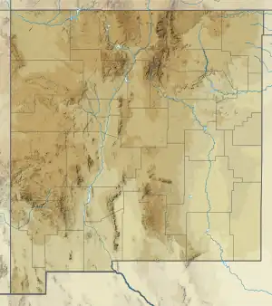
 Sanders Canyon Formation (the United States)  Sanders Canyon Formation (New Mexico) | |
Description
The formation consists of volcaniclastic mudstone (70%) and sandstone (30%), with less sandstone in the higher beds. The grayish-purpose color contrasts with the reddish color of the underlying Cub Mountain Formation and reflects a content of greater than 25% volcanic debris. The upper beds interfinger with the overlying Sierra Blanca Volcanics. Total thickness is about 150 meters (490 ft) at the type section,[2] but total thickness may be as much as 400 meters (1,300 ft).[3]
The formation is part of the only extensive exposures of Cretaceous and Paleogene rocks in a large area of south-central and southeastern New Mexico. It is interpreted as sediments deposited by north-northeast-flowing streams. It may correlate with the Palm Park Formation and Rubio Peak Formation, and the overlying Sierra Blanca Volcanics have a maximum age of 38 million years, suggesting the age of the Sanders Canyon Formation is between 43 million and 38 million years.[4]
History of investigation
The formation was first defined by Steven M. Cather in 1991, from beds formerly assigned to the Cub Mountain Formation. The formation was named for Sanders Canyon, just north of the type section.[2]
Footnotes
- Cather 1991, p. 269.
- Cather 1991, pp. 268–269.
- Koning et al. 2011.
- Cather 1991, p. 265.
References
- Cather, Steven M. (1991). "Stratigraphy and provenance of upper Cretaceous and Paleogene strata of the western Sierra Blanca Basin, New Mexico" (PDF). New Mexico Geological Society Field Conference Series. 42: 265–275. Retrieved 13 July 2021.
- Koning, Daniel; Kempter, Kirt; Zeigler, Kate E.; Cikowski, Colin (2011). "Geologic Map of the Cub Mountain Quadrangle, Lincoln County, New Mexico" (PDF). New Mexico Bureau of Geology and Mineral Resources Open File Digital Geologic Map. OF-GM 138. Retrieved 13 July 2021.