Sancey-le-Grand
Sancey-le-Grand (French pronunciation: [sɑ̃sɛ lə ɡʁɑ̃]) is a former commune in the Doubs department in the Bourgogne-Franche-Comté region in eastern France. On 1 January 2016, it was merged with Sancey-le-Long into the new commune Sancey.[2]
Sancey-le-Grand | |
|---|---|
Part of Sancey | |
 | |
 Coat of arms | |
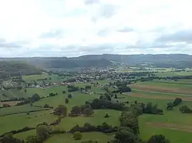
Location of Sancey-le-Grand | |
 Sancey-le-Grand  Sancey-le-Grand | |
| Coordinates: 47°17′41″N 6°34′59″E | |
| Country | France |
| Region | Bourgogne-Franche-Comté |
| Department | Doubs |
| Arrondissement | Montbéliard |
| Canton | Bavans |
| Commune | Sancey |
| Area 1 | 23.55 km2 (9.09 sq mi) |
| Population (2013)[1] | 930 |
| • Density | 39/km2 (100/sq mi) |
| Time zone | UTC+01:00 (CET) |
| • Summer (DST) | UTC+02:00 (CEST) |
| Postal code | 25430 |
| Elevation | 461–800 m (1,512–2,625 ft) |
| 1 French Land Register data, which excludes lakes, ponds, glaciers > 1 km2 (0.386 sq mi or 247 acres) and river estuaries. | |
Geography
The commune lies on the first plateau of the river Doubs 55 km (34 mi) northeast of Besançon and 45 km (28 mi) southeast of Montbéliard.
Population
|
| |||||||||||||||||||||||||||||||||||||||||||||||||||||||||||||||||||||||||||||||||||||||||||||||||||||||||||||||
| Source: Cassini-EHESS[3] | ||||||||||||||||||||||||||||||||||||||||||||||||||||||||||||||||||||||||||||||||||||||||||||||||||||||||||||||||
See also
References
- Populations légales 2013: Téléchargement du fichier d'ensemble, INSEE
- Arrêté préfectoral 23 September 2015 (in French)
- Des villages de Cassini aux communes d'aujourd'hui: Commune data sheet Sancey-le-Grand, EHESS (in French).
External links
Wikimedia Commons has media related to Sancey-le-Grand.
- Sancey-le-Grand on the regional Web site (in French)
This article is issued from Wikipedia. The text is licensed under Creative Commons - Attribution - Sharealike. Additional terms may apply for the media files.