Sambaa K'e (lake)
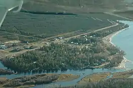
Sambaa K’e (SALM-bah-kay;[3] South Slavey, place of trout[4]) is a lake in the Dehcho Region of the Northwest Territories of Canada. The only settlement on its shores shares the same name; both were officially known as Trout Lake until 2016, when their names were changed to reflect local usage.[4]
| Sambaa Kʼe | |
|---|---|
| Trout Lake | |
 The settlement of Sambaa Kʼe, on the south shore of the eponymous lake | |
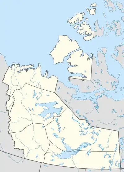
 Sambaa Kʼe Location in the Northwest Territories | |
| Location | Dehcho Region, Northwest Territories, Canada |
| Coordinates | 60.55°N 121.24°W |
| Primary inflows | Paradise River East, Island River, Moose River |
| Primary outflows | Trout River |
| Catchment area | 5,694 km2 (2,198 sq mi) |
| Basin countries | Canada |
| Max. length | 51 km (32 mi) |
| Max. width | 15 km (9.3 mi) |
| Surface area | 504 km2 (195 sq mi) |
| Surface elevation | 503 m (1,650 ft) |
| Settlements | Sambaa Kʼe |
| References | [1][2] |
Sambaa K’e lies at an elevation of 503 metres (1,650 ft)[2] and is 103 kilometres (64 mi) long and 12 kilometres (7.5 mi) wide,[1] covering an area of 513 square kilometres (198 sq mi).[2] It drains an area of 5,694 square kilometres (2,198 sq mi); major rivers that enter the lake include Paradise River East from the east, Island River from the south (next to the settlement), and Moose River from the north. Trout River, a tributary of the Mackenzie River, exits the lake from the northeast.[1]
Drinking water for the community of Sambaa K’e comes from the local water treatment facility, which draws water from the lake.[1] Known sources of lake water contamination include the local sewage lagoon, hazardous waste from a World War II-era U.S. Air Force outpost on the lake, and diesel leakage from the local power station.[5]
Fishing for lake trout, walleye, northern pike and Arctic grayling draws tourists to the lake.[6][7] The local people also rely on the lake environment to support the hunting, trapping and fishing activities that comprise a major part of their livelihood. Common traditional food sources include moose, woodland caribou, grouse, porcupine, beaver, trout, pickerel, duck, and various berries.[5] A proposal to create a 10,600-square-kilometre (4,100 sq mi) protected area including the Sambaa K’e watershed is currently under study.[3][8]
References
- "Community of Sambaa K'e Source Water Protection Plan" (PDF). March 2015. Retrieved April 29, 2017.
- Herdendorf, Charles E. (1982). "Large Lakes of the World". Journal of Great Lakes Research. 8 (3): 379–412. doi:10.1016/S0380-1330(82)71982-3.
- "Protected Area Initiatives in the NWT". CPAWS. Retrieved April 29, 2017.
- Geens, Jennifer (June 21, 2016). "Trout Lake, N.W.T., changes its name to Sambaa Kʼe". CBC. Retrieved April 29, 2017.
- Carter, Blair (2007). Water and Social Well-Being in the Northwest Territories (PDF) (M.E.S.). University of Waterloo. pp. 64–65. Retrieved April 29, 2017.
- "Sambaa Kʼe Fishing and Tourism Lodge". Northwest Territories Tourism. Retrieved April 29, 2017.
- Quenneville, Guy (June 16, 2010). "Fishing tourism going strong". Northern News Services. Retrieved April 29, 2017.
- "Advancing Conservation Interests in the Northwest Territories". Parks Canada. April 1, 2017. Retrieved April 29, 2017.