Rouez
Rouez (French pronunciation: [ʁwe]), also called Rouez-en-Champagne, is a commune in the Sarthe department in the region of Pays de la Loire in north-western France.
Rouez-en-Champagne | |
|---|---|
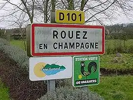 A road sign at the entrance to Rouez | |
.svg.png.webp) Coat of arms | |
Location of Rouez-en-Champagne | |
 Rouez-en-Champagne  Rouez-en-Champagne | |
| Coordinates: 48°08′25″N 0°06′46″W | |
| Country | France |
| Region | Pays de la Loire |
| Department | Sarthe |
| Arrondissement | Mamers |
| Canton | Sillé-le-Guillaume |
| Intercommunality | Champagne Conlinoise et Pays de Sillé |
| Government | |
| • Mayor (2020–2026) | Ludovic Robidas[1] |
| Area 1 | 33.65 km2 (12.99 sq mi) |
| Population | 796 |
| • Density | 24/km2 (61/sq mi) |
| Demonym | Rouéziens |
| Time zone | UTC+01:00 (CET) |
| • Summer (DST) | UTC+02:00 (CEST) |
| INSEE/Postal code | 72256 /72140 |
| Elevation | 92–171 m (302–561 ft) |
| 1 French Land Register data, which excludes lakes, ponds, glaciers > 1 km2 (0.386 sq mi or 247 acres) and river estuaries. | |
Geography
The village lies in the middle of the commune, on the left bank of the Merdereau, a left tributary of the Vègre, which flows southeastward through the commune.
See also
References
- "Répertoire national des élus: les maires". data.gouv.fr, Plateforme ouverte des données publiques françaises (in French). 2 December 2020.
- "Populations légales 2020". The National Institute of Statistics and Economic Studies. 29 December 2022.
Wikimedia Commons has media related to Rouez.
This article is issued from Wikipedia. The text is licensed under Creative Commons - Attribution - Sharealike. Additional terms may apply for the media files.