Rheinhöhenweg Trail
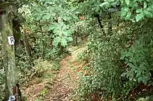
The Rheinhöhenweg Trail is a popular hiking trail on the mountains of the Rhine Valley. It leads from the Lower Rhine in Bonn passing the Loreley up to the Upper Rhine. There is a Rheinhöhenweg Trail on both sides of the Rhine River. On the left side it goes from Bonn to Alsheim, which is to the south of Mainz, with a total length of 240 km. On the right side it goes from Bonn-Beuel to Wiesbaden with a total length of 272 km. Both trails together have a combined length of over 500 km. The Rheinhöhenweg Trail is marked by a black R on a white background. The trails on the left and on the right side are frequently connected by hiking trails called "Rheinhöhen Connection Trails", marked by the sign "RV".
| Rheinhöhenweg | |
|---|---|
 The trail passes Schloss Stolzenfels | |
| Length | 240 km (150 mi) |
| Location | North Rhine-Westphalia, Rhineland-Palatinate, Hesse, Germany |
| Trailheads | Bonn→Alsheim (left side), Bonn-Beuel→Wiesbaden (right side) |
| Use | Hiking |
| Difficulty | Easy |
| Season | All year |
| Sights | Numerous castles at the river Rhine. |


The Rheinhöhenweg Trail passes a vast number of famous castles like the Godesburg, Lahneck Castle, Stolzenfels Castle, Castle Rheineck, Rheinstein Castle, Drachenburg Palace and many others.
External links
- Rheinhöhenweg trail
- (in German) Rheinhöhenweg
- (in German) Rheinhöhenweg on the left side