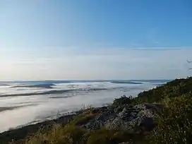
Mount Race
Mount Race, 2,365 feet (721 m), is a mountain in Berkshire County, Massachusetts. It shares many characteristics with the slightly higher Mount Everett about a mile to the north. Part of the Taconic Mountains, Race is known for its waterfalls, an eastern escarpment of nearly 2,000 feet, and expansive views. The Appalachian Trail crosses its summit, which has an open forest of dwarf pitch pine and scrub oak.
| Mount Race | |
|---|---|
 | |
| Highest point | |
| Elevation | 2,365 ft (721 m) |
| Prominence | 453 ft (138 m) |
| Coordinates | 42°04′57″N 73°25′56″W |
| Geography | |
| Location | Southwest Berkshire County, Massachusetts |
| Parent range | Taconic Mountains |
| Geology | |
| Age of rock | Ordovician |
| Mountain type | Thrust fault; metamorphic rock |
| Climbing | |
| Easiest route | Race Brook Falls Trail and Appalachian Trail |
Details
Both Race Brook Falls and Bear Rock Falls spill from the steep eastern slopes of Mount Race, the summit of which is part of a divide between the Hudson and Housatonic rivers. The peak bears the surname of William Race, a local resident killed in 1755 by agents of Livingston Manor in a colonial border dispute concerning ownership and farm tenancy.[1][2][3]
Western slopes are in the town of Mount Washington, and the east slopes are in Sheffield, Massachusetts. Much of the mountain is part of Mount Washington State Forest; other parcels are privately held.
References
- see mention of Mt. Race history in "Long-term Monitoring, Mt. Washington State Forest, 2009. (This state report appears to rely for its history note solely on "The Berkshire Hills" 1939 by the Federal Writers' Project. page 182:"In 1755, William Race, a Mount Washington pioneer, was shot to death by members of the Livingston party in a section of town near the present Mt. Race, probably named for the murdered man.")
- https://www.mass.gov/doc/long-term-ecological-monitoring-program-mount-washington-forest-reserve/download
- https://archive.org/details/berkshirehills00fede/page/182/mode/2up?q=Race
Sources
- Massachusetts Trail Guide (2004). Boston: Appalachian Mountain Club.
External links
- South Taconic Range trail map.
- Mount Washington State Forest. Massachusetts DCR.
- Mount Everett State Reservation. Massachusetts Department of Conservation and Recreation.
- Mount Washington State Forest map
- Berkshire Natural Resource Council
- Berkshire Chapter of the Appalachian Mountain Club
- Commonwealth Connections proposal PDF download. Retrieved March 2, 2008.
- Appalachian Trail Conservancy.