Río Grande, Jayuya, Puerto Rico
Río Grande is a barrio in the municipality of Jayuya, Puerto Rico. Its population in 2010 was 879.[3][4][5]
| Census | Pop. | Note | %± |
|---|---|---|---|
| 1950 | 1,488 | — | |
| 1960 | 1,022 | −31.3% | |
| 1980 | 749 | — | |
| 1990 | 607 | −19.0% | |
| 2000 | 910 | 49.9% | |
| 2010 | 879 | −3.4% | |
| U.S. Decennial Census 1900 (N/A)[6] 1910-1930[7] 1930-1950[8] 1980-2000[9] 2010[10] | |||
Río Grande | |
|---|---|
Barrio | |
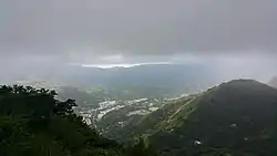 View from Cerro Cumbre Alta in Río Grande | |
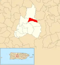 Location of Río Grande within the municipality of Jayuya shown in red | |
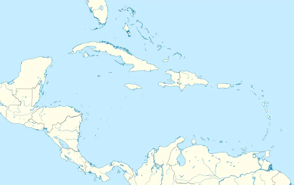 Río Grande Location of Puerto Rico | |
| Coordinates: 18°13′49″N 66°34′18″W[1] | |
| Commonwealth | |
| Municipality | |
| Area | |
| • Total | 1.89 sq mi (4.9 km2) |
| • Land | 1.89 sq mi (4.9 km2) |
| • Water | 0.00 sq mi (0.0 km2) |
| Elevation | 1,946 ft (593 m) |
| Population (2010) | |
| • Total | 879 |
| • Density | 465.1/sq mi (179.6/km2) |
| Source: 2010 Census | |
| Time zone | UTC−4 (AST) |
See also
References
- "US Gazetteer 2019". US Census. US Government.
- U.S. Geological Survey Geographic Names Information System: Río Grande Barrio
- Picó, Rafael; Buitrago de Santiago, Zayda; Berrios, Hector H. Nueva geografía de Puerto Rico: física, económica, y social, por Rafael Picó. Con la colaboración de Zayda Buitrago de Santiago y Héctor H. Berrios. San Juan Editorial Universitaria, Universidad de Puerto Rico,1969.
- Gwillim Law (20 May 2015). Administrative Subdivisions of Countries: A Comprehensive World Reference, 1900 through 1998. McFarland. p. 300. ISBN 978-1-4766-0447-3. Retrieved 25 December 2018.
- Puerto Rico: 2010 Population and Housing Unit Counts.pdf (PDF). U.S. Dept. of Commerce, Economics and Statistics Administration, U.S. Census Bureau. 2010.
- "Report of the Census of Porto Rico 1899". War Department Office Director Census of Porto Rico. Archived from the original on July 16, 2017. Retrieved September 21, 2017.
- "Table 3-Population of Municipalities: 1930 1920 and 1910" (PDF). United States Census Bureau. Archived (PDF) from the original on August 17, 2017. Retrieved September 21, 2017.
- "Table 4-Area and Population of Municipalities Urban and Rural: 1930 to 1950" (PDF). United States Census Bureau. Archived (PDF) from the original on August 30, 2015. Retrieved September 21, 2014.
- "Table 2 Population and Housing Units: 1960 to 2000" (PDF). United States Census Bureau. Archived (PDF) from the original on July 24, 2017. Retrieved September 21, 2017.
- Puerto Rico: 2010 Population and Housing Unit Counts.pdf (PDF). U.S. Dept. of Commerce Economics and Statistics Administration U.S. Census Bureau. 2010. Archived (PDF) from the original on 2017-02-20. Retrieved 2019-08-02.
This article is issued from Wikipedia. The text is licensed under Creative Commons - Attribution - Sharealike. Additional terms may apply for the media files.