Purmerul Peak
Purmerul Peak (Bulgarian: връх Пурмерул, romanized: vrah Purmerul, IPA: [ˈvrɤx pormɛˈruɫ]) is the ice-covered peak rising to 1915 m[1] in the west foothills of Bruce Plateau on Loubet Coast in Graham Land, Antarctica. It has steep and partly ice-free south and west slopes, and surmounts Hamblin Glacier to the southwest and Hugi Glacier to the north.
The peak is named after the Thracian god Purmerul.
Location
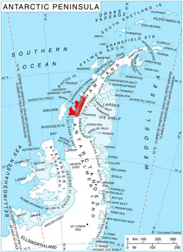
Purmerul Peak is located at 66°23′51″S 65°08′39″W, which is 14.58 km north by east of Semela Ridge, 11.1 km east of Mount Lyttleton, 20 km south-southeast of Crookes Peak and 16.11 km northwest of Slessor Peak. British mapping in 1976.
Maps
- British Antarctic Territory. Scale 1:200000 topographic map. DOS 610 Series, Sheet W 66 64. Directorate of Overseas Surveys, Tolworth, UK, 1976.
- Antarctic Digital Database (ADD). Scale 1:250000 topographic map of Antarctica. Scientific Committee on Antarctic Research (SCAR). Since 1993, regularly upgraded and updated.
Notes
- Reference Elevation Model of Antarctica. Polar Geospatial Center. University of Minnesota, 2019
References
- Bulgarian Antarctic Gazetteer. Antarctic Place-names Commission. (details in Bulgarian, basic data in English)
- Purmerul Peak. SCAR Composite Gazetteer of Antarctica
External links
- Purmerul Peak. Copernix satellite image
This article includes information from the Antarctic Place-names Commission of Bulgaria which is used with permission.