Pughoboto
Pughoboto (Pron:/ˌzʌnˈhiːbəʊtəʊ/) is a town and a town area committee in the Zünheboto District of the Indian state of Nagaland.
Pughoboto | |
|---|---|
Town | |
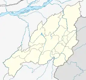
 Pughoboto in Zünheboto | |
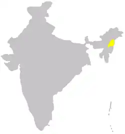
 Pughoboto Location of Pughoboto in North-East India | |
| Coordinates: 25.97°N 94.52°E | |
| Country | |
| State | Nagaland |
| District | Zünheboto |
| Founded by | Sümi Naga |
| Area | |
| • Total | 18 km2 (7 sq mi) |
| Elevation | 1,352 m (4,436 ft) |
| Population (2011)[1] | |
| • Total | 12,477 |
| • Density | 200/km2 (500/sq mi) |
| Languages | |
| • Official | English and Sümi |
| Time zone | UTC+5:30 (IST) |
| Vehicle registration | NL-06 |
| Website | http://Zunheboto.nic.in |
It is one of the oldest subdivisions in Nagaland, India. The Sümi Nagas originated from Pughoboto. Christianity in the Sümi region first arrived at Ighanumi village.
Demographics
As of the 2011 India census,[2] Pughoboto had a population of 12,477. Males made up 53% of the population and females 47%. Pughoboto had an average literacy rate of 85%, with male literacy at 81% and female literacy at 77%. In Pughoboto, 9% of the population was under 6 years of age.
Climate
The average climatic temperature in Pughoboto, India is 27.7°C (81.86°F).[3]
References
- "Census of India: Search Details".
- "Census of India 2001: Data from the 2001 Census, including cities, villages and towns (Provisional)". Census Commission of India. Archived from the original on 16 June 2004. Retrieved 1 November 2008.
- http://www.accuweather.com/Pughoboto%5B%5D
This article is issued from Wikipedia. The text is licensed under Creative Commons - Attribution - Sharealike. Additional terms may apply for the media files.