< Portal:U.S. roads









.JPG.webp)








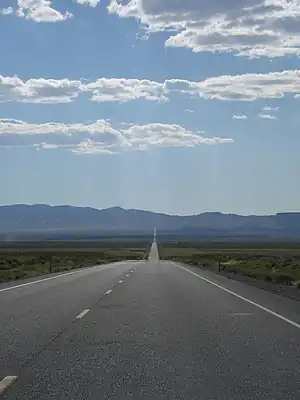
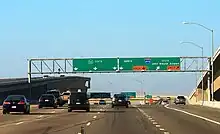


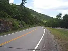





.JPG.webp)
_x_I-678_1.JPG.webp)
![A drawing entitled "the escape of Stonewall Jackson's Army down the valley pike at Strausburg [sic], Va." U.S. Library of Congress Collection](../../I/Valley_Pike%252C_1862.jpg.webp)



_from_east_end_after_opening%252C_April_2016.jpg.webp)


_at_Maryland_State_Route_170_(Aviation_Boulevard)_in_Stony_Run%252C_Anne_Arundel_County%252C_Maryland.jpg.webp)




_at_Francis_Street_in_Annapolis%252C_Anne_Arundel_County%252C_Maryland.jpg.webp)




Portal:U.S. roads/Did you know
This is an archive of previous "Did you know?" items on the U.S. Roads Portal. Items are listed by the first month that they were displayed. To nominate an interesting fact for next month, please visit Portal:U.S. Roads/Did you know/Recommend.
2006
February
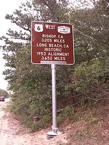
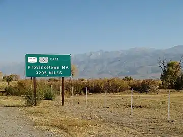
- ... that U.S. Route 6 once connected Provincetown, Massachusetts with Wilmington, California for a total length of 3652 miles (5,877 km) and was the longest highway in US history?
- ... that U.S. Route 50 in Nevada is nicknamed the "Loneliest Road in America" and is also the home of the "Loneliest Payphone in America"?
- ... that Scenic U.S. Route 412 is only one of two such "scenic" designations in the US (the other is on U.S. Route 40)?
- ... that the concurrency of Oklahoma State Highway 20/Arkansas State Highway 43 is possibly the only multi-state concurrency in the country?
- ... that Alt Bus US 66 was the only double-bannered US route in history?
March
- ... Hurricane Charley is sometimes referred to locally as the I-4 Hurricane because the storm's path closely followed Interstate 4 for its last 100 miles (160 km)?
- ... a McDonald's is built over Interstate 44 near Vinita, Oklahoma and is only one of several structures built over an interstate?
- ... Puerto Rico's highway system consists of four different classes?
- ... even though U.S. Route 60 is a "zero highway" and should have crossed the country, its original western terminus was in Springfield, Missouri?
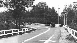
- ... the Dixie Highway (pictured) was actually a whole system of roads and not a single highway?
April

Interstate H-1 eastbound previous to the Waikiki exits
- ... there are interstate highways in Alaska, Hawaii (H-1 pictured), and Puerto Rico?
- ... U.S. Route 97 was once proposed in Alaska?
- ... Vermont State Highway 26 is only 69 feet (21 m) long?
- ... U.S. Route 99 was known as the Main Street of California?
- ... Interstate 180 in Wyoming has five traffic lights?
- ... there is an unmarked Interstate 444 in Tulsa, Oklahoma?
2007
February
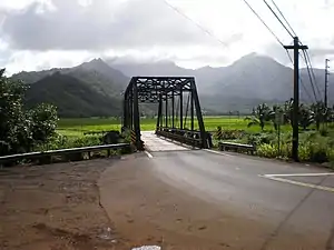
- ... that Hawaii Route 560 was added to the National Register of Historic Places in 2004 because of its historical character of one lane bridges?
August

I-15 southbound at milepost 17.8—afternoon sun in a bright red rock cut
- ... that New York State Route 104 was once U.S. Route 104?
- ... that the 30-mile (48 km) section of Interstate 15 in Arizona (pictured) was the most expensive section of rural freeway through the Virgin River Gorge?
- ... that New Mexico State Road 6563 takes its number from the wavelength (6563 Å) used by scientists to locate areas of interest on the Sun?
- ... that New York State Route 18 was once 230 miles (370 km) long?
- ... that although Pennsylvania Route 576 is north–south, it is signed as east–west?
September

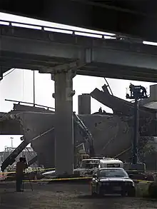
A portion of Interstate 580 following the collapse
- ... that a tanker fire once caused part of the MacArthur Maze (pictured) to collapse?
- ... that Interstate 78 is routed on two one-way streets in eastern New Jersey?
- ... that Interstate 676 has stoplights on it?
- ... that Interstate 95 is still incomplete?
- ... that Interstate 97 is the only primary Interstate Highway outside of Hawaii to not cross a county line?
October

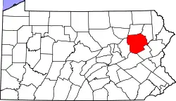
Luzerne County, Pennsylvania highlighted in red
- ... that Interstate 90 is longer than the entire British motorway network?
- ... that the segment of Pennsylvania Route 309 known as the Bethlehem Pike between Quakertown and Philadelphia is over 300 years old?
- ... that Luzerne County (pictured) is the only county in Pennsylvania with county routes?
- ... that Wisconsin was the first state to sign route numbers on its state highways in 1918?
- ... that some Vermont routes are town-maintained and use a different style sign than state-maintained routes?
November

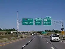
Interstate 190 northbound at exit 18A (New York State Route 324) on Grand Island
- ... that New York State Route 20SY was the only state highway to have an "SY" suffix in its name?
- ... that New Jersey Route 47 is the longest state route in New Jersey at 75 miles (121 km)?
- ... that North Carolina has surpassed Texas and now has the largest state highway network in the U.S. at 79,779 miles (128,392 km)?
- ... that Interstate 190 (pictured) is the only auxiliary Interstate Highway to reach the Canadian border?
- ... that part of Connecticut Route 108 was established as the Farm Highway in 1696?
2008
February

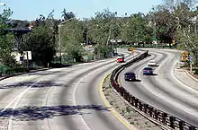
Arroyo Seco Parkway looking south from Marmion Way
- ... that the passing lanes of the Arroyo Seco Parkway (pictured), California's first freeway, were paved in a different color to encourage drivers to stay in their lanes?
- ... that Henry Ford helped stop construction of a state highway in the Upper Peninsula of Michigan in order to gain admission to the exclusive Huron Mountain Club?
- ... that New Mexico State Road 4 forms the core of Jemez Mountain Trail National Scenic Byway, with trails to Puebloan ruins, a 10,199-foot (3,109 m) mountain, and a 70-foot (21 m) waterfall from roadside turnouts?
- ... that Nevada State Route 88 is one of three state routes that cross the Nevada-California state line with the same number?
- ... that Interstate 70 in Utah was built along an entirely new route, and is the longest road built in the US over a new route since the Alaska Highway?
April 1 (April Fool's Day)

I-75 shield
- ... that Interstate 75 (pictured), is a freeway running from Michigan to Florida?
- ... that Interstate 80 is another freeway that runs from California to New Jersey?
- ... that New York State Route 292 is not the shortest state route in New York?
- ... that New York State Route 174 isn't either?
- ... that it is unknown how many state roads there are in the United States?
- ... and known even less how many county roads?
- ... that no matter how much you wish they did, United States Federal Routes don't exist?
April

Seney Stretch along M-28
- ... that the Mount Rose Summit along Nevada State Route 431 is the highest pass open year-round in the Sierra Nevada mountain range?
- ... that the Seney Stretch (pictured) is 25 miles (40 km) of "straight as an arrow highway" commonly called the most boring highway in Michigan?
- ... that WIS 35 is the longest highway in Wisconsin?
- ... that U.S. Route 12 was extended into Washington in 1967, taking over most of the routing of U.S. Route 410?
- ... that New England Route 12 is a state-numbered route that keeps its number across four states?
- ... that the Chickasaw Turnpike is the only two-lane turnpike in Oklahoma?
May

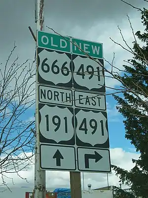
Old and new route numbers at the intersection with US 191 in Monticello
- ... that U.S. Route 491 (pictured) was created in part due to large amounts of sign thefts from its former route number?
- ... that the highway centerline was invented in Wayne County, Michigan in 1911?
- ... that Massachusetts was the first state to establish a state highway system in 1893?
- ... that Washington State Route 339 is the only state highway in Washington state to consist only of a Washington State Ferries route?
- ... that Nevada State Route 722 is an old routing of both U.S. Route 50 in Nevada and the Lincoln Highway that was abandoned in 1967 due to steep grades and sharp curves?
- ... that there is still a gap in Interstate 95 in the state of New Jersey?
June

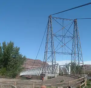
Hite Crossing Bridge, Glen Canyon National Recreation Area
- ... that Utah State Route 95 (pictured) is called the Bicentennial Highway because the highway was rebuilt and dedicated as part of the U.S. Bicentennial celebrations?
- ... that Pennsylvania Route 402 used part of what is now U.S. Route 209 in Minisink Hills?
- ... the Forty Mile Desert, traversed by Interstate 80 in Nevada was the deadliest and most dreaded portion of the California Trail?
- ... that County Route 18 in Otsego County, New York has three suffixed route that all cross county lines along with itself?
- ... that M-117 was dedicated in 1993 to the deactivated 117th Quartermaster Battalion formerly based out of Kingsford, Michigan?
- ... the Million Dollar Highway (U.S. Route 550) is the only north–south U.S. Highway in the U.S. state of Colorado west of the continental divide?
August

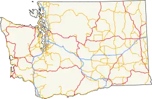
Map of U.S. Routes in Washington
- ... U.S. Routes within Washington state (map pictured) currently make up about 1,800 miles (2,897 km) of the Washington highway system?
- ... Utah State Route 279 was one of four finalists in a contest to determine the most beautiful highway to open to traffic in 1963?
- ... County Route 676 in Middlesex County, New Jersey was signed in April 2008 during a blade sign rehabilitation by NJDOT?
- ... Rhode Island Route 114 has wrong-way concurrency with itself?
- ... U.S. Route 189 has a discontinuity in signage that originates where the Federal Highway Administration instructed UDOT not to sign a constructed re-route of the highway?
- ... California State Route 70 was once signed as U.S. Route 40 Alternate as this road was more likely to be open during winter storms than the main route over Donner Pass?
September

I-15 at the Cedar Pocket
- ... Utah loaned Arizona money to expedite construction of Interstate 15 in Arizona (pictured)?
- ... that Utah State Route 30 is the only highway signed as a Utah state route that runs from state line to state line?
- ... that the longest suspension bridge in Utah is along Utah State Route 128?
- ... the low overpasses on Storrow Drive in Boston once caused a truck full of scissors to spill its cargo, resulting in over thirty cars getting flat tires?
- ... that when Idaho State Highway 41 goes through Oldtown, Idaho, the northbound lanes are in Idaho, but the southbound lanes are in Newport, Washington and is the unsigned Washington State Route 41?
October

Map of Eisenhower Tunnel in Colorado
- ... that Washington State Route 124 follows the route of the Lewis and Clark National Historic Trail from Piper Canyon Road to its eastern terminus in Waitsburg?
- ... that U.S. Route 395 in California has views of both Mount Whitney, the highest point in the contiguous United States, and Death Valley, the lowest point in the North American continent?
- ... that the Eisenhower Tunnel (map pictured) is the highest point on the Interstate Highway System, highest automotive tunnel in the world, and the longest tunnel built for the Interstate Highway System?
- ... that Interstate 15 in Utah connects every metropolitan statistical area in the state, except one, Logan?
- ... that Interstate 580, currently under construction, when finished will connect with Carson City, one of 5 state capitals with no connection to the Interstate Highway system?
- ... that Interstate 19 is signed in metric?
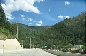
November

Interstate 90 in Wallace, Idaho
- ... that even though Washington State Route 527 was added as part of the Pacific Highway in the 1920's and part of the older highway system from 1937 until 1943, and later between 1957 and 1970, the actual road opened on October 17, 1969, one year before it officially became State Route 527?
- ... that proponents of the I-90 bypass of Wallace, Idaho (pictured) and I-70 through Glenwood Canyon have both errantly claimed these pieces as the last stretches of the Interstate Highway System to open to traffic, even though gaps in the system still exist along I-70 in Breezewood, Pennsylvania and I-95 in Somerset, New Jersey?
- ... there have been three completely different routings of US 50 through Utah, each differing from the others by hundreds of miles?
- ... that Interstate 405 in southern California is the most congested piece of the Interstate highway system?
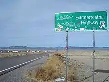
- ... Nevada State Route 375 is known as the "Extraterrestrial Highway" due to its proximity to Area 51 and high number of UFO sightings?
December

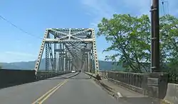
Julia Butler Hansen Bridge to Puget Island, Washington
- ... that U.S. Route 40 in Colorado crosses the continental divide 3 times?
- ... that Wyoming Highway 89 is so numbered from a failed proposal for U.S. Route 89 to stay in that state rather than enter Idaho?
- ... that U.S. Route 6 was a discontinuous route from spring 1983 to spring 1984 because of the most costly landslide in the United States that destroyed the town of Thistle, Utah?
- ... that Washington State Route 409's route is connected by a ferry and a bridge (pictured) and that the bridge was formerly a ferry route too?
- ... that Washington State Route 100 ends at itself and is signed as a "loop"?
2009
January
- ... the 1971 road movie Duel was filmed near Acton, California along the Sierra Highway, an old alignment of U.S. Route 6 and later California State Route 14?
- ... that Interstate 990 is the highest numbered Interstate in actual use?
- ... that Wyoming Highway 789 was part of a proposed border-to-border U.S. Highway 789 that would have run from Sweetgrass, Montana to Nogales, Arizona?
- ... that U.S. Route 62 runs "backwards", bearing west for several miles before ending at its northern terminus at New York State Route 104 near the Rainbow Bridge?
- ... the modern U.S. Route 91 is only about one-tenth of the historical length of the highway?
February

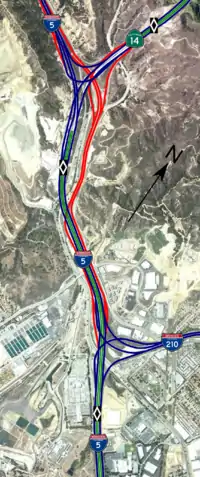
Aerial map and diagram of the Newhall Pass Interchange
- ... that Washington State Route 531's bridge over Cougar Creek had a collapsed culvert that was discovered and fixed during October 2008?
- ... the routing of U.S. Route 191 has changed so many times that Yellowstone National Park is the only place that has been continuously served by the highway?
- ... that the Robert Moses State Parkway was originally one continuous road; however, due to low usage, a portion of the parkway near Niagara Falls was removed, separating the parkway into two sections?
- ... that the Newhall Pass interchange (pictured) has collapsed from earthquakes twice and burned from trucks colliding in a tunnel once?
March
- ... that New York State Route 17 is currently the longest New York State Highway? It stretches 397 miles (639 km). When it becomes fully transformed into Interstate 86, the title of longest New York State Route will be passed down to New York State Route 5 which is 370.87 miles (596.86 km) long.
- ... that New York State Route 437 is the shortest signed state highway in New York, located entirely within the vicinity of Melrose Park in Cayuga County? It connects NY 38 and NY 38A.
- ... that Florida State Road 9336 is the only signed four digit state route in Florida?
- ... that California State Route 49 is so numbered to honor the California gold rush of 1849, that occurred along the areas served by the highway?
April 1 (April Fool's Day)

I-75 shield
- ... that Interstate 75 (pictured), is a road?
- ... that Interstate 90 is another freeway that runs from Washington to Massachusetts?
- ... that California State Route 78 is not the longest state route in California?
- ... that U.S. Route 1243435454656 does not exist?
- ... that it is unknown how many freeway exits there are in the United States?
- ... that some really weird freaks of nature do nothing but study roads all day?
April
- ... the highest road in the California state route system is California State Route 120 over Tioga Pass [elevation 9,943 feet (3,031 m)]?
- ... Interstate 99 is so numbered because it was written into law by Congressman Bud Shuster, not per the usual numbering scheme for Interstate highways?
- ... Interstate 238 exists even though there is no I-38, as all x80 numbers were in use in the state of California at the time?
- ... the highest road in the Utah state route system is Utah State Route 150 over Bald Mountain Pass [elevation 10,715 feet (3,266 m)]?
May
- ... the highest road in the Nevada state route system is Nevada State Route 431 over Mount Rose Summit [elevation 8,911 feet (2,716 m)]?
- ... the highest road in the Colorado state highway system and U.S. Highway system is U.S. Route 34 over Trail Ridge Road inside Rocky Mountain National Park [elevation 12,183 feet (3,713 m)]?
- ... that Interstate 90 has a complete set (190 through 990) of spur routes in New York and is the only Interstate Highway that has a complete set within any state?
- ... that the portion of U.S. Route 209 in New York had five different designations over a span of 10 years in the 1920s and 1930s?
- ... that New York State Route 990V, the highest-numbered signed state highway in New York, is actually a reference route?
June
- ... that a one-mile (1.6 km) portion of New York State Route 17 is actually in Pennsylvania?
- ... that U.S. Route 40 Scenic and U.S. Route 412 Scenic are the only two scenic special routes that remain in the U.S. Highway System?
- ... that most of New York State Route 37B's original alignment was destroyed as part of the St. Lawrence Seaway's construction?
- ... that U.S. Route 666 is the only route that has served all of the Four Corners states at the same time?
- ... that there are no Interstate Highways that connect northern Nevada to southern Nevada?
July

The Dewey Bridge, constructed in 1916
- ... that the southbound lane of Idaho State Highway 41 through Oldtown is actually in Newport, Washington with an unsigned designation of Washington State Route 41?
- ... that Utah State Route 276 includes the only auto ferry in a landlocked western state?
- ... the completion of Interstate 17 shortened the distance of the truck route between Phoenix and Flagstaff, Arizona, by approximately 80 miles (130 km) (versus the former route of U.S. Route 89 between those two cities)?
- ... that although the Utah portion of the Colorado River is over 400 miles (640 km) long, there are only three bridges in the state that cross it: the Dewey Bridge (pictured in 2006), an unnamed bridge carrying US 191 and the Hite Crossing Bridge?
- ... that ownership and maintenance of New York State Route 338 was transferred from the state of New York to Washington County just 16 years after the state originally acquired the highway?
August

SR 508 eastbound as Main Avenue in Morton near the SR 7 intersection
- ... that the portion of Washington State Route 508 (pictured in Morton) in Bear Canyon was reconstructed in 2007 and 2009 due to two different washouts?
- ... that Interstate 190 in New York was originally designated as "Interstate 90N"?
- ... that the Peshekee River Bridge that later carried US 41 was the first bridge designed and built by the Michigan State Highway Department in 1914?
- ... that Arizona State Route 101, Arizona State Route 202 and Arizona State Route 303 are Metropolitan Phoenix freeways that are or will be built to Interstate Highway standards but financed with local taxes?
- ... that Washington State Route 231 is 8.97 miles (14.44 km) longer than its parent route?
September

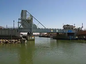
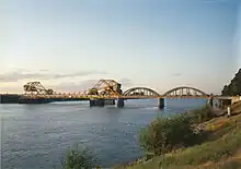
Drawbridge at Tilghman Island, Maryland
- ... that while traversing mountainous terrain, Arizona State Route 87 has portions where traffic in one direction crosses over the traffic lanes for the other direction?
- ... that Washington State Route 213 was proposed for 35 years before a small, 0.35-mile (0.56 km) long segment was added to the state highways system in 2008?
- ... that the Maryland Route 33 drawbridge onto Tilghman Island (pictured) is among the busiest in the United States and the world in terms of drawbridge openings?
- ... that Utah State Route 127 extended along a causeway to an island in the Great Salt Lake, before flooding submerged the causeway?
October

Southbound New Jersey Route 55 approaching the exit for Deptford Center Road, exit 58
- ... that much of the current alignment of Maryland Route 413 follows a former Pennsylvania Railroad line into Crisfield?
- ... that bad fate fell upon many construction workers during the construction of New Jersey Route 55 (pictured), fueling a belief that the highway was cursed as a result of building over Indian burial grounds in Deptford Township?
- ... that one of the landmarks along Interstate 84 in Utah is the 1000 mile tree, planted by Union Pacific Railroad workers to celebrate the first transcontinental railroad reaching 1,000 miles (1,600 km) from its origin in Omaha, Nebraska?
- ... that New Jersey Route 47 received the name "Delsea Drive" by the New Jersey Legislature in 1933 after a reporter for the Woodbury Times joked how the road connected the Delaware River with the Atlantic Ocean (the sea)?
November

Looking westbound along the Vestal Parkway (NY 434) in Vestal
- ... that the New Jersey Route 70 bridge over the Manasquan River is known as the September 11th Memorial Bridge in honor of residents of Monmouth and Ocean counties who lost their lives in the September 11 attacks?
- ... that the Baltimore–Washington Parkway was once planned to be a part of Interstate 295, but never did because not enough funds were available to upgrade the road to Interstate Highway standards?
- ... that the first cloverleaf interchange in the United States was built in 1929 at what is now New Jersey Route 35 and U.S. Route 1/9 in Woodbridge?
- ... that the Mousetrap is a freeway interchange that was completely re-designed after a truck hauling torpedoes overturned, paralyzing the transportation network in Denver for a day?
- ... that New York State Route 434 (pictured) was designated as NY 188 for less than a year?
December

Maryland Route 231 (Prince Frederick Road) at the intersection with Maryland Route 5 Business in the heart of downtown Hughesville
- ... that New Jersey Route 37 is named "Little League World Champions Boulevard" in honor of Toms River East Little League's victory in the 1998 Little League World Series?
- ... that the business route of Maryland Route 5 in Hughesville (pictured) uses green shields with the word "business" in place of "Maryland"?
- ... that the Interstate 695 beltway around Baltimore was initially planned as a county project in 1949 before being taken over by the state by 1953?
- ... that New Jersey Route 88 was referred to in the Bruce Springsteen song "Spirit in the Night"?
- ... that Washington State Route 231 is almost 9 miles (14 km) longer than its "parent" route, Washington State Route 23?
2010
January
- ...that New Jersey Route 31 and Utah State Route 38 were both renumbered from "Route 69" due to sign theft that resulted from the sexual meaning of the number 69?
- ... that New Jersey Route 88 was referred to in the Bruce Springsteen song "Spirit in the Night"?
- ... that Washington State Route 231 is almost 9 miles (14 km) longer than its "parent" route, Washington State Route 23?
- ... the creator of the sculpture Metaphor: The Tree of Utah (pictured) was inspired by the long, straight, desolate stretch of Interstate 80 across the Bonneville Salt Flats?
- ...that what is now U.S. Route 30 in New Jersey was originally chartered as the White Horse Pike in 1854, a turnpike that was to run from Camden to Stratford and eventually to Atlantic City?
February

Interstate 78 across the Watchung Reservation in New Jersey
- ...that North Carolina Highway 3 switched designations with North Carolina Highway 136 in 2002 to honor the late Dale Earnhardt, a NASCAR driver who drove the #3 car?
- ...that the State Circle in Annapolis, Maryland is designated Maryland Route 797 and has a circumference of 0.27 miles (0.43 km)?
- ...that there is a land bridge for animals over Interstate 78 in New Jersey (pictured) near the Watchung Reservation?
- .... that Arizona State Route 51, formerly known as the Squaw Peak Freeway—a derogatory term for Native American women—was renamed the Piestewa freeway after Lori Piestewa, the first Native American woman to die in combat while serving the U.S. Military?
- ...that New Jersey Route 31 and Utah State Route 38 were both renumbered from "Route 69" due to sign theft that resulted from the sexual meaning of the number 69?
March

Hand-painted centerline on state highway M-15 in Marquette County, Michigan in 1917
- ...that, according to the Michigan Department of Transportation, the first highway centerline in the US (pictured) was painted on the first designation of M-15 in 1917?
- ...that a controversy occurred when the Daniel Boone Parkway in Kentucky was renamed to the Hal Rogers Parkway, after a congressman who had secured funding to get tolls removed from the road?
- ...that the Brooklyn–Queens Expressway portion of Interstate 278 was the subject of a Sufjan Stevens album entitled The BQE recorded in 2007?
- ...that Nevada State Route 447 is the access to the site of the Burning Man festival?
- ...that North Carolina Highway 3 switched designations with North Carolina Highway 136 in 2002 to honor the late Dale Earnhardt, a NASCAR driver who drove the #3 car?
April 1 (April Fool's Day)

The route, the route, the route is on fire
- ... that Pennsylvania Route 61 (pictured) is a really smokin' highway?
- ... that traffic on Missouri Route 13 drives on the wrong side of the road?
- ... that cars aren't allowed on state highway M-185?
- ... that Minnesota State Highway 23 is a highway in Wisconsin?
- ... that playing with matches is not good for bridges?
April

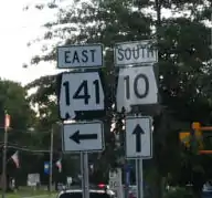
Alabama route 10 and 141 signs as posted in Easthampton, Massachusetts
- ... that in July 2005, signage at the intersection of Massachusetts Route 10 and Massachusetts Route 141 (pictured) identified the routes with Alabama route markers?
- ... that California State Route 4 has portions that are multi-lane freeway, and portions that are a single lane?
- ... that with a 1981 expansion, U.S. Route 191 became 10 times longer than its parent, U.S. Route 91?
- ... that the US National Park Service is helping to fund improvements to county road H-58, which serves as the main access road to the Pictured Rocks National Lakeshore in the Upper Peninsula of Michigan?
- ... that the numerical designation of Nevada State Route 140 was influenced by backers of the "Winnemucca to the Sea Highway", a proposed route that would connect northwestern Nevada, southern Oregon and the California coast under one highway number?
- ... that none of State Highway 32 as it was originally designated through southwestern Oklahoma in 1934 is a part of the current route?
May

Seney Stretch along M-28
- ... that the Seney Stretch (pictured) along M-28 in Michigan's Upper Peninsula is 25 miles (40 km), but "others claim it's 50 miles [80 km], only because it seems longer"?
- ... that the MDSHA announced plans to sell the Maryland Route 545 bridge over Little Elk Creek, built in 1932, to an interested buyer as the bridge is too narrow to carry current traffic?
- ...that speed limits on Guam Highway 1 may differ depending on which side of the road you are on?
- ... that the Bradley Airport Connector, a freeway in the U.S. state of Connecticut, was renamed the "82nd Airborne Memorial Highway" in 1999 to honor the 82nd Airborne Division?
- ... that the post office in Coxs Creek, Kentucky, had to be moved because it created many accidents along U.S. 31E?
June

Approaching Donner Pass from the east on Lincoln Highway / old US 40, April 2007
- ...that although Donner Pass (pictured) has historically carried the First Transcontinental Railroad, Lincoln Highway, Victory Highway and California Trail across the Sierra Nevadas, the planners of the Interstate Highway system instead decided to route Interstate 80 across a higher summit 2 miles (3.2 km) to the north?
- ...that while traversing mountainous terrain, Interstate 5 in California has a portion where traffic in one direction crosses over the traffic lanes for the other direction?
- ...that the Harbor Tunnel Thruway, otherwise known as Interstate 895 in Maryland, has had three different sets of exit numbers?
- ...that construction of Interstate 140 outside Wilmington, North Carolina was delayed in part to redesign an off-ramp to avoid a 450-year-old oak?
- ...that prior to Interstate 410 and the Interstate Highway System, Texas State Highway Loop 13 was the primary loop around San Antonio?
July
.JPG.webp)
Portage Lake Lift Bridge, at night, connecting the cities of Hancock and Houghton, Michigan
- ...that M-26 between Houghton and Hancock, Michigan uses the Portage Lake Lift Bridge (pictured), the heaviest and widest double-decked lift bridge in the world?
- ... that the Keller Ferry, which operates as part of Washington State Route 21 was taken over by the Washington Department of Highways on September 1, 1930, although a cable ferry was operated during the early 1890s?
- ... that U.S. Route 20 in Massachusetts used to be part of the Boston Post Road, one of the earliest roads established in the United States?
- ... that the two roads that use former New Jersey Route 65, Port Street and Doremus Avenue, dead-end just after their respective intersection?
- ...that California State Route 174, which includes a historic 1924 bridge, was not designated a State Scenic Highway due to opposition by residents concerned about their property rights?
August

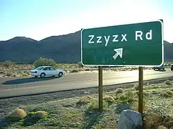
Road sign for Zzyzx Road in California
- ...that Zzyzx Road (sign pictured) in California is the inspiration for two different films?
- ...that Northwest Airlines Flight 255 crash landed on Interstate 94 outside of Detroit Metropolitan Airport in 1987?
- ...that in the 1950s, four service plazas on the Garden State Parkway had uniformed female employees known as the "Park-ettes" whose duties included providing directions and other information to motorists as well as rendering odd bits of service such as sewing a missing button on a patron's coat?
- ...that a "token war" between the Connecticut Turnpike and the New York City Subway developed in the 1980s when subway riders discovered that the turnpike's cheaper tokens fit in fare boxes?
September

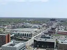
Looking east from the top of the Boji Tower showing the corner of Michigan and Grand avenues, part of the Capitol Loop
- ... that the Capitol Loop (pictured), a state highway in Lansing, Michigan serving the State Capitol, was designated in a plan to revitalize downtown?
- ... that the Carlin Tunnel, along Interstate 80 in Nevada, has its origins in an effort by the Southern Pacific Railroad to straighten the alignment of the First Transcontinental Railroad in 1903?
- ...that the odds of someone dying on the portion of Interstate 40 in Haywood County, North Carolina are 20 times greater than winning the Powerball lottery?
- ...that a part of New York State Route 329 in Watkins Glen served as a segment of the Watkins Glen Grand Prix Course from 1948 to 1952?
- ...that prior to the construction of the Puncheon Run Connector in Dover, Delaware, a site along Puncheon Run had to be excavated as it consisted of prehistoric Native American artifacts?
October

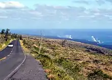
Lava from Puʻu ʻŌʻō flows through subsurface lava tubes until it meets the ocean, creating the steam plumes seen in the distance from Chain of Craters Road
- ... that Hawaii's Chain of Craters Road (pictured) has been blocked repeatedly by lava flows from Kīlauea volcano (pictured) since it was built in 1928?
- ... that the part of Arkansas Highway 29 that goes through Hope, Arkansas, is referred to as "Bill Clinton Drive"?
- ... that the interchange between Maryland Route 90 and U.S. Route 113 sat unused for 24 years until US 113 was relocated as a four-lane divided highway in 2000?
- ... that two bridges are currently under construction in Nevada that when finished will claim the title of longest in the United States: the Mike O'Callaghan – Pat Tillman Memorial Bridge will be the longest and first major composite steel/concrete arch in the U.S. and the Galena Creek Bridge will have the longest concrete arch?
- ...that Interstate 129 and U.S. Route 77 both end at Interstate 29 less than 1 mile (1.6 km) after crossing the Missouri River into Sioux City, Iowa?
November

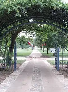
- ...that a part of Texas State Highway 165 (pictured) runs within the Texas State Cemetery in Austin?
- ... that during the "Southbelt Shuffle" event on M-6 south of Grand Rapids, Michigan, horses were ridden on the partially completed freeway?
- ... that the Benton City – Kiona Bridge is believed to be the first steel box girder bridge in the United States, and still carries Washington State Route 225 today?
- ... that part of the northern Oklahoma State Highway 92 is named after country singer Garth Brooks?
- ...that U.S. Route 50 in California was the route traveled by many '49ers and the Pony Express, and later became California's first state highway and a branch of the Lincoln Highway?
December

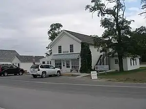
- ...that M-209, serving as a connection to the former Coast Guard station in Glen Haven, Michigan (general store pictured), was the shortest state highway in the state at a half-mile until 1996?
- ...that Arkansas Highway 980 is the state highway designation for all state maintained airport roads in Arkansas?
- ...that Nebraska Highway 14 became a cross-Nebraska highway with the completion of the Chief Standing Bear Memorial Bridge over the Missouri River in 1998?
- ...that most of New Jersey Route 29 was designated as a National Scenic Byway called the Delaware River Scenic Byway in 2009?
- ... that Louisiana Highway 975 is a gravel state highway along the banks of the Atchafalaya River?"
2011
January

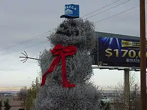
Tumbleweed Snowman
- ... that the Albuquerque Metropolitan Arroyo Flood Control Authority has installed a tumbleweed snowman (pictured) at the Big I interchange every year since 1995?
- ... that Interstate 335 was designated in 1987 to allow a portion of the Kansas Turnpike to raise the speed limit to 65 mph (105 km/h) in compliance with a change in the National Maximum Speed Law?
- ... that the interchange between Interstate 476 and U.S. Route 30 in Radnor Township, Pennsylvania contains a large crushed-stone image of a griffin to commemorate Radnor's history as part of the Welsh Tract?
- ... that most of U.S. Route 2 in Vermont was originally part of the Theodore Roosevelt International Highway, an early transcontinental North American auto trail?
- ... that construction of Interstate 140 outside Wilmington, North Carolina was delayed in part to redesign an off-ramp to avoid a 450-year-old oak?
February

Disambiguation sign posted in advance of the MD 68 interchange on westbound I-70 near Clear Spring
- ...that signs (pictured) were placed on westbound Interstate 70 to reduce motorist confusion between Maryland Route 68 and Interstate 68, which meet I-70 17 miles (27 km) apart in Washington County, Maryland?
- ... that there are about 2,980 miles (4,800 km) of U.S. Routes in the U.S. state of New Mexico, including U.S. Route 491, which was formerly U.S. Route 666?
- ...that the previous marker for the Massachusetts Turnpike, which had a pilgrim hat with a Native American feather sticking through it, was revised in 1989 to remove the feather as motorists sometimes mistakenly turned in the direction the arrow pointed (right) when attempting to enter the turnpike?
- ...that residents of Seattle have disparagingly referred to the Tacoma Spur as "the road to nowhere" and likened its exit ramps to tentacles?
- ...that the section of Interstate 30 in Texas between Fort Worth and Dallas, called the "Tom Landry Freeway", was renamed the Tom Landry Super Bowl Highway between June 15, 2010 and February 6, 2011 to commemorate Super Bowl XLV being held at nearby Cowboys Stadium?
March

Westbound on the Benedict Bridge over the Patuxent River looking toward Benedict
- ... that the Benedict Bridge (pictured), which carries Maryland Route 231 between Charles and Calvert counties in Southern Maryland, was the southernmost crossing of the Patuxent River for 25 years?
- ... that Washington State Route 230 is one of two legislated but unconstructed highways in the state?
- ... that Delaware Route 71 currently follows its original alignment, even though the route has been realigned during its history?
- ... that M-57 passes Rosie's Diner near Rockford, Michigan, a restaurant that served as the filming location in Little Ferry, New Jersey for a series of Bounty paper towel commercials starring Rosie the Waitress?
- ... that a portion of Pennsylvania Route 563 had to be rerouted due to the creation of Lake Nockamixon?
April 1 (April Fool's Day)

So many lights but no clocks
- ... that Nevada State Route 604 (pictured) is one of the most famous highways in the world?
- ... that because of some torpedos, cars were once stranded in a mousetrap?
- ... that trying to drive the length of Maryland Route 797 sends drivers in circles?
- ... that Interstate 4 crosses some of the coldest, most snow covered terrain in North America?
- ... that people who have driven Utah State Route 299 end to end several times are really crappy drivers?
- ... that 99 percent of people who claim to have been to Beatosu, Ohio are lying?
April

Plants washed onto the road at the Post Office, Pago Pago, American Samoa
- ... that the territory of American Samoa has three numbered highways, AS001 (pictured), AS005 and AS006?
- ... that sections of state highway M-37 in Michigan have been named for a Civil War general, a governor, and the road's "divine scenic and recreational delights"?
- ... that what is now Pennsylvania Route 132 (Street Road) was included in the original survey plans of William Penn for the Province of Pennsylvania?
- ...that the Camino Colombia Toll Road was foreclosed on in late 2003 and auctioned off on January 6, 2004?
- ... that Maryland Route 648I is the designation for the driveway to a Knights of Columbus hall and is named McGivney Way in honor of Michael J. McGivney, the founder of the organization?
May

Interstate 99 northbound in Blair Township
- ...that Bud Shuster named Interstate 99 (pictured) after a street car, No. 99, that took people from Shuster's hometown of Glassport to McKeesport?
- ...that U.S. Route 6 and U.S. Route 50 enter and leave the state of Utah on a concurrent alignment, but in the center of the state are almost 100 miles apart?
- ...that Eden Brent has a blues song named "Mississippi Number 1" in honor of Mississippi Highway 1?
- ...that the Illiana Expressway is a proposed Interstate-standard tollway connecting northeastern Illinois and northwestern Indiana?
- ... that the former exit 43 (now exit 284) on Interstate 80 in Pennsylvania that serves Pocono Raceway was named the Richard Petty Interchange in honor of the NASCAR legend that drove the #43 car?
June

The SS Drummond Islander IV crossing the De Tour Passage
- ... that M-134 is one of three state highways in Michigan on an island, and one of two to use a ferry (pictured)?
- ...that an abandoned stretch of the partially-built Pennsylvania Route 23 freeway in Lancaster County was given to local farmers to use and is now known as the "Goat Path Expressway"?
- ...that Summerlin Parkway, a freeway in Las Vegas, was initially constructed by the Summerlin homeowners' association?
- ... that the route of New York State Route 298 includes Carrier Circle, which is one of two traffic circles that directly connect to an interchange of the New York State Thruway?
- ...that the bridge that carried Maryland Route 32 across the Patapsco River in Sykesville between 1963 and 2004 was the longest of only three aluminum triangular box beam girder bridges constructed in the United States?
July

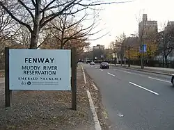
Westernmost end of the Fenway near Brookline Avenue
- ... that the Boston Park Board was given permission to review building designs for new structures along the Fenway (pictured) to prevent unattractive buildings from depreciating property values?
- ... the Tie Fork Rest Area along U.S. Route 6 in Utah was voted one of the most beautiful buildings in the state of Utah by the American Institute of Architects?
- ... that the westbound lanes of Interstate 470 in Missouri were closed for a month due to a landslide which caused the roadway to collapse?
- ...that the Memorial Tunnel along the West Virginia Turnpike was the first tunnel in the U.S. to have closed-circuit television monitoring?
- ...that the northernmost miles of pavement of the Kettle Moraine Scenic Drive in Wisconsin were part of the original track circuit for Road America?
August

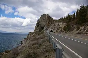
The Cave Rock Tunnel in winter
- ... prior to the construction of the Cave Rock Tunnel (pictured), U.S. Route 50 was a single lane road featuring a hanging bridge along the eastern shore of Lake Tahoe?
- ...that Utah State Route 32 is a former section of U.S. Route 189 that became disconnected from the rest of the route when the portion through the town of Hailstone was submerged by the Jordanelle Reservoir?
- ...that the Central Scranton Expressway was built on a portion of the former Lackawanna and Wyoming Valley Railroad right-of-way passing beneath the Harrison Avenue Bridge?
- ...that the final piece of mainline Interstate 80 to open to traffic was a 5 mile stretch in Utah that included the interchange with Interstate 215 and the Salt Lake International Airport, in 1986?
- ... the original Reno Arch was installed to celebrate the completion of the Lincoln and Victory Highways?
September

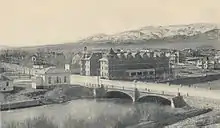
Virginia Street Bridge in downtown Reno, Nevada
- ... that legend has it that newly divorced women would throw their rings off of the Virginia Street Bridge (pictured c. 1910), which carries U.S. Route 395 Business across the Truckee River in Reno, Nevada, to celebrate the end of their marriages?
- ... that in 1966, the freeway conversion of US 131 forced the former Grand Rapids Speedrome, a race track, to close?
- ...that a bridge and a downstream ford on present-day Pennsylvania Route 134 were used by Union troops during the 1863 Battle of Gettysburg?
- ...that U.S. Route 550 crosses three highway passes, all of which are higher than 10,500 feet (3,200 m) in elevation?
- ...that when Maryland Route 145's present bridge over Loch Raven Reservoir was completed in 2000, the old bridge constructed in 1922 was retained and refurbished for recreational use?
October

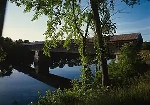
The Cornish–Windsor Covered Bridge
- ... that the eastern terminus of Vermont Route 44 is just west of the Cornish–Windsor Covered Bridge, the second longest covered bridge in the United States (pictured)?
- ...that the Ronald Reagan Trail is a collection of highways in central Illinois that connect villages and cities that were of importance to former United States President Ronald Reagan?
- ... that both Interstate 81 and U.S. Route 11 in West Virginia roughly follow the Warrior Path, an old Indian trail through the Eastern Panhandle region?
- ... that using much of South Dakota Highway 87 costs $15 per vehicle due to state park admission fees?
- ... that the Pittsburgh Wayfinder System is composed of more than 1,500 traffic signs that point the way to popular destinations in the City of Pittsburgh?
November

- ... that a portion of Virginia State Route 110 is used for the course of the Marine Corps Marathon (pictured)?
- ... that a landmark along Interstate 84 is the Thousand Mile Tree, which marks the western progress of exactly 1000 miles along the original alignment of the First Transcontinental Railroad?
- ... that the Michigan Department of Transportation has erroneously marked Forest Highway 16 as "County Road H-16" on their maps since 1992?
- ... that the section of Maryland Route 307 between the Dorchester–Caroline county line and Federalsburg became the first section of state road placed under contract for construction by the Maryland State Roads Commission in June 1909?
- ...that, despite being added to California's state highway system in 1933, the portion of State Route 190 over the Sierra Nevada remains unconstructed?
December

- ...that the introduction of E-ZPass (pictured) has led to "significant improvements of infant health" among mothers giving birth that lived near toll plazas?
- ... that state highway K-143 near Salina, Kansas, uses three different types of pavement on its 4.6 miles (7.4 km)?
- ...that the first modern roundabout on the Maryland highway system was constructed at the intersection of Maryland Route 94 and Maryland Route 144 in Lisbon in 1993?
- ...that comedian Robert Schimmel was killed in an accident on Loop 101 in Scottsdale, Arizona in 2010?
- ...that the Old Baltimore Pike was used by the French army during their march from Newport, Rhode Island to Yorktown during the Revolutionary War in 1781?
2012
January

- ...that scenic State Route 160 crosses California's Sacramento River twice on 1923 bascule bridges (one pictured) patented by Joseph B. Strauss, who went on to design the Golden Gate Bridge?
- ...that Pennsylvania Route 152 was originally a pathway known as the Limekiln Road built in 1693 to transport lime from kilns in Upper Dublin Township?
- ...that Virginia State Route 204 is the access road to George Washington Birthplace National Monument in Westmoreland County, Virginia?
- ...that the northern terminus of Massachusetts Route 21 was truncated from Athol to Belchertown due to the creation of the Quabbin Reservoir?
- ... that the state of Wisconsin proposed the route of Highway 57 as an Interstate Highway corridor in the 1950s?
February

- ...that the Merritt Parkway (pictured) was named one of America's Most Endangered Historic Places in 2010?
- ... that Colorado State Highway 257 has two interchanges only 0.3 miles apart?
- ...that a portion of the U.S. Route 222 freeway bypass north of Reading, Pennsylvania was once known as "The Road to Nowhere" as it was constructed before other sections of the bypass?
- ...that the Amstutz Expressway section of Illinois Route 137 was used in the filming of the movies Groundhog Day and The Blues Brothers?
- ...that U.S. Route 56 was originally proposed by the Mid-Continent Diagonal Highway Association as U.S. Route 55 and was to connect New Mexico or Arizona with Manitowoc, Wisconsin?
March

- ... that Rim Drive in Oregon, a scenic highway cited by the American Automobile Association as one of the ten most beautiful roads in the U.S., is a 33-mile loop that follows the caldera rim around Crater Lake (pictured)?
- ...that Rolling Road in Baltimore County, Maryland is named for the now obsolete tobacco hogsheds being rolled to the port down the road?
- ...that Utah State Route 901 is an unimproved road adopted into the state road network specifically to stop construction of a rail line to a proposed nuclear *waste dump" on Goshute tribal lands?
- ...that when Nebraska completed construction of its stretch of Interstate 80 in 1974, it became the first state in the U.S. to complete its mainline interstate system?
- ... that despite being only 9.3 mi (15.0 km) long, South Carolina Highway 291 runs by two colleges and an airport in Greenville?
April 1 (April Fool's Day)

- ... that there's this road out in Nevada (pictured) that is totally out of this world?
- ... that drivers on Route 54 have trouble figuring out what state they're in?
- ... that a Gore not only invented the internet but the U.S. Highway shield as well?
- ... that Batman regularly uses U.S. Route 29 in Maryland on his way to save children?
- ... that M-212 in Michigan has a connection to Hawaii?
April

Launch of Discovery on February 24, 2011
- ...that Florida State Road 528 was the site of a 40-mile (64 km) backup near Cape Canaveral from sightseers wishing to view the final launch (pictured) of the Space Shuttle Discovery in 2011?
- ... that U.S. Route 102 was the first US Highway designation to be decommissioned in 1928?
- ... that U.S. Route 63 and U.S. Route 163 are separated by 1,000 miles (1,600 km)?
- ...that the Route 4 bypass around Charlotte, North Carolina is numbered as such because the loop has a radius of about 4 miles (6.4 km)?
- ...that Maryland Route 135 once had a sign that suggested to truck drivers "If Brakes Fail Ditch Truck Immediately" on the highway's steep descent of Backbone Mountain?
May

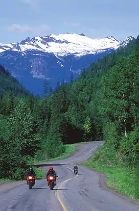
Motorcycles on the International Selkirk Loop, Colville National Forest, northeast Washington
- ...that Idaho State Highway 1, U.S. Route 2, U.S. Route 95, Washington State Route 20, and Washington State Route 31 make up the U.S. portion of the International Selkirk Loop (pictured), the only international scenic byway in North America?
- ...that Ranch to Market Road 187 was the site for filming portions of the 2011 film Seven Days in Utopia?
- ...that the Gila River Native Americans opposed the naming of Arizona State Route 347 after actor John Wayne because he had appeared in movies where he killed Native Americans?
- ...that in 1821, the Maryland General Assembly conscripted several banks to fund the construction of a turnpike between Boonsboro and Hagerstown along what is now U.S. Route 40 Alternate between Hagerstown and Frederick?
- ...that U.S. Route 160 was satirized in a song popularized by C. W. McCall, where he humorously describes an out-of-control truck's descent from Wolf Creek Pass, describing it as "37 miles 'o hell"?
June

Point Iroquois Lighthouse boardwalk along the Whitefish Bay National Forest Scenic Byway
- ... that the Whitefish Bay National Forest Scenic Byway in the Upper Peninsula of Michigan follows the shore of Whitefish Bay and provides access to the Point Iroquois Lighthouse (pictured)?
- ...that Parley's Canyon, which carries Interstate 80 across the Wasatch Mountains, is named for Parley P. Pratt, a polygamist Mormon leader who was murdered by the ex-husband of his 12th wife?
- ...that U.S. Route 6 in Ohio crosses the Black River on the Charles Berry Bridge , the second-largest bascule bridge in the world?
- ...that the proposed Texas State Highway Spur 1966 connecting to the University of Texas at El Paso campus was numbered in honor of the 1966 NCAA championship of the 1965–66 Texas Western Miners men's basketball team?
- ...that U.S. Route 11 near Hagerstown, Maryland, has been relocated and placed in a tunnel in separate projects to lengthen the runway at Hagerstown Regional Airport?
July

US 50 stretching across the Nevada desert
- ... that a roadtrip along U.S. Route 50 in Nevada (pictured) was the inspiration for Stephen King's novel Desperation?
- ... that in 1976, the now former M-147 was described as "the second shortest highway on Michigan's state highway system, but for those who travel it one way, M-147 is the longest road in the world"?
- ... that New York State Route 192 and its suffixed route, 192A, were two of only three decommissioned routes in Franklin County's section of Adirondack Park?
- ...that the Hibbs Bridge on the Snicker's Gap Turnpike, which partly replaced the first toll road in the United States, still carries traffic, and is being rebuilt in its original state?
- ... that the shortest state road in New Mexico is only 0.250 miles (402 m) long?
August

SR 55 southbound at I-405 interchange in Costa Mesa
- ... that the first carpool lanes in Orange County, California were opened on SR 55 (pictured) in 1985?
- ... that Maryland Route 378 in Ocean City is entirely one-way northbound?
- ... that roughly 2% of the United States annual coal supply is extracted from the corridor of Utah State Route 10?
- ... that M-55 boasted signs at the Cadillac, Michigan, city limits proclaiming the city home of Paul McMullen, a 1500-meter runner who competed in the 1996 Summer Olympics?
- ... that U.S. Route 178 provides access to the highest point in South Carolina, Sassafras Mountain?
September

The Davison (M-8)
- ...that the Davison Freeway (pictured) in Detroit, Michigan was the first urban, depressed freeway in the United States?
- ...that South Carolina Highway 700 connects Charleston with Wadmalaw Island, the site of the only working tea plantation in the United States?
- ...that the first roundabout constructed in St. Mary's County, Maryland, was at the junction of Maryland Route 234 and Maryland Route 238?
- ...that the first callboxes in San Diego County, California were on California State Route 52 near Convoy Street in 1988?
- ...that it took two years to restore U.S. Route 90 in Mississippi following Hurricane Katrina in 2005?
October

Route 17 at the Linwood Avenue East exit
- ...that Route 17 (pictured) in New Jersey was renumbered from Route 2 in 1942 to match New York State Route 17 and provide a single number for military caravans during World War II?
- ...that Wurzbach Parkway, an unnumbered freeway in San Antonio, Texas, does not connect directly to the city's other freeways?
- ...that Pennsylvania Route 163 never strays more than 250 feet (76 m) from the Mason–Dixon Line?
- ... that State Highway 7 in the US state of Minnesota follows the Minnesota River National Scenic Byway along Lac qui Parle by the state line?
- ...that critic H. L. Mencken panned the proposed renaming of Wilkens Avenue in Baltimore as Sunset Boulevard in 1932?
November

Night photograph of the Mackinac Bridge
- ...that Interstate 75 (pictured crossing the Mackinac Bridge) is the only highway that exists on both the Upper and Lower peninsulas of Michigan?
- ...that the construction of the Hampstead Bypass along Maryland Route 30 was delayed in the 1990s due in part to a habitat of bog turtles?
- ... that U.S. Routes within Washington state currently make up about 1,800 miles (2,900 km) of the Washington highway system?
- ...that the only state-numbered highways shorter than one mile (1.6 km) in the Massachusetts highway system are Route 15 and Route 108, which are extensions of the same-numbered highways in Rhode Island and New Hampshire, respectively?
- ... that Mississippi Highway 198 is the designation given to former alignments of U.S. Highway 98 in the state?
December

The Prospect Highway at one of the scenic overlooks along the mountainside
- ..that the Prospect Mountain Veterans Memorial Highway (pictured) is the only reference route in New York owned by the New York State Department of Environmental Conservation?
- ...that Route 54 passes the stone boundary marker denoting the junction of the Transpeninsular Line and the southern end of the Mason–Dixon Line between Mardela Springs, Maryland, and Delmar, Delaware?
- ... that Colorado State Highway 35 is so short that two interchanges overlap each other?
- ... that 2⅓ miles (5.8 km) of Iowa Highway 316 form the border between Marion County and Warren County, Iowa?
- ... that Furnace Brook Parkway, a historic road in Quincy, Massachusetts, is named for a stream at the site of the first iron blast furnace in the United States, built in 1644?
2013
January

Gateway I-94 bridge over US 24
- ... that US Highway 24 in Michigan follows Telegraph Road (pictured), which is named for the mid-19th-century telegraph lines it followed?
- ... that New York State Route 30 is the longest of only five state highways in Hamilton County, New York?
- ... that Utah's Patchwork Parkway is the second-highest paved road in the state of Utah at 10,626 feet (3,239 m) above sea level?
- ... that Maryland Route 170 was relocated for the construction of Baltimore/Washington International Airport in the late 1940s?
- ... that Washington State Route 220 was one of twelve highways removed from the Washington state highway system in 1991?
February

Signage denoting the State Senator Norman J. Levy Memorial Parkway designation just south of exit M7E on the northbound Meadowbrook
- ... that the Meadowbrook State Parkway (pictured) was dedicated in 1998 in memory of Norman J. Levy, the New York State Senator who sponsored the first U.S. law requiring seat belts while driving?
- ...that California State Route 174, which includes a historic 1924 bridge, was not designated a State Scenic Highway due to opposition by residents concerned about their property rights?
- ...that Maryland Route 117 was the inspiration for the song "Take Me Home, Country Roads" by John Denver?
- ... that County Road 510 in Marquette County, Michigan, previously crossed the Dead River on a bridge moved to the site from Pennsylvania?
- ... that the east end of Nevada State Route 230 is known as the Welcome Interchange?
March

SR 162 crosses the Puyallup River northwest of Orting on the McMillin Bridge opened in 1934
- ...that the McMillin Bridge (pictured) on State Route 162 in Washington was built with concrete instead of steel during the Great Depression to save the Department of Highways a grand total of $826, about $14,000 in 2013?
- ... that a second segment of Arkansas Highway 341 was created when residents appealed to the Arkansas State Highway Commission to buy and maintain a private ferry, which was closing?
- ...that there is a replica of the Cape Henlopen Light in the middle of the roundabout on Delaware Route 1A entering Rehoboth Beach?
- ...that at approximately 878 miles (1,413 km) in length, Interstate 10 is the longest highway in Texas?
- ... that the local nickname for Interstate 194 in Battle Creek, Michigan, is "the Penetrator"?
April 1 (April Fool's Day)

I-95 shield
- ...that Interstate 95 (pictured) is a road?
- ...that Quebec Route 366 runs from Astoria, Oregon to Atlantic City, New Jersey?
- ...that traffic on Utah State Route 92 drives on the wrong side of the road?
- ...that New York State Route 120A is a route in Connecticut?
- ... that trying to drive the length of Maryland Route 797 sends drivers in circles?
April

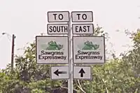
The original Sawgrass Expressway road signs
- ...that Florida State Road 869 (the Sawgrass Expressway) had a mascot, a swamp frog named Cecil B. Sawgrass, who appeared on road signs (pictured)?
- ... that the Julian road, predecessor to California State Route 67, was described as a "disgrace to the county"?
- ...that U.S. Route 127 is home to the 127 Corridor Sale, which is known as "The World's Longest Yard Sale"?
- ...that Washington State Route 432 ends at an intersection with Interstate 5 nicknamed the Longview Wye, despite being located in the neighboring city of Kelso?
- ... that M-68 was a discontinuous state trunkline highway in Northern Michigan between 1940 and 1946?
May

Seward Highway looking southbound along the Turnagain arm stretch
- ...that most of the length of the Seward Highway (pictured), which connects Anchorage and Seward, Alaska, is within Chugach National Forest?
- ...that Connecticut Route 136 is one of only two state highways in Connecticut that has a gap in state maintenance?
- ...that the northern half of Oklahoma State Highway 95 was once part of U.S. Route 56?
- ...that New Jersey Route 324 is the only state highway in New Jersey where neither of its termini is another roadway?
- ...that Idaho State Highway 50 provides access to Twin Falls from Interstate 84 over the Snake River?
June

Portage Lake Lift Bridge
- ... that U.S. Route 41 in Michigan including the Portage Lake Lift Bridge (pictured) was the state's first Michigan Heritage Route in 1995?
- ... that Washington State Route 8, which currently runs from Elma to Olympia, originally used the current route of U.S. Route 12 from Elma to Grand Mound, from 1964 until 1967?
- ... that at only 0.32 miles (0.51 km) long, New Jersey Route 64 is a state highway that consists primarily of a bridge over Amtrak-maintained railroad tracks?
- ...that the Utah Scenic Byways program includes the highest paved road in the state with a summit at 10,715 ft (3266 m)?
- ... that renowned magazine illustrator David Hunter Strother recounted a treacherous journey on the Moorefield and North Branch Turnpike in his recollections of the American Civil War in Harper's Magazine?
July

Anton Anderson Memorial Tunnel
- ...that the Anton Anderson Memorial Tunnel (pictured) uses computer regulated traffic controls to safely carry bi-directional automobile and train traffic through the single-laned tunnel?
- ...that the exit that connects the Hutchinson River Parkway and the Merritt Parkway over the New York–Connecticut state line is numbered 30 in New York, but 27 in Connecticut?
- ...that though primary east–west U.S. Route numbers end in 0, U.S. Route 2 broke this pattern so as to avoid having a U.S. Route 0?
- ... that at Harveys Lake, Pennsylvania, the Pennsylvania Department of Transportation signed Route 415 on two highways around the lake?
- ... that Kansas highway K-140's route was originally established in 1925 as U.S. Route 40S?
August

View north to the Terwilliger curves from Terwilliger Boulevard
- ... that the Terwilliger curves (pictured), a six-lane section of Interstate 5 in Portland, Oregon, had an average of 100 car accidents per year between 1995 and 2005?
- ... that unlike elsewhere in the United States, traffic on highways in the United States Virgin Islands drives on the left?
- ... that New Hampshire Route 113B is a suffixed route of Maine State Route 113, and it comes nowhere near its implied parent, New Hampshire Route 113?
- ... that though it only contains 4% of the nation's roads, America's National Highway System carries more than 40% of all highway traffic and 90% of tourist traffic?
- ... that although the New Jersey Route 85 freeway was never built, it is still listed in the state's Route Log?
September
- ...that the Enchanted Highway (pictured) in North Dakota is lined with scrap metal sculptures, including the largest of these sculptures in the world?
- ...that since May 2011, portions of Interstate 95 in Maine have the highest speed limits east of the Mississippi River, at 75 miles per hour (121 km/h)?
- ...that though California State Route 120 has been rerouted to have a 4% grade near Priest, the old 17% grade is still open to through traffic?
- ...that the shortest section of Interstate Highway between state lines is Interstate 95 in the District of Columbia, which traverses 0.11 miles (0.18 km) of the district on the Woodrow Wilson Bridge?
- ... that U.S. Route 50 has had 3 different routings between Ely, Nevada and Green River, Utah through the years that differ by hundreds of miles?
October

State Route 102 within Acadia National Park in Maine
- ... that Maine State Route 102 (pictured) was previously a lasso-shaped route in which one could be traveling due north on a road signed "south"?
- ... that U.S. Highway 23 in Michigan was the proposed site for General Motors big to develop an electronic highway in 1961?
- ... that the section of Interstate 40 in Tennessee between Nashville and Memphis is known the Music Highway?
- ... that the construction of Hawaii's Interstate H-3 may have caused the extinction of a native bird known as the O‘ahu ‘Alauahio?
- ... that Highway 22, Puerto Rico's most traveled highway, is part of the Interstate Highway System as unsigned Interstate PR2?
November
- ... that the design of the Mission Valley Viaduct on Interstate 805 was inspired by the Mission San Diego de Alcala and recognized by the American Society of Civil Engineers?
- ... that Ohio State Route 607 was upgraded to state highway after Morgan Township was asked to give the road up?
- ... that although Cape Cod Expressway was planned to run from New York City to Provincetown, Massachusetts along many state and federal highways, it was never built?
- ... that the two roads that use former New Jersey Route 65, Port Street and Doremus Avenue, dead-end just after their respective intersection?
- ... that between 2003 and 2011, the 2.44-mile (3.93 km) long Iowa Highway 107 consisted of two segments wholly within Meservey and Thornton, Iowa?
December
- ... that Ohio State Route 367 no longer exists; it was designated in 1933, and replaced by State Route 708 in 1938?
- ... that until 1951, when the Seward Highway was finished, in order for travelers to drive on the Hope Highway, they had to transport their cars on the Alaska Railroad?
- ... that the M-64 highway designation in Michigan was moved twice in two years by exchanging the number with different roads?
- ... that Pennsylvania Route 343 underwent numerous realignments until 1970?
- ... that Military Road in Arlington County, Virginia, was built by U.S. Army troops in just three days?
2014
January

CA 14U along Sierra Highway in Santa Clarita
- ...that although signed, California State Route 14U (pictured) is not listed in Caltrans route log?
- ...that when the US 41 Marquette Bypass opened in November 1963, cufflinks using jasper unearthed in the construction were supposed to be given to President Kennedy, but he was shot just hours later in Dallas?
- ...that Atlantic City High School in Atlantic City, New Jersey, is accessed via a trumpet interchange with US 40 and US 322?
- ...that Farm to Market Road 28 was originally designated on April 29, 1942 to run from SH 37 just south of Mount Vernon, Texas to the settlement of Macon, only to be cancelled and added to FM 21 later that day?
- ...that markers at or near Sherman Summit mark the highest location along the transcontinental Interstate 80, U.S. Route 30, Lincoln Highway and the First Transcontinental Railroad?
February

Legacy Parkway approaching 500 South
- ...that upon the opening of Legacy Parkway (pictured) over 2,000 acres (8.1 km2) of protected areas were created as well?
- ...that PennDOT turned over maintenance of Pennsylvania Route 82 in East Marlborough Township to the township in 1998 because they wanted to make improvements to the road without waiting through the PennDOT approval process?
- ... that four U.S. highways, including US-64, converge in a traffic circle surrounding the Cimarron County Courthouse in Boise City, Oklahoma?
- ... that both Interstate 81 and U.S. Route 11 in West Virginia roughly follow the Warrior Path, an old Indian trail through the Eastern Panhandle region?
- ...that a four-and-a-half-mile-long (7.2 km) section between Redwood Road and the Salt Lake City Airport holds the distinction of being the final link of Interstate 80 to be completed?
March

A rural segment of I-37 between Corpus Christi and San Antonio
- ...that Interstate 37 (pictured) is one of the few limited-access hurricane evacuation routes away from the Texas coast?
- ...that only one of the twenty-six tunnels on the Blue Ridge Parkway is in Virginia?
- ... that M-78, a state highway in Michigan, was extended several times and converted into a freeway, but now follows its original 1919 routing?
- ... that U.S. Route 20 in Massachusetts used to be part of the Boston Post Road, one of the earliest roads established in the United States?
- ...that Alameda Street was built by Los Angeles County, California as a "truck boulevard" to the port?
April
.JPG.webp)
Brick-paved section of Lincoln Highway in West Omaha near Elkhorn
- ..that nearby town officials caused an uproar when they moved highway markers from the Lincoln Highway in Omaha, Nebraska (pictured) to their local roadway after the highway was rerouted there in 1930?
- ...the western terminus of Interstate 70 isn't a town, but a fort?
- ...the only part of County Route 583 in Mercer County, New Jersey, maintained by the county is the section concurrent U.S. Route 206?
- ... that Interstate 15, a north-south Interstate, crosses the Continental Divide of the Americas at Monida Pass?
- ... that Ford Road in Dearborn, Michigan, was named for William Ford, father of Henry?
May
_x_I-678_1.JPG.webp)
I-495 near the I-678 exit
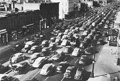
- ...that the Long Island Expressway (pictured) in New York is known as "the world's longest parking lot" due to its congestion?
- ... that Colorado State Highway 263 lies entirely within the city limits of Greeley, Colorado?
- ...that Interstate 285 roughly forms the boundary between area code 404 serving the center of Atlanta and area code 770 serving the outlying areas?
- ... that the Post Rock Scenic Byway is so named because of limestone fenceposts?
- ... that Federal Forest Highway 13 in the Hiawatha National Forest in Michigan crosses the Sturgeon River on a T-beam bridge built in 1941?
June
![A drawing entitled "the escape of Stonewall Jackson's Army down the valley pike at Strausburg [sic], Va." U.S. Library of Congress Collection](../../I/Valley_Pike%252C_1862.jpg.webp)
A drawing entitled "the escape of Stonewall Jackson's Army down the valley pike at Strausburg [sic], Va." U.S. Library of Congress Collection
- ...that the Valley Pike was a toll road managed by Harry F. Byrd which followed a Native American migratory trail in the Shenandoah Valley?
- ... that the newest Interstate Highway designation in Michigan is Interstate 73, but it has never been built?
- ...that the city of San Francisco contributed a large proportion of the funds for constructing the extension of Junipero Serra Boulevard beyond the city limits?
- ...that County Route 91 in Onondaga County, New York is signed as County Route 57 for New York State Route 57, the route it replaced?
- ... that Utah's Beaver Canyon Scenic Byway is the fifth highest paved road in the state, at 9,200 feet (2,800 m), but that its unpaved portion rises even higher, at over 10,200 feet (3,100 m) in elevation?
July

I-182 in Richland
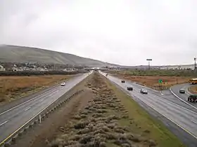
- ... that there are over 2500 miles of interstate and U.S. highways in Washington (I-182 pictured)?
- ... that a helicopter once crashed on Interstate 84 in New York, stopping traffic and causing a power outage?
- ... that Colorado State Highway 57 is not marked throughout its length?
- ... that U.S. Route 127 in Michigan was tripled in length by extending the highway to replace its parent route, U.S. Route 27 in 2002?
- ...that prior to Interstate 410 and the Interstate Highway System, Texas State Highway Loop 13 was the primary loop around San Antonio?
August
- ... that the construction of Interstate 8 (pictured) in California cost $1 million per mile?
- ...that scenes from the movie Field of Dreams were filmed along U.S. Highway 151 near Dubuque, Iowa?
- ... that Washington State Route 203 originally was split into four roads, later combined in 1937?
- ...that Interstate 865 in Indiana was numbered as such as opposed to Interstate 665 because 9-1-1 operators might have difficulty determining if a distressed motorist was saying "65" or "665"?
- ... that Orange County Route 9 in New York is, by itself, longer than five of the county's state highways?
September

View of Newburgh Bay and Pollepel Island from highway, 2006
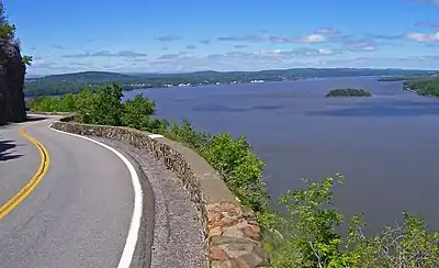
- ... that the construction of the Storm King Highway (pictured) took 22 miles (35 km) off the drive between Newburgh and West Point, New York, two cities only 10 miles (16 km) apart?
- ...that women helped construct Interstate 29 in Iowa because there was a shortage of male workers?
- ... that despite being less than 1 mile (1.6 km) long, Washington State Route 433 is considered a Highway of Statewide Significance by the Washington State Department of Transportation?
- ...that neither the western nor eastern termini of U.S. Route 6 are the most western and eastern points on the route?
- ... that there are over three thousand miles of interstate highways and U.S. Routes in the state of Utah?
October
- ... that Ohio State Route 212 has followed the same route since 1939?
- ... that Washington State Route 106 has been renumbered four times over a 49-year period from 1915 until 1964?
- ... that the United States Department of Transportation incorrectly lists the former Interstate 87 bridge on Warren County Route 35 as an old state road?
- ... that a private company wants to pay for the construction of County Road 595 in Marquette County, Michigan, to connect its nickel mine to its processing mill?
- ...that County Route 708 in Camden County, New Jersey is only one of four routes in that county that has multiple routes of the same number?
November
- ... that the longest and shortest state highways in Washington are located in Pend Oreille County?
- ... that New York State Route 194 was the only state highway in Lewis County removed because of the 1980 state maintenance swaps?
- ... that Colorado State Highway 64 is named the Stegosaurus Freeway in Dinosaur?
- ... that Michigan is home to the first roadside table in the country, which was installed next to U.S. Route 16?
- ...that Maryland Route 222 is the only Maryland state route that has the same number as a U.S. route?
December
- ...that in 2006 Pennsylvania Route 291 was rerouted around the Philadelphia International Airport due to runway expansion?
- ... that there has never been a Michigan highway numbered M-2, but all other numbers less than M-126 have been used?
- ...that when U.S. Route 13 between Dover and Wilmington, Delaware was widened into a divided highway in 1934 it was the longest stretch of divided highway in the world at the time?
- ... that Interstate 90 has a complete set (190 through 990) of spur routes in New York and is the only Interstate Highway that has a complete set within any state?
- ...that about three-quarters of the Oroville-Chico Highway (now Route 149) in California's Sacramento Valley has been absorbed by realignments of Routes 70 and 99?
2015
January
- ... that U.S. Route 395 has two segments in California, as the route enters and returns from Nevada, with exit numbers restarting for both segments?
- ... that M-168 in Elberta previously connected to a car ferry dock?
- ... that the construction of the LaSalle Expressway through eastern Niagara Falls indirectly contributed to the Love Canal disaster?
- ... that Washington State Route 504 was damaged when Mount St. Helens erupted in 1980 and had to be rebuilt on higher ground?
- ... that in June 1991, a gasoline tanker attempting to exit from Interstate 68 at Cumberland, overturned and set eight houses on fire, causing US$250,000 in damages?
February

Frankford Avenue Bridge over the Pennypack Creek in Northeast Philadelphia
- ...that U.S. Route 13 crosses the Pennypack Creek in Northeast Philadelphia on the Frankford Avenue Bridge (pictured), which was built in 1697 and is the oldest bridge in continuous use in the United States?
- ...that although 3 digit numbers in the U.S. Highway system are supposed to be used for spur routes, U.S. Route 191, U.S. Route 287, and U.S. Route 395 run almost the entire length of the United States, from Mexico to Canada?
- ... that the Dalton Highway (Alaska Highway 11) crosses both the Arctic Circle and Continental Divide?
- ... that Interstate 375 in Detroit, Michigan was the shortest signed Interstate Highway in the country at 1.06 miles (1.71 km) until Interstate 110 in El Paso, Texas was signed?
- ... that the stub of New York State Route 220 east of Oxford was originally part of an unsigned legislative route from 1916 to 1921?
March and April

The Schuylkill Parkway freeway stub in Bridgeport
- ...that the Schuylkill Parkway freeway stub (pictured) in Bridgeport, Pennsylvania has been used as a filming location as well as for training emergency vehicle drivers and for commercial vehicle driver tests?
- ...that Interstate 15's route through Arizona is completely isolated from the rest of the state road network?
- ... that M-80 serves the Chippewa County International Airport on the site of the former Kinross Air Force Base?
- ...that State Route 70, a National Scenic Byway through California's Feather River Canyon, was constructed using an access road laid out by the Utah Construction Company when it built the Western Pacific Railroad in the canyon?
- ...that the Delaware Turnpike and Northeast Expressway connecting Wilmington, Delaware to Baltimore, Maryland were dedicated by President John F. Kennedy one week before his assassination and were named the John F. Kennedy Memorial Highway in his honor?
May

US 25 on Gratiot Avenue in Detroit in 1941
- ... that the original route of US Highway 25 between Detroit and Port Huron, Michigan followed Gratiot Avenue (pictured), named for Fort Gratiot that was built in the aftermath of the War of 1812?
- ...that state funding reserved for the canceled Bay Freeway project in Seattle was instead used to widen U.S. Route 195 to four lanes in Eastern Washington?
- ...that Park Road 1836, which serves the San Jacinto Battleground State Historic Site in Texas, is numbered to commemorate the year that Texas won its independence from Mexico?
- ... that the restoration of wetlands in a mitigation bank created in the path of the planned Poinciana Parkway sextupled cost estimates for the highway?
- ... that New York State Route 17M is the original surface routing of New York State Route 17 from Middletown to Harriman?
June and July
- ...that the Airline Highway in Louisiana was considered a pet project of Governor Huey P. Long as it reduced the length of his journey between the capitol building in Baton Rouge and the bars and establishments in New Orleans?
- ... that for its first 25 years of existence in Michigan, US Highway 33 did not have an independent routing?
- ... that the Delaware Department of Transportation maintains 89 percent of the roads in Delaware?
- ...that the easternmost part of California State Route 20 follows a branch of the historic California Trail, parts of which have been preserved as a National Recreation Trail?
- ...that the original designation for Route 574 in Erie County, New York and its eastern terminus were removed four years apart?
August
- ...that a portion of Interstate 190 in Massachusetts was built with extra-wide shoulders, which are painted green, to prevent runoff from contaminating the nearby Wachusett Reservoir?
- ... that the Keller Ferry, which operates as part of Washington State Route 21 was taken over by the Washington Department of Highways on September 1, 1930, although a cable ferry was operated during the early 1890s?
- ... that U.S. Highway 12 followed the route of the St. Joseph Trail until 1962, and since then it has followed the Sauk Trail, two former Indian trails in the Lower Peninsula of Michigan?
- ...that a rest area along Interstate 295 in New Jersey was named in honor of Howard Stern by Governor Christine Todd Whitman as payback for Stern granting Whitman airtime during her 1993 gubernatorial campaign?
- ...that the two parts of California State Route 139 were constructed by a joint highway district of Lassen and Modoc Counties and by the U.S. federal government before being turned over to the state?
September

I-180/US 85/I-25 BUS at its northern terminus at US 30/I-80 BUS in Cheyenne
- ...that Interstate 180 (pictured) in Cheyenne, Wyoming is a surface highway for its entire length?
- ...that the Indiana State Road System has a mileage cap of 12,000 miles (19,000 km)?
- ...that during the construction of Interstate 279 in Pittsburgh, Pennsylvania in 1987, a 19th-century cemetery was discovered?
- ...that in 2013 North Carolina Highway 45 was extended from Swan Quarter to North Carolina Highway 12 in Ocracoke via the Swan Quarter-Ocracoke Ferry across the Pamlico Sound?
- ... that a portion of the Rhode Island Route 37 expressway was inadvertently constructed over a historic cemetery in Cranston, Rhode Island?
October
- ... that New York State Route 146B was decommissioned after as little as 17 years after its initial designation?
- ... that Michigan highway M-97 was simultaneously named both Reid Highway and Groesbeck Highway by different levels of government from 1927 until 1949, the year it was dedicated to Alex Groesbeck?
- ...that New Mexico State Road 6563 takes its number from the wavelength (6563 Å) used by scientists to locate areas of interest on the Sun?
- ...that Pennsylvania Route 645 was designated in 1962 in order to provide a route number at the Frystown interchange of I-78/US 22?
- ...that the original plans for Interstate 359 in Tuscaloosa, Alabama called for no interchanges between the termini at I-59 and 15th Street?
November
- ...that a section of Interstate 85 near Charlotte, North Carolina was named the Jeff Gordon Expressway in honor of NASCAR driver Jeff Gordon in 2012 after he recorded his 85th career win?
- ...that prior to the opening of M-231 in Michigan, a "M23.1k Run" was held with participation limited to 231 runners?
- ...that after Pennsylvania Route 856 was decommissioned, local residents complained about lack of snow removal and felt that the Pennsylvania Department of Transportation had abandoned the road?
- ... that Washington State Route 113 was given to Clallam County in 1955, only to be given back to the state in 1991?
- ... that Fulton County Route 112, the continuation of New York State Route 309, was once the site of an old Indian trail in the Adirondacks?
December

Marquette–Negaunee Road in 1917
- ... that the first highway centerline (pictured) was painted on the Marquette–Negaunee Road by K.I. Sawyer in 1917?
- ...that California's four-lane Bayshore Highway, now a freeway, was built to high standards in the 1920s and '30s, but was called "Bloody Bayshore" because of the number of crashes?
- ... that Ronald Reagan Cross County Highway in Hamilton County, Ohio, was the first highway to be named after U.S. President Ronald Reagan?
- ... that to prevent flooding on Colorado State Highway 74, 34-foot high walls were constructed along the road?
- ... that before its removal, Pennsylvania Route 963 was the easternmost state traffic route in Pennsylvania?
2016
January

Main Street and the Hotel Jerome
- ... that Colorado State Highway 82 (pictured, as Aspen's Main Street) intersects only one other state highway along its 85-mile (137 km) length?
- ...that all three states where U.S. Route 99 once ran maintain a state route 99 that is a portion of the former route?
- ... that before its reconstruction in the late 1990s, Cincinnati's Fort Washington Way was the most accident-prone mile of urban freeway in Ohio?
- ...that the final piece of the coast-to-coast Interstate 10 to be completed was the Papago Freeway Tunnel in 1990?
- ... that Maryland Route 24 parallels Deer Creek through Rocks State Park?
February
- ...that the final piece of the Mexico to Canada freeway Interstate 5 was dedicated south of Stockton, California in 1979?
- ... that U.S. Highway 102 was the first U.S. Highway in Michigan to be decommissioned, just two years after designation?
- ...that Pennsylvania Route 715 was designated in 1963 in order to provide a route number at the Tannersville interchange of I-80?
- ...that the final piece of the coast-to-coast Interstate 90 to be built was a viaduct over downtown Wallace, Idaho, dedicated in 1991?
- ... that County Route 41 in Onondaga County, New York, was once part of two state highways and one turnpike?
March

The Chickasaw Turnpike westbound at Mile 13
- ... that the Chickasaw Turnpike (pictured) is the only two-lane turnpike in Oklahoma?
- ... that Wisconsin Highway 131 crosses nine bridges in 7.3 miles (11.7 km) between the communities of Rockton and Ontario?
- ... that only 2 miles (3 km) of New York State Route 279's 9-mile (14 km) alignment is maintained by the state of New York?
- ...that Interstate 80 in Nevada crosses the Forty Mile Desert, the most dangerous part of the California Trail?
- ... that plans were shelved for the Southside Connector over concerns that it would pollute aquifers that were later found to be polluted inadvertently by the military?
April

Old and new route numbers at the intersection with US 191 in Monticello
- ... that U.S. Route 491 (pictured) was created in part due to large amounts of sign thefts from its former route number?
- ... that M-66 is the only state highway that runs the length of the Lower Peninsula of Michigan?
- ...that the original vertical lift bridge carrying U.S. Route 213 over the Chesapeake and Delaware Canal in Chesapeake City, Maryland was destroyed by the tanker Franz Klassen in 1942?
- ...that the Bradshaw Trail is a historic overland stage route and the first road connecting Riverside County, California USA to the Colorado River?
- ...that Vermont Route 26 is only 69 feet (21 m) long?
May

Bridge over Hanalei River on Hawaii Route 560
- ... that Hawaii Route 560 (pictured) was added to the National Register of Historic Places in 2004 because of its historical character of one lane bridges?
- ...that a one-mile (1.6 km) stretch of New Jersey Route 57 in Franklin Township, Warren County was the first concrete road built in New Jersey, having been constructed in 1912?
- ...that US 395 was unaffected by California's 1964 state highway renumbering, but it was later truncated due to an expansion of I-15 and I-215?
- ...that Maryland Route 577 follows the border between Caroline and Dorchester counties for its entire length?
- ...that 3 pairs of California and Nevada state highways retain the same number while crossing the state border, California State Route 28/Nevada State Route 28, California State Route 88/Nevada State Route 88 and California State Route 266/Nevada State Route 266?
June
_from_east_end_after_opening%252C_April_2016.jpg.webp)
Viewed from the east end of the Evergreen Point Floating Bridge in Medina shortly after opening in April 2016
- ...that Washington State Route 520 is carried across Lake Washington on the world's longest floating bridge (pictured), which opened in 2016 to replace the previous title-holder at the same site?
- ...that Pennsylvania Route 901 was extended northwest from Minersville to Shamokin to provide a route for traffic to an interchange with I-81 northwest of Minersville?
- ...that the first limited-access road in California was the Ramona Parkway, which was constructed in 1935 in the city of Los Angeles along the current routing of I-10?
- ... that Interstate 97 is the shortest 2-digit mainline Interstate and only intracounty 2-digit Interstate in the contiguous United States?
- ...that both U.S. Route 191 and Interstate 15 (former U.S. Route 91) connect to highways numbered 4 in Canada?
July

The Arroyo Seco Parkway looking south from Marmion Way, showing the differently-colored passing lanes
- ...that the passing lanes of the Arroyo Seco Parkway (pictured), California's first freeway, were paved in a different color to encourage drivers to stay in their lanes?
- ...that the western terminus of Delaware Route 2 was cut back from the Maryland border to the eastern part of Newark in 2013 in order to reduce sign clutter in Newark?
- ... that the 30-mile (48 km) section of Interstate 15 in Arizona was the most expensive section of rural freeway through the Virgin River Gorge?
- ... that New York State Route 3 initially extended as far west as Niagara County?
- ... that although it has not been signed since 1979, Interstate 296 near Grand Rapids is still a current part of the Interstate Highway System?
August
- ... that drivers of large vehicles on Utah State Route 9 are charged an additional toll to pay for National Park Service workers to stop traffic at the other end of the Zion - Mt. Carmel Tunnel?
- ... that the Greenfield Lane segment of the decommissioned New York State Route 273 is no longer part of the highway's new designation?
- ... that a five-mile-long (8.0 km) section of the Seward Highway south of Anchorage, Alaska, has different speed limits for the right and left lanes?
- ... that Interstate 83 (I-83) is the shortest Interstate highway (85.3 miles (137.3 km)) with any associated routes (I-283)?
- ...that the city of West Sacramento, California is converting the former State Route 275 freeway into a surface road by replacing interchanges with at-grade intersections?
September
- ...that Interstate 238 is signed north/south, but is actually an east/west route?
- ... that New York State Route 18 once extended as far south as Pennsylvania and as far east as Webster?
- ... that M-95 in Michigan has been named for Leif Ericson, the Norse explorer?
- ... that New Mexico State Road 4 forms the core of Jemez Mountain Trail National Scenic Byway, with trails to Puebloan ruins, a 10,199-foot (3,109 m) mountain, and a 70-foot (21 m) waterfall from roadside turnouts?
- ...that the eastern terminus of Interstate 70 is at a park and ride lot in Baltimore?
October
- ... that Nevada State Route 722 is an old routing of both U.S. Route 50 in Nevada and the Lincoln Highway that was abandoned in 1967 due to steep grades and sharp curves?
- ... that part of Connecticut Route 108 was established as the Farm Highway in 1696?
- ...that the Sierra Highway was described in a promotional book to recruit teachers to California as "a highway with a hundred by-ways, each by-way with a hundred wonders"?
- ... that M-46 is only one of three trans-peninsular state highways in the Lower Peninsula of Michigan?
- ... that Interstate 70 in Utah was built along an entirely new route, and is the longest road built in the US over a new route since the Alaska Highway?
November

The Tridge in winter
- ... that in Midland, Michigan, M-20 passes The Tridge (pictured), a three-legged bridge?
- ...that much of Maryland Route 260 was built on the former right-of-way of the Chesapeake Beach Railway?
- ... that Utah State Route 30 is the only highway signed as a Utah state route that runs from state line to state line?
- ... that New York State Route 434 was designated as NY 188 for less than a year?
- ...that North Carolina Highway 3 switched designations with North Carolina Highway 136 in 2002 to honor the late Dale Earnhardt, a NASCAR driver who drove the #3 car?
December
- ...that Maryland Route 178 follows part of the route George Washington traveled to Annapolis to resign his commission in the Continental Army at the conclusion of the American Revolutionary War?
- ... that M-60 is one of three Michigan state highways with a business route?
- ... that while traversing mountainous terrain, Arizona State Route 87 has portions where traffic in one direction crosses over the traffic lanes for the other direction?
- ... that New Jersey Route 47 received the name "Delsea Drive" by the New Jersey Legislature in 1933 after a reporter for the Woodbury Times joked how the road connected the Delaware River with the Atlantic Ocean (the sea)?
- ... that the Mousetrap is a freeway interchange that was completely re-designed after a truck hauling torpedoes overturned, paralyzing the transportation network in Denver for a day?
2017
January
- ... that the Newhall Pass interchange has collapsed from earthquakes twice and burned from trucks colliding in a tunnel once?
- ...that Dupont Road, which carries a portion of Delaware Route 100, was built by the DuPont Company in the 19th century to transport black powder south to the Christina River to be shipped, bypassing the city of Wilmington?
- ... that Washington State Route 213 was proposed for 35 years before a small, 0.35-mile (0.56 km) long segment was added to the state highways system in 2008?
- ... that M-94 in Manistique, Michigan crosses the Siphon Bridge, a structure once described in the pages of the Ripley's Believe It or Not! column?
- ... that one of the landmarks along Interstate 84 in Utah is the Thousand Mile Tree, planted by Union Pacific Railroad workers to celebrate the first transcontinental railroad reaching 1,000 miles (1,600 km) from its origin in Omaha, Nebraska?
February
- ...that the Kirkwood Highway portion of Delaware Route 2 was constructed as a divided highway in the late 1930s and early 1940s to provide access to Delaware Park Racetrack?
- ... that M-154 is one of three state highways in Michigan on an island?
- .... that Arizona State Route 51, formerly known as the Squaw Peak Freeway—a derogatory term for Native American women—was renamed the Piestewa freeway after Lori Piestewa, the first Native American woman to die in combat while serving the U.S. Military?
- ... that Interstate 990 in New York is the highest numbered Interstate in actual use?
- ... the highest road in the Nevada state route system is Nevada State Route 431 over Mount Rose Summit [elevation 8,911 feet (2,716 m)]?
March
- ... that Skyline Drive in Shenandoah National Park in Virginia was once proposed to be named the Hoover Highway after President Herbert Hoover?
- ... that numbered highways in the Northern Mariana Islands beginning with 1 are on Rota, beginning with 2 on Tinian, and beginning with 3 on Saipan?
- ... that M-179 is a Pure Michigan Byway named for Chief Noonday?
- ... that the section of Delaware Route 1 between Dover and Smyrna once had road signs in metric units in anticipation of the United States converting to the metric system?
- ... that North Dakota Highway 1804 and North Dakota Highway 1806 follow the Lewis and Clark Trail along the Missouri River and were numbered to reflect the years of the Lewis and Clark Expedition?
April

The Blue Ridge Parkway near Grandfather Mountain
- ... that Blue Ridge Parkway (pictured) was built as a part of the New Deal?
- ... that M-49 is the only state highway in Michigan that connects to a like-numbered route in another state, in this case Ohio State Route 49?
- ... that Pennsylvania Route 321 was designated to provide access to the recreational area around the Allegheny Reservoir?
- ... that California State Route 49 is so numbered to honor the California gold rush of 1849, that occurred along the areas served by the highway?
- ... that much of the current alignment of Maryland Route 413 follows a former Pennsylvania Railroad line into Crisfield?
May
- ...that the Smyrna Rest Area along U.S. Route 13 in Smyrna, Delaware, is home to the Delaware Highway Memorial Garden, which has a path with bricks bearing the names of people who died along roads in Delaware?
- ...that California State Route 266 has more connections to Nevada State Routes than California's road network?
- ...that Puerto Rico Highway 52 was the first toll road in Puerto Rico?
- ... that in 1919, Michigan was the second state to sign numbered highways after Wisconsin?
- ... that Washington State Route 124 follows the route of the Lewis and Clark National Historic Trail from Piper Canyon Road to its eastern terminus in Waitsburg?
June
- ... that M-212 is the shortest signed highway in Michigan, connecting to Aloha State Park?
- ... that Pennsylvania Route 407 was extended and Pennsylvania Route 374, Pennsylvania Route 438, Pennsylvania Route 524, Pennsylvania Route 632, and Pennsylvania Route 848 were all created so that Interstate 81 would have interchanges with numbered highways north of Scranton?
- ... that part of the Kansas highway K-99 honors the war dead of Frankfort, which lost more men per capita in World War II than any other community in the United States?
- ... that U.S. Route 199 is numbered as a spur of U.S. Route 99, which no longer exists?
- ... that Texas State Highway NASA Road 1, which runs near the Johnson Space Center, was renumbered from a portion of Farm to Market Road 528 in 1965?
July
- ... that Washington State Route 522 has been named as one of the most dangerous highways in the United States?
- ... that the former two-lane U.S. Route 50 bridge over the Choptank River in Cambridge, Maryland had the center section removed and is now Bill Burton Fishing Pier State Park?
- ... that the last eight miles (13 km) of U.S. Route 45 in the country to be paved were in the Military Hills area of eastern Ontonagon County, connecting the Gulf of Mexico and Lake Superior with a hard-surfaced road in 1959?
- ... that Utah State Route 127 extended along a causeway to an island in the Great Salt Lake, before flooding submerged the causeway?
- ...that construction of Interstate 140 outside Wilmington, North Carolina was delayed in part to redesign an off-ramp to avoid a 450-year-old oak?
August

1955 map of the proposed Michigan Turnpike
- ... that a proposed Michigan Turnpike (map pictured) would have run through the Detroit area if the State Highway Commissioner did not stall it until the creation of the Interstate Highway System made the proposal obsolete?
- ... although still commonly called Nevada State Route 49 by visitors to Nevada's Black Rock Desert and the Burning Man festival, the highway hasn't been maintained by the state since the 1980s?
- ... that road closures and detours from flood damage along Pennsylvania Route 32 in the 2000s significantly affected businesses, forcing some to close down?
- ... the completion of Interstate 17 shortened the distance of the truck route between Phoenix and Flagstaff, Arizona, by approximately 80 miles (130 km) (versus the former route of U.S. Route 89 between those two cities)?
- ... that Florida State Road 9336 is the only signed four digit state route in Florida?
September
_at_Maryland_State_Route_170_(Aviation_Boulevard)_in_Stony_Run%252C_Anne_Arundel_County%252C_Maryland.jpg.webp)
View north from the south end of MD 995
- ...that Maryland Route 995 (pictured) is the designation for Amtrak Way, the road leading to the BWI Rail Station that is served by Amtrak and MARC Train?
- ...that the route of modern Interstate 84 traces its origins to a compromise in a dispute over the routing of U.S. Route 30 in the western US that resulted in the creation of U.S. Route 30S?
- ...that I-475 near Flint is named the "David Dunbar Buick Freeway" after the founder of Buick Motor Company?
- ...that a section of Texas State Highway 130 has a posted speed limit of 85 mph (137 km/h), the highest posted speed limit in the United States?
- ...that Interstate 8 has the lowest above-ground elevation of any Interstate at 52 feet (16 m) below sea level near El Centro, California?
October
- ...that, although the first section of Washington State Route 520 opened in 1963, the 13-mile (21 km) freeway wasn't fully completed until 1981?
- ...that in 1993, the New York State Thruway became the first road to implement the E-ZPass electronic toll collection?
- ...that Interstate 87 in North Carolina and Virginia is numbered in honor of important dates in the history of both states, such as the founding of the Roanoke Colony in 1587, the Virginia Plan helping to develop the U.S. Constitution in 1787, and the creation of North Carolina State University in 1887?
- ... that M-17 used to extend across the Lower Peninsula of Michigan, but now it only runs from Ann Arbor to Ypsilanti?
- ...that Maryland Route 700 was constructed in 1941 to provide an improved connection to the Glenn L. Martin Company aircraft manufacturing plant as the United States entered World War II?
November

Abandoned section of the Pennsylvania Turnpike
- ...that a section of the Pennsylvania Turnpike was abandoned (pictured) after the road was relocated to bypass the Rays Hill and Sideling Hill tunnels in 1968?
- ...that two rest areas along Interstate 80 in New Jersey were shut down in 1982 due to chronic use for homosexual activities?
- ... that M-38 was previously a part of M-35 that was 65 miles (105 km) away from the rest of the highway?
- ...that Florida State Road A1A was renumbered from State Road 1 in 1946 in order to reduce confusion with nearby U.S. Route 1?
- ...that the former alignment of U.S. Route 80 in California was designated as a state historic route called Historic U.S. Route 80 in 2006?
December

The "Tunnel of Trees" between Harbor Springs and Good Hart
- ... that along the "Tunnel of Trees" (pictured), M-119 has no centerline?
- ... that Pennsylvania Route 863 was designated in 1962 to provide a route number at the interchange with I-78 in New Smithville?
- ...that Nevada State Route 447 is the access to the site of the Burning Man festival?
- ... that none of State Highway 32 as it was originally designated through southwestern Oklahoma in 1934 is a part of the current route?
- ... that the Bradley Airport Connector, a freeway in the U.S. state of Connecticut, was renamed the "82nd Airborne Memorial Highway" in 1999 to honor the 82nd Airborne Division?
2018
January

Orchard Pond Parkway route marker
- ...that the Orchard Pond Parkway (pictured) was the first privately-built toll road to be constructed in Florida?
- ...that Interstate 180 in Illinois was built to connect Interstate 80 to a steel plant in Hennepin?
- ... that an original proposed designation of New York State Route 97 was NY 17L, a fourteenth suffixed spur of NY 17?
- ...that the Mike O'Callaghan–Pat Tillman Memorial Bridge, currently used by U.S. Route 93 and proposed for use by Interstate 11, is the first steel-concrete composite arch bridge built in the United States?
- ...that the intersection of Pennsylvania Route 132 and Knights Road in Bensalem Township was ranked by Time magazine as the most dangerous intersection in the United States from 2003 until 2012?
February
- ... that urban planner Robert Moses was said to have laughed at protesters he encountered while surveying routes for the Clearview Expressway in New York City in the 1950s?
- ... that county road H-63 runs along Mackinac Trail, a former Indian path in the Upper Peninsula of Michigan?
- ... that U.S. Route 12 was extended into Washington in 1967, taking over most of the routing of U.S. Route 410?
- ... that there were formerly plans to rename the portion of Delaware Route 8 along Division Street in Dover to Martin Luther King Jr. Boulevard?
- ...that the Arroyo Seco Parkway follows the former routing of the California Cycleway?
March
- ... that the former M-122 connected US 2 in St. Ignace to the state car ferry docks?
- ... that Utah State Route 276 includes the only auto ferry in a landlocked western state?
- ... that U.S. Route 40 Scenic is the only scenic special route that remains in the U.S. Highway System?
- ... that the section of Interstate 30 between Fort Worth and Dallas is named the Tom Landry Highway in honor of longtime Dallas Cowboys coach Tom Landry?
- ... that Nevada State Route 375 is known as the "Extraterrestrial Highway" due to its proximity to Area 51 and high number of UFO sightings?
April

J. F. Roberts Octagonal Barn, located on Missouri Route 48
- ... that there is an eight-sided barn (pictured) on Missouri Route 48?
- ... that nearly US$700 million was allocated to the process of downgrading Interstate 895 in New York City from a freeway to a boulevard?
- ... that U.S. Route 40 in Colorado crosses the continental divide 3 times?
- ... that U.S. Route 10 crosses Lake Michigan from Wisconsin to Michigan via a privately-owned carferry?
- ... that the Chickasaw Turnpike is the only two-lane turnpike in Oklahoma?
May and June
- ... that the Interstate 695 beltway around Baltimore was initially planned as a county project in 1949 before being taken over by the state by 1953?
- ... that the Peshekee River Bridge that later carried US 41 was the first bridge designed and built by the Michigan State Highway Department in 1914?
- ... that Interstate 190 in New York was originally designated as "Interstate 90N"?
- ... that the numerical designation of Nevada State Route 140 was influenced by backers of the "Winnemucca to the Sea Highway", a proposed route that would connect northwestern Nevada, southern Oregon and the California coast under one highway number?
- ... that bad fate fell upon many construction workers during the construction of New Jersey Route 55, fueling a belief that the highway was cursed as a result of building over Indian burial grounds in Deptford Township?
July

Alabama route 10 and 141 signs as posted in Easthampton, Massachusetts
- ... that in July 2005, signage at the intersection of Massachusetts Route 10 and Massachusetts Route 141 (pictured) identified the routes with Alabama route markers?
- ... that during the "Southbelt Shuffle" event on M-6 south of Grand Rapids, Michigan, horses were ridden on the partially completed freeway?
- ... that during the construction of New York City's Van Wyck Expressway, a four-story apartment building was placed on metal rollers and relocated away from the expressway's path?
- ...that U.S. Route 50 in California was the route traveled by many '49ers and the Pony Express, and later became California's first state highway and a branch of the Lincoln Highway?
- ... that the Baltimore–Washington Parkway was once planned to be a part of Interstate 295, but never did because not enough funds were available to upgrade the road to Interstate Highway standards?
August

Interstate 78 across the Watchung Reservation in New Jersey
- ...that there is a land bridge for animals over Interstate 78 in New Jersey (pictured) near the Watchung Reservation?
- ... that Interstate 86 in Idaho follows a section of the historic Oregon Trail?
- ... that Magnolia Way, officially designated as Mississippi Highway 780, offers drivers no reassurance?
- ... that Interstate 84 is the longest freeway in Oregon and the only one to traverse the state from west to east?
- ... that during the "Southbelt Shuffle" event on M-6 south of Grand Rapids, Michigan, horses were ridden on the partially completed freeway?
September
- ... that a 156-foot (48 m) tunnel for the Lower Manhattan Expressway was built in New York City in the 1960s, but was never used?
- ... that Wyoming Highway 89 is so numbered from a failed proposal for U.S. Route 89 to stay in that state rather than enter Idaho?
- ... that M-67, a state highway in the Upper Peninsula of Michigan, has remained essentially unchanged but the highways connecting to it have changed three times since 1919?
- ... the highest road in the Utah state route system is Utah State Route 150 over Bald Mountain Pass [elevation 10,715 feet (3,266 m)]?
- ... that WIS 35 is the longest highway in Wisconsin?
October
- ...that Interstate 580 has portions opened to traffic in the 1960's but was unsigned until 2012?
- ...that two 4 character Interstate Highway designations have existed, Interstate H-201 and Interstate 180N?
- ...that Interstate 82 was moved to the northeast side of the Yakima River after the government was sued by the Yakama Nation?
- ...that Utah officialls originally mocked the route of Interstate 70 as a road to nowhere but it was so routed to appease military planners who wanted a better route between Southern California and Denver, Colorado?
- ...that to be considered an All-American Road, a road must be deemed to be important enough to be destination unto itself?
November
- ... that one of the reasons for the creation of the newly designated Interstate 11 is to address two identified bottlenecks in the NAFTA created CANAMEX Corridor?
- ...that the section of Florida State Road 520 between Florida State Road 50 and Interstate 95 is nicknamed "Bloody 520" due to the numerous fatalities that have occurred along the road?
- ... that a section of Washington State Route 24 through Hanford was closed to traffic during World War II, and never reopened?
- ...that a section of Pennsylvania Route 44 in Potter County is named Highway to the Stars as it passes through Cherry Springs State Park, an International Dark Sky Park that is popular among astronomers and stargazers?
- ...that the U.S. Route 91 corridor was the birthplace of two major fast food chains, the first McDonald's on E street in San Bernardino and the first Kentucky Fried Chicken on State Street in Salt Lake City?
December
- ...that although Interstate 8 does not cross the US-Mexico border it has multiple U.S. Border Patrol checkpoints, due to its proximity to the border near Yuma, Arizona and Jacumba, California?
- ... that Interstate 75 is the only freeway in the Upper Peninsula of Michigan?
- ... that sections of Washington State Route 821 are shut down for annual cattle drives, a marathon, and a heritage tractor run?
- ...that Pennsylvania Route 297 was renumbered from Pennsylvania Route 295 to avoid a number conflict when Interstate 295 was extended into Pennsylvania?
- ...that the section of Interstate 75 along Alligator Alley in Florida has a number of small bridges to allow wildlife to pass under the freeway?
2019
January and February

M-10 (Lodge Freeway) passing under Cobo Hall
- ... that M-10 (Lodge Freeway, pictured) in the Detroit area is named for John C. Lodge, a former Detroit mayor?
- ... that despite being only eight miles (13 km) long, Washington State Route 546 is considered a major freight highway due to its connections to Interstate 5 and the Canadian border?
- ... that the section of U.S. Route 322 along two-lane Conchester Highway in Delaware County, Pennsylvania has received the nickname "Killer Conchester" due to the large number of accidents and fatalities that occur along the road?
- ... that if constructed, the proposed extension of Interstate 11 would be the first Interstate Highway to connect northern Nevada to southern Nevada?
- ... that most of New York State Route 37B's original alignment was destroyed as part of the St. Lawrence Seaway's construction?
March

Drawbridge at Tilghman Island, Maryland
- ... that the Maryland Route 33 drawbridge onto Tilghman Island (pictured) is among the busiest in the United States and the world in terms of drawbridge openings?
- ... the Lincoln Highway Bridge is an isolated historical relic along the original routing of the Lincoln Highway and proposed original alignment for U.S. Route 50 that is now inaccessible to the public as it is inside of the Dugway Proving Ground?
- ... that the Robert Moses State Parkway was originally was one continuous road; however, due to low usage, a portion of the parkway near Niagara Falls was removed, separating the parkway into two sections?
- ... that Mattawa residents opposed to a roundabout on Washington State Route 243 later apologized to the state government for their stance on the project?
- ... that in 2014, the Zoo Interchange in Milwaukee became the first place that orange pavement markings were tested in the United States?
April
_at_Francis_Street_in_Annapolis%252C_Anne_Arundel_County%252C_Maryland.jpg.webp)
View along MD 797, which follows State Circle in Annapolis
- ...that the State Circle (pictured) in Annapolis, Maryland is designated Maryland Route 797 and has a circumference of 0.27 miles (0.43 km)?
- ... that seven of eight major bridges on Washington State Route 504 were destroyed by a lahar during the 1980 eruption of Mount St. Helens?
- ... that the New Jersey Route 70 bridge over the Manasquan River is known as the September 11th Memorial Bridge in honor of residents of Monmouth and Ocean counties who lost their lives in the September 11 attacks?
- ... that California State Route 4 has portions that are multi-lane freeway, and portions that are a single lane?
- ... that a new section of US 2 was detoured around the Cut River Bridge when the latter was delayed due to World War II?
May

Hand-painted centerline on state highway M-15 in Marquette County, Michigan in 1917
- ...that, according to the Michigan Department of Transportation, the first highway centerline in the US (pictured) was painted on the first designation of M-15 in 1917?
- ... that none of State Highway 32 as it was originally designated through southwestern Oklahoma in 1934 is a part of the current route?
- ...that speed limits on Guam Highway 1 may differ depending on which side of the road you are on?
- ...that in the 1950s, four service plazas on the Garden State Parkway had uniformed female employees known as the "Park-ettes" whose duties included providing directions and other information to motorists as well as rendering odd bits of service such as sewing a missing button on a patron's coat?
- ...that California State Route 174, which includes a historic 1924 bridge, was not designated a State Scenic Highway due to opposition by residents concerned about their property rights?
June

Mileage sign at the eastern terminus of I-70 near Baltimore
- ...there is a sign (pictured) at the terminus of Interstate 70 near Baltimore listing the distance to Cove Fort, Utah?
- ... that ownership and maintenance of New York State Route 338 was transferred from the state of New York to Washington County just 16 years after the state originally acquired the highway?
- ... the routing of U.S. Route 191 has changed so many times that Yellowstone National Park is the only place that has been continuously served by the highway?
- ... that state highway M-343 between Kalamazoo and Richland, Michigan, was part of M-43 for a century until Kalamazoo wanted to assert control over some other streets?
- ... that Washington State Route 142 once included the largest prestressed concrete bridges in the state?
July

Westbound view on beginning of US 50 in Ocean City, with an overhead sign giving the distance to the western terminus in Sacramento, California
- ...there is a sign (pictured) at the terminus of U.S. Route 50 in Ocean City, Maryland listing the distance to Sacramento, California?
- ...the construction of the Eisenhower Tunnel became an event in the history of the women's rights movement when Janet Bonnema, the lone female engineering technician on the project, was initially not allowed to enter the tunnel and sued for the right to do the same work as her male counterparts?
- ... that the portion of U.S. Route 209 in New York had five different designations over a span of 10 years in the 1920s and 1930s?
- ... that Washington State Route 99 passes under downtown Seattle in a tunnel that was excavated by the world's largest tunnel boring machine?
- ...that a controversy occurred when the Daniel Boone Parkway in Kentucky was renamed to the Hal Rogers Parkway, after a congressman who had secured funding to get tolls removed from the road?
August

Sign at beginning of westbound US 6 in Provincetown, Massachusetts
- ...there is a sign (pictured) at the terminus of U.S. Route 6 in Provincetown, Massachusetts listing the distance to the current terminus in Bishop, California and the historical terminus in Long Beach, California?
- ...that a section of Interstate 10 west of Houston, Texas is believed to be the widest highway in the world at 26 lanes?
- ... that the design of the Mission Valley Viaduct on Interstate 805 was inspired by the Mission San Diego de Alcala and recognized by the American Society of Civil Engineers?
- ...that the Black River National Forest Scenic Byway in the Upper Peninsula of Michigan connects to the tallest ski flying hill in the world and one of two National Forest harbors in the United States?
- ...that in 2003, CDOT purged all but 500 feet of SH 110, so that it could have a state access route to its Silverton Maintenece Field, making it the shortest highway in Colorado?
September

Sign for US 20 at Kenmore Square, near the Boston Citgo sign
- ...there is a sign (pictured) at the terminus of U.S. Route 20 in Boston, Massachusetts listing the distance to Newport, Oregon?
- ... that there is a 137 mile span in the Sierra Nevada mountains with no road crossings? Excluding non-through and seasonally closed roads, there is an over 200 mile gap with no highway crossings between Walker Pass along California State Route 178 and Carson Pass along California State Route 88?
- ... that the name of the Saginaw Trail in Michigan comes from the Ojibwe word for "where the Sauk were"?
- ... that after the September 11 attacks, a seldom-staffed temporary border patrol checkpoint was installed on Interstate 91 near White River Junction, Vermont, about 100 miles (160 km) from the Canadian border?
- ... that a section of U.S. Route 97 Alternate in central Washington state was rebuilt on higher ground in the 1950s to prevent inundation from a new hydroelectric dam?
October and November

Mileage sign at the western terminus of US 50
- ...there is a sign (pictured) at the terminus of U.S. Route 50 in Sacramento, California listing the distance to Ocean City, Maryland?
- ... that the loop of M-123 north of M-28 has been the Tahquamenon Scenic Heritage Route since 2007?
- ...that U.S. Route 222 has like-numbered state route continuations in both Maryland and Pennsylvania?
- ... that Washington State Route 231 is 8.97 miles (14.44 km) longer than its parent route?
- ...that New York State Route 269 follows the border between Niagara and Orleans counties for its entire length?
December

US 6 heading east from Bishop, California
- ...there is a sign (pictured) at the terminus of U.S. Route 6 in Bishop, California listing the distance to the terminus in Provincetown, Massachusetts?
- ...that prior to Interstate 410 and the Interstate Highway System, Texas State Highway Loop 13 was the primary loop around San Antonio?
- ... that U.S. Route 20 in Massachusetts used to be part of the Boston Post Road, one of the earliest roads established in the United States?
- ...that the odds of someone dying on the portion of Interstate 40 in Haywood County, North Carolina are 20 times greater than winning the Powerball lottery?
- ...that Nebraska Highway 14 became a cross-Nebraska highway with the completion of the Chief Standing Bear Memorial Bridge over the Missouri River in 1998?
2020
January

Sign at western origin of US 20 in Newport, Oregon
- ...there is a sign (pictured) at the terminus of U.S. Route 20 in Newport, Oregon listing the distance to Boston, Massachusetts?
- ... that Interstate 335 was designated in 1987 to allow a portion of the Kansas Turnpike to raise the speed limit to 65 mph (105 km/h) in compliance with a change in the National Maximum Speed Law?
- ...that most of New Jersey Route 29 was designated as a National Scenic Byway called the Delaware River Scenic Byway in 2009?
- ...that residents of Seattle have disparagingly referred to the Tacoma Spur as "the road to nowhere" and likened its exit ramps to tentacles?
- ... that Delaware Route 71 currently follows its original alignment, even though the route has been realigned during its history?
February

Seney Stretch along M-28
- ... that the Seney Stretch (pictured) along M-28 in Michigan's Upper Peninsula is 25 miles (40 km), but "others claim it's 50 miles [80 km], only because it seems longer"?
- ...that while traversing mountainous terrain, Interstate 5 in California has a portion where traffic in one direction crosses over the traffic lanes for the other direction?
- ...that a "token war" between the Connecticut Turnpike and the New York City Subway developed in the 1980s when subway riders discovered that the turnpike's cheaper tokens fit in fare boxes?
- ... that the part of Arkansas Highway 29 that goes through Hope, Arkansas, is referred to as "Bill Clinton Drive"?
- ...that prior to the construction of the Puncheon Run Connector in Dover, Delaware, a site along Puncheon Run had to be excavated as it consisted of prehistoric Native American artifacts?
March

Approaching Donner Pass from the east on Lincoln Highway / old US 40, April 2007
- ...that although Donner Pass (pictured) has historically carried the First Transcontinental Railroad, Lincoln Highway, Victory Highway and California Trail across the Sierra Nevadas, the planners of the Interstate Highway system instead decided to route Interstate 80 across a higher summit 2 miles (3.2 km) to the north?
- ...that the Harbor Tunnel Thruway, otherwise known as Interstate 895 in Maryland, has had three different sets of exit numbers?
- ... that the two roads that use former New Jersey Route 65, Port Street and Doremus Avenue, dead-end just after their respective intersection?
- ...that Interstate 129 and U.S. Route 77 both end at Interstate 29 less than 1 mile (1.6 km) after crossing the Missouri River into Sioux City, Iowa?
- ...that a part of New York State Route 329 in Watkins Glen served as a segment of the Watkins Glen Grand Prix Course from 1948 to 1952?
April

Road sign for Zzyzx Road in California
- ...that Zzyzx Road (sign pictured) in California is the inspiration for two different films?
- ... that the interchange between Interstate 476 and U.S. Route 30 in Radnor Township, Pennsylvania contains a large crushed-stone image of a griffin to commemorate Radnor's history as part of the Welsh Tract?
- ... that part of the northern Oklahoma State Highway 92 is named after country singer Garth Brooks?
- ...that U.S. Route 101 in Oregon is noted for several unique bridges designed by Conde McCullough who insisted that a bridge should be "built economically, efficiently, and with beauty"?
- ...that Arkansas Highway 980 is the state highway designation for all state maintained airport roads in Arkansas?
August

Arroyo Seco Parkway looking south from Marmion Way
- ... that the passing lanes of the Arroyo Seco Parkway (pictured), California's first freeway, were paved in a different color to encourage drivers to stay in their lanes?
- ... that Henry Ford helped stop construction of a state highway in the Upper Peninsula of Michigan in order to gain admission to the exclusive Huron Mountain Club?
- ... that New Mexico State Road 4 forms the core of Jemez Mountain Trail National Scenic Byway, with trails to Puebloan ruins, a 10,199-foot (3,109 m) mountain, and a 70-foot (21 m) waterfall from roadside turnouts?
- ... that Nevada State Route 88 is one of three state routes that cross the Nevada-California state line with the same number?
- ...that Interstate 270 Spur in Maryland is the only Interstate Highways to have the word "Spur" next to the I-270 shield?
This article is issued from Wikipedia. The text is licensed under Creative Commons - Attribution - Sharealike. Additional terms may apply for the media files.
